

On Track In Tarras
words and images by Geoff Marks
For experienced or advanced mountain bikers, the Cluden Creek to McPhies Ridge Track is a 60km loop ride through some iconic Central Otago landscapes. Allow 6-7 hours to complete this challenging circuit.
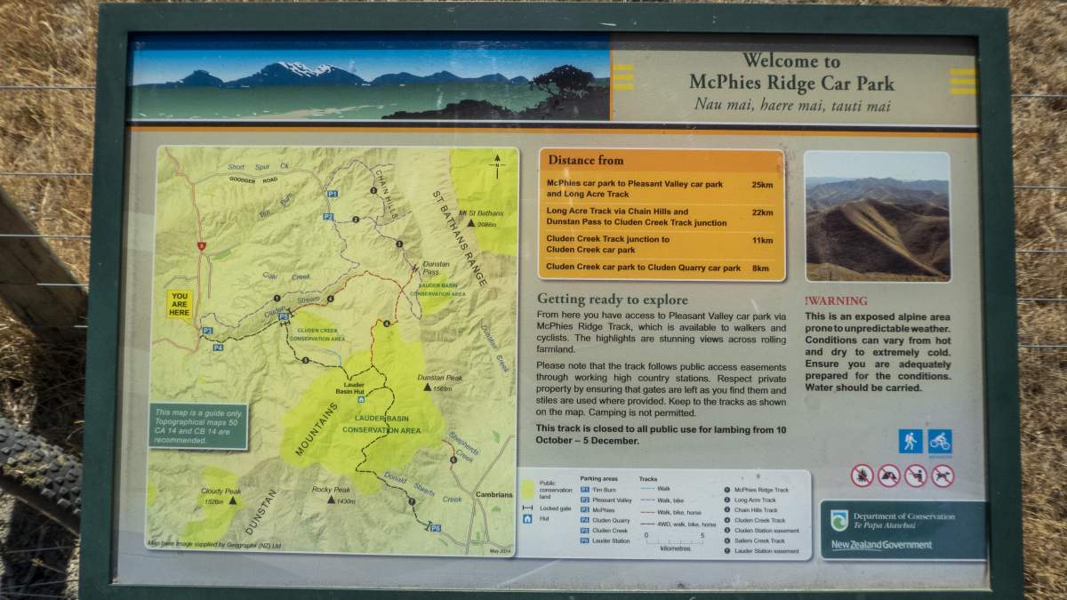
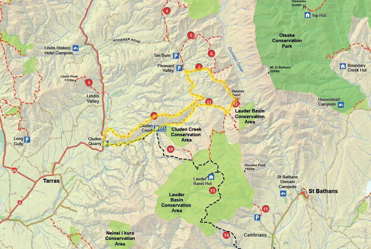
There's a vast network of Central Otago trails to be explored between the Lindis Pass, Cluden Creek and Lauder Basin Conservation Areas which are ideal for experienced intermediate or advanced mountain bikers seeking a full-day adventure. This network of 4WD farm roads and tramping tracks connect SH8 between Tarras and the Lindis Pass to the Manuherika Basin near Lauder and St Bathans.
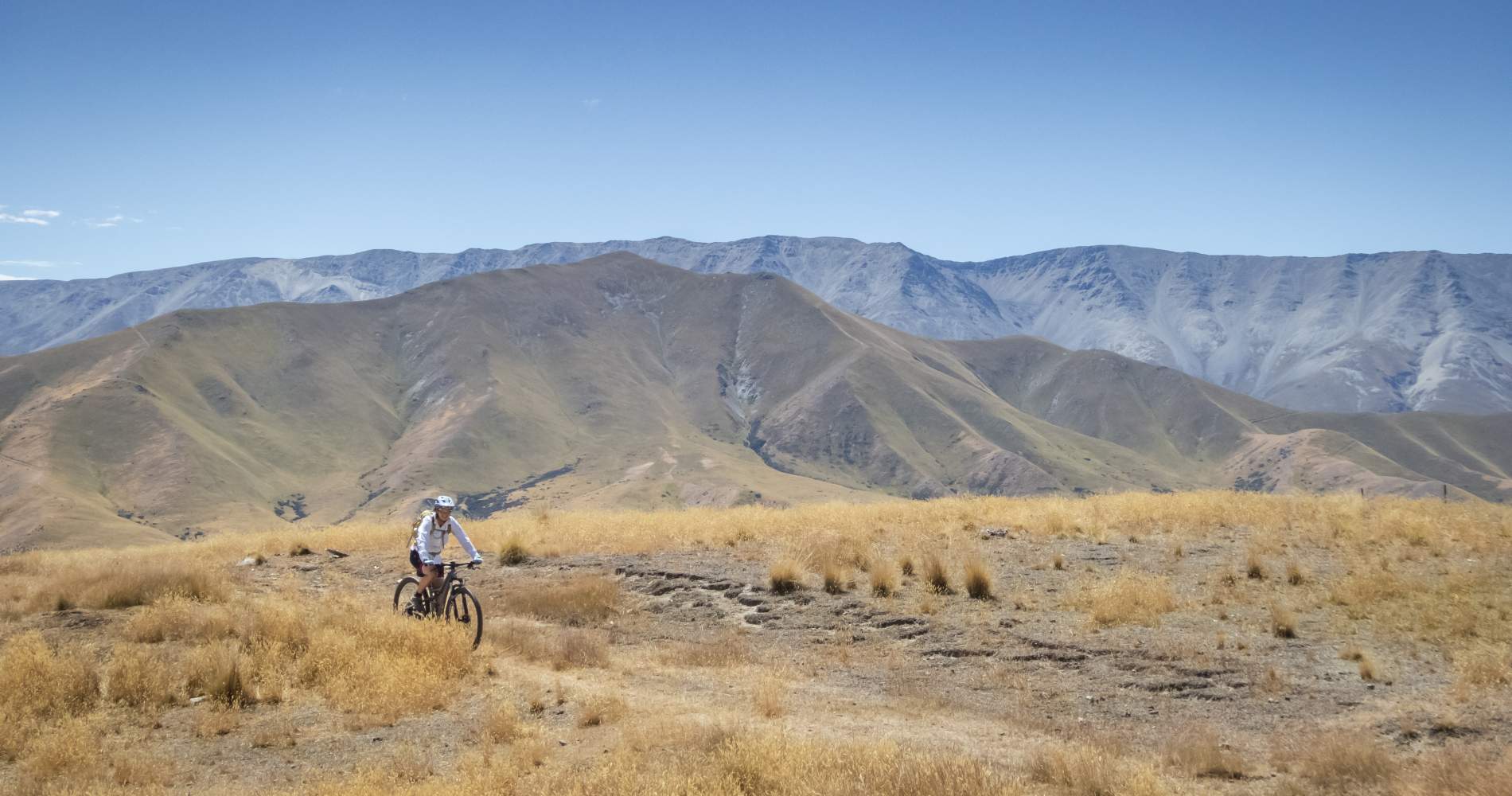
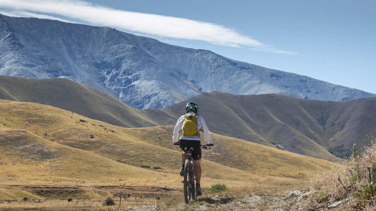
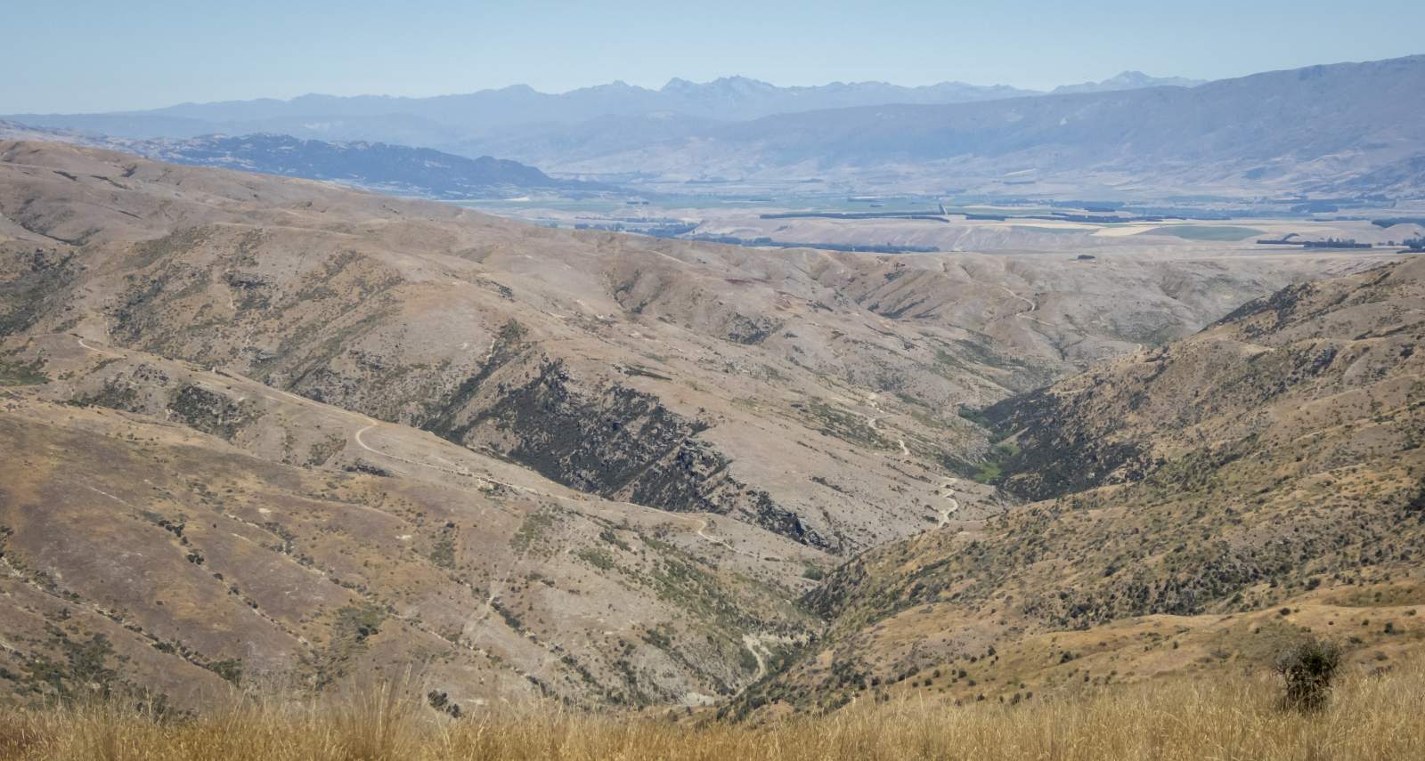
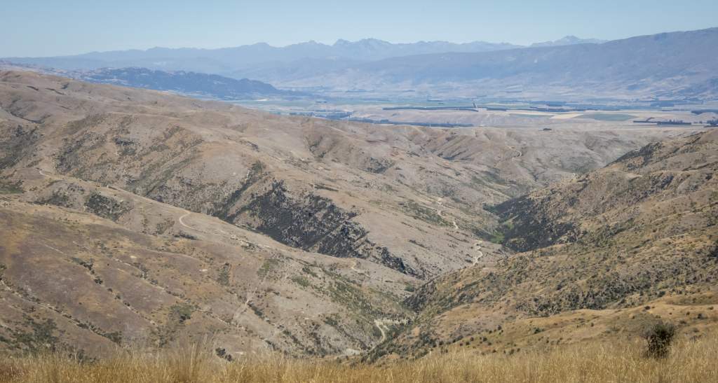
The landscape through this region is iconic Central Otago high-country dominated by open tussock and rocky outcrops. The altitude rises from around 300m in the valleys up to 1,500m, so mountain bikers can expect some grunty hill climbs. However, the reward of groveling up steep tracks is the captivating views from the tops – across the Dunstan Mountains and St Bathans Range out to the Upper Clutha and as far away as Mount Aspiring and even Aoraki | Mt Cook on a clear day.
Using the online maps and guides provided the Department of Conservation (see website links above) it’s possible to link together some great loop rides, ranging from 60km to 90km or more including some epic full day missions crossing mountain passes from one catchment to another. The account below describes a fun but challenging (you've been warned) 60km loop ride from Cluden Creek car park just north of Tarras. This makes a decent day trip from Cromwell, Queenstown or Wanaka.
For a longer 80km+ loop from Tarras check out this route.
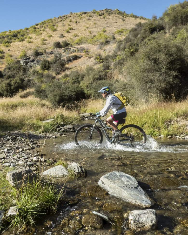
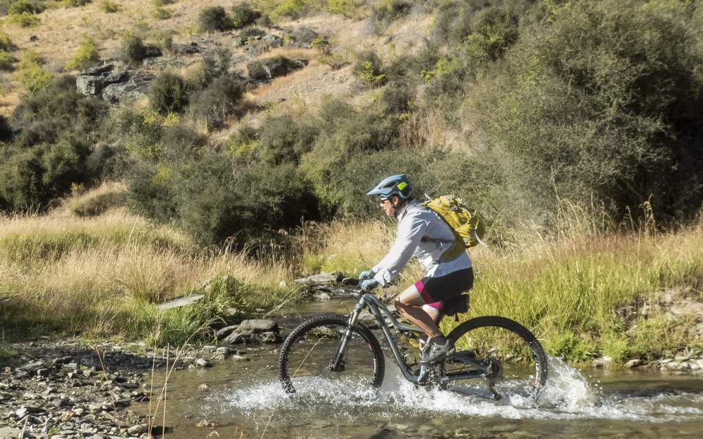
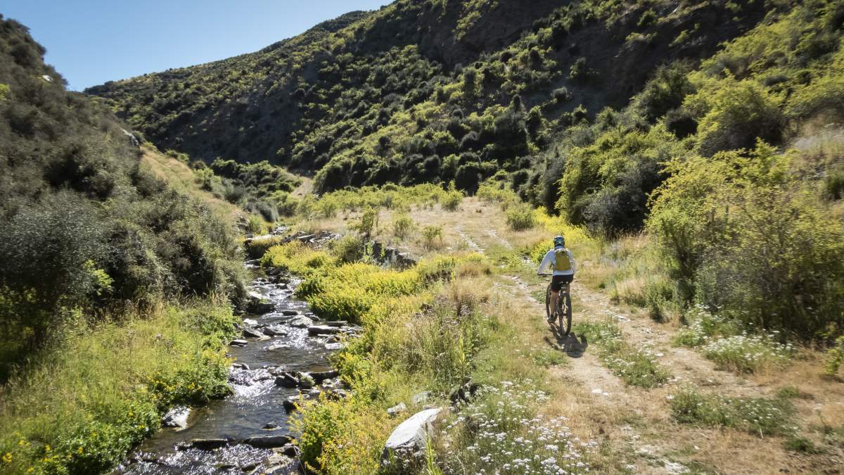
Photo: frequent stream crossings along Cluden Creek are refreshing on a hot summer's day in Central!

Sensational carrot cake at Tarras Country Cafe.
The small country village of Tarras is the gateway to the Lindis Pass and, despite its diminutive size, is a bustling little settlement thanks to its location on the main SH8 route between Mount Cook and Queenstown. The Tarras Country Café is the ideal pre-ride stop for coffee.
Top tip - the homemade carrot cake or date scones with obligatory jam and whipped cream are sensational. (Go on, you deserve it, you’re about to burn off a few thousand calories on your bike in the hills)!
From Tarras it’s a 12km drive north along SH8 to the turn off to Cluden Creek Road. Given the day’s forecast was to be hot (MetService had described the weather as “warmer than usual”, which transpired to be an understatement), we parked in the shade next to the bridge at the bottom of the gravel road. We had full water bladders (3-litres each) weighing down our day packs, but we would be grateful for the fluid as the route was far hillier and also took longer than we expected – partly due to the extremely hot weather.
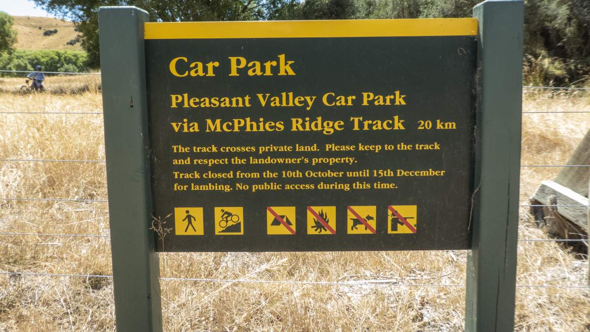
Please note that these tracks are closed for lambing 10 October – 15 December.
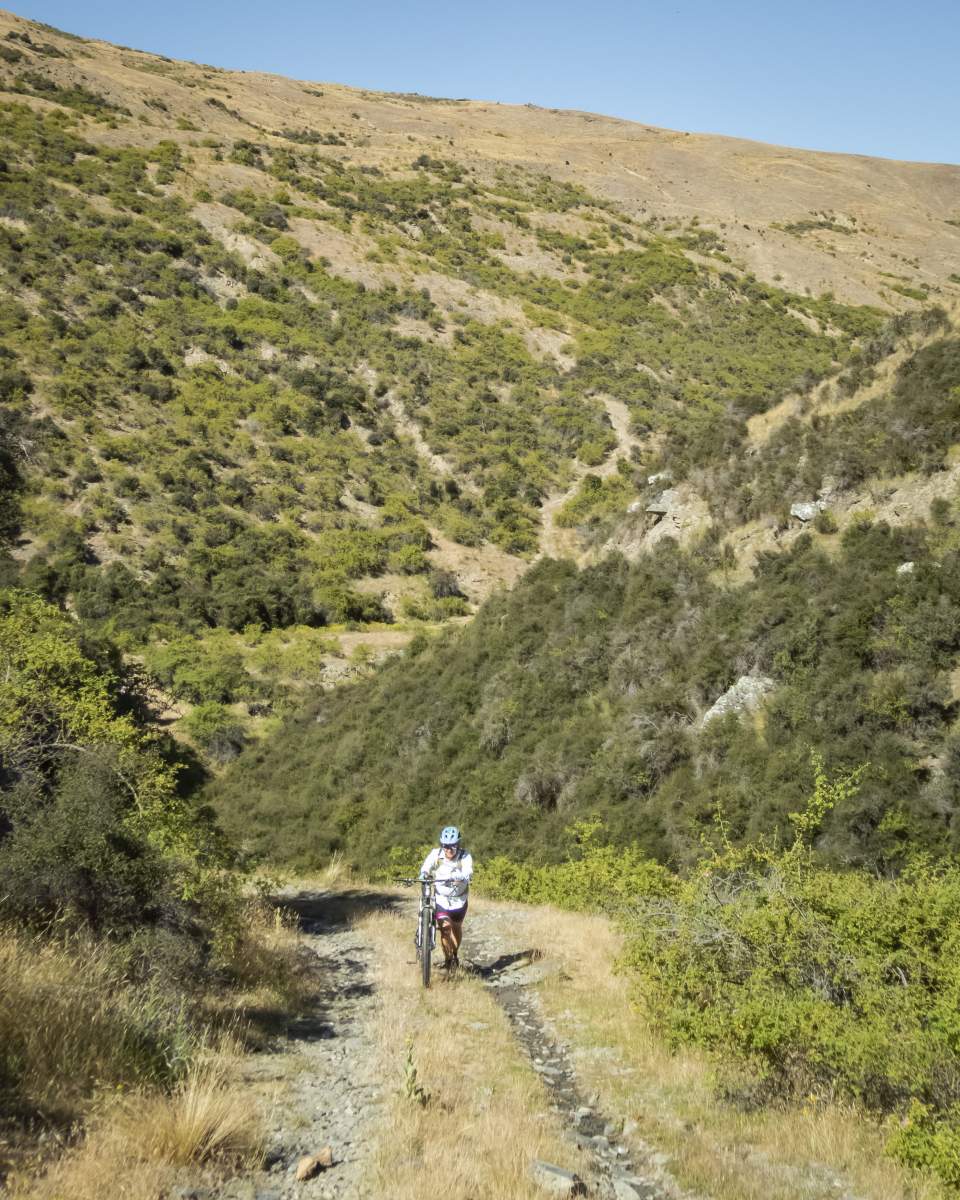
The tortoise and the hare! Be prepared to push up some steep sections on the Cluden Creek Track.
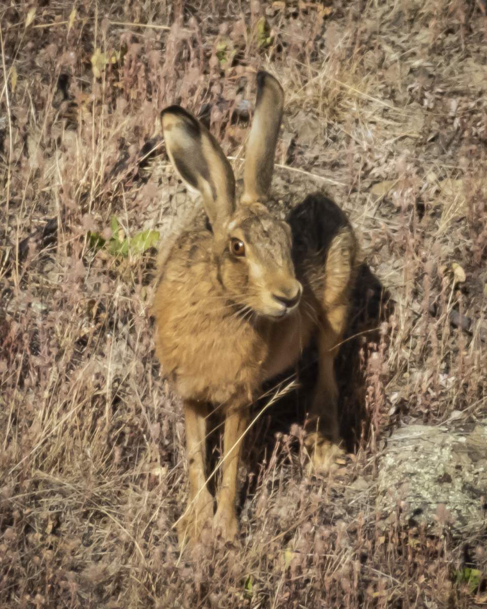
There's plenty of wildlife to be seen along this ride... including the occasional hare!
From the Cluden Creek car park it’s a 20km ride along a well-formed farm track to Lauder Basin Conservation Area Road and the Dunstan Pass Track. A friend who had recommended this loop but hadn’t ridden it for a few years, described the road along these lines, “you’ll be fine, just a few short, sharp pinches. Nothing more than 100m long…from memory”.
Well, either his memory was fading, or it was extremely selective, as there were certainly more than a couple of lengthy and very steep climbs which we grovelled up in the sweltering heat. However, as we climbed further along the steep-sided creek the landscape opened out and the scenery became more dramatic with imposing views of the Chain Hills dwarfed by the dark scree-covered faces of the St Bathans Range.
DOC describe the Cluden Creek Road as an advanced mountain biking route which is probably accurate as some sections of the road were steep and rough with exposed drop-offs. Apparently, sections of track can also be very boggy after rain.
Pleasant riding along Cluden Creek.
Climbing out of Cluden Creek via some sharp, steep pinches.
The terrain was too steep in places to describe as “undulating”, so after 20km (approx. 2hours) of ups and downs, we reached a crossroads of sorts where we turned left (north) on to the Dunstan Pass Track. This short 4km leg climbs to Dunstan Pass before descending to Dunstan Creek and then connects with the Long Acre Track. The views here are spectacular and it’s worth finding a spot for lunch to take in the dramatic landscapes. We were briefly joined by a NZ falcon (karearea) over lunch, which despite being classed as threatened–nationally vulnerable by DOC, seem to be recovering in this part of Central Otago.
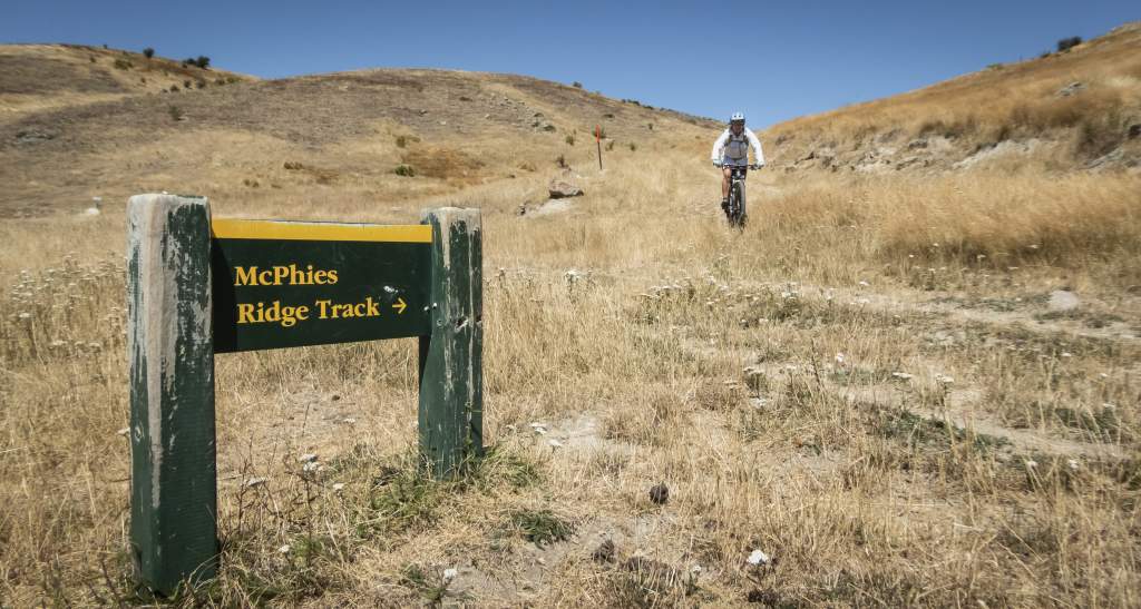
Following the Long Acre Track for about 7km we connected to the McPhies Ridge Track where there’s a very flash looking new farm hut. From here another very daunting climb beckoned with a steep track leading up on to McPhies Ridge itself. After about 10-15minutes of pushing, sweating and maybe the odd bit of swearing, the track plateaued out and was rideable again. Having caught our breath, we were then able to take in more stunning views of the Chain Hills, St Bathan’s Range and even glimpses of the snow and ice of the Rob Roy Glacier and Mount Aspiring in the far distance.
What goes up... must come down. Descending to the junction with Dunstan Pass Track.
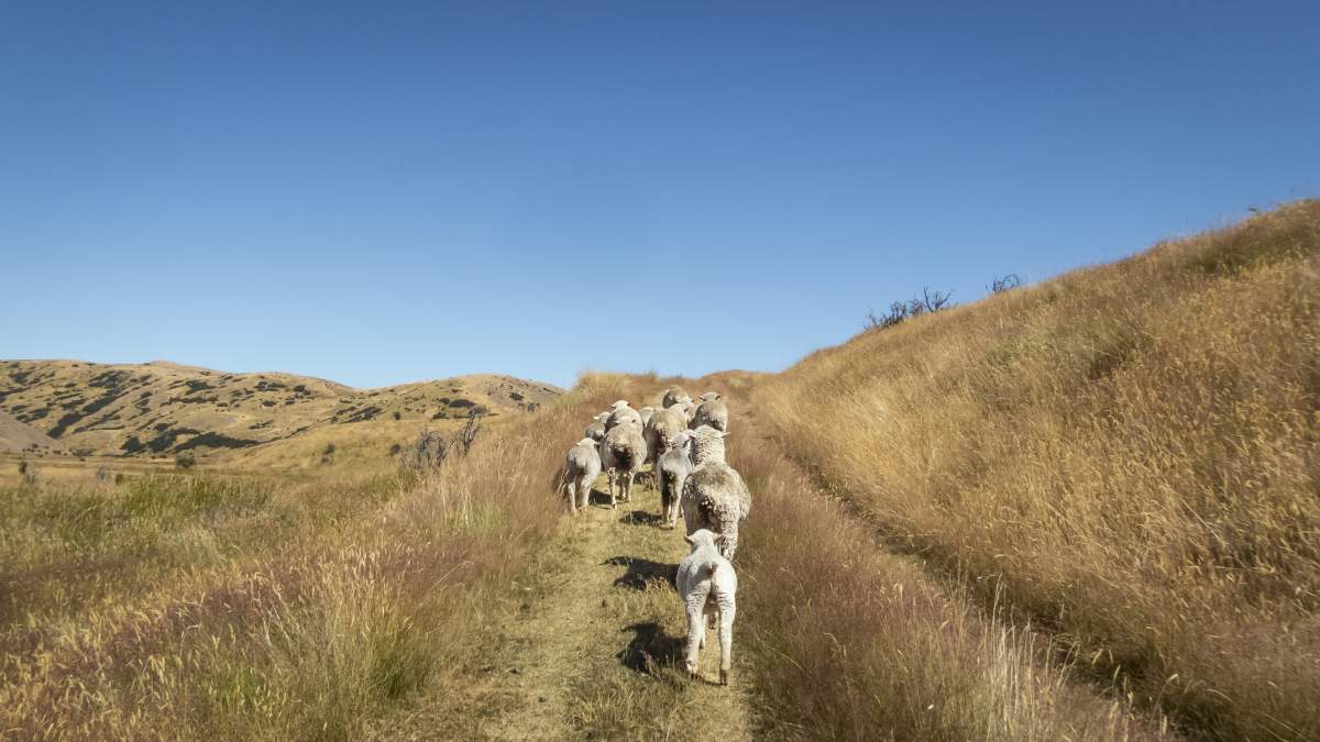
The locals lack all road sense! Please slow down around livestock.
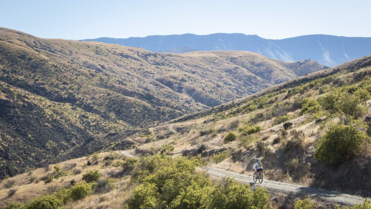
Dramatic views of the St Bathans Range
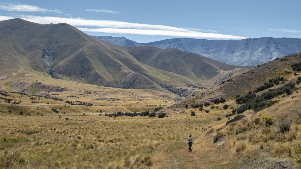
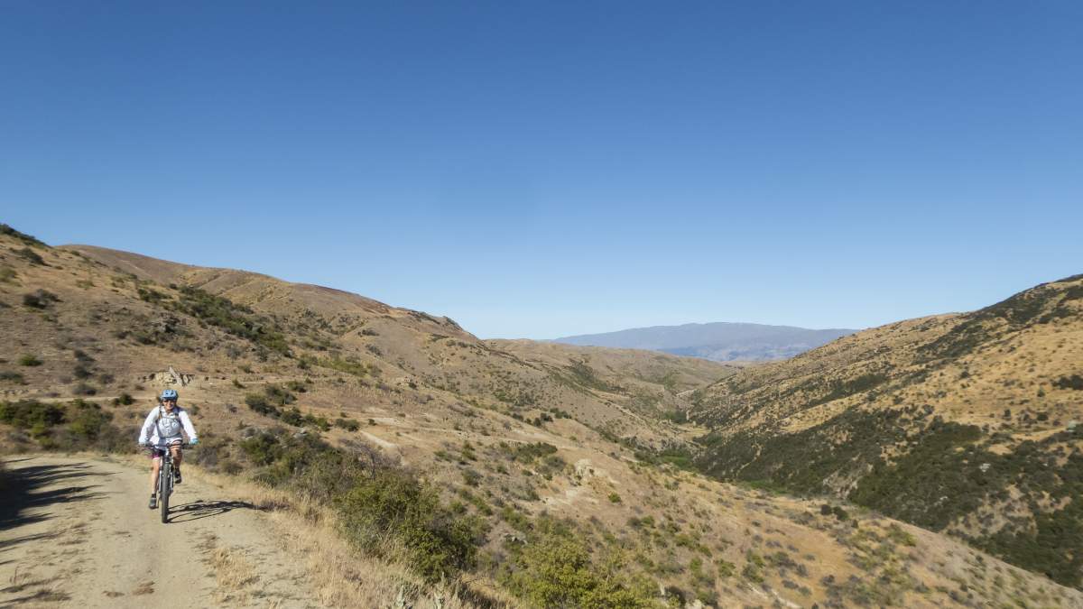
Iconic Central Otago landscapes
McPhies Ridge can definitely be described as undulating, or even gently rolling, and the track was in excellent condition allowing for some fun, flowing downhills. After about 15km one final, long descent brought us back down to the Lindis River.
Ironically, the last few, billiard-table-flat kilometres were perhaps the most technical of the whole ride. The meadow next to the river was overgrown with head high grass obscuring the view of the single-track making riding almost impossible. Hay fever sufferers beware! But this was a small inconvenience compared to what was a fun loop ride that was challenging enough to feel like an honest day out, and certainly worthy of the morning’s cream tea back in Tarras.
Oh, and by the way, the other great reason to leave your car by the bridge, is the easy access to a great swimming hole in the Lindis River, just perfect recovery on a scorching hot Central Otago summer’s day.
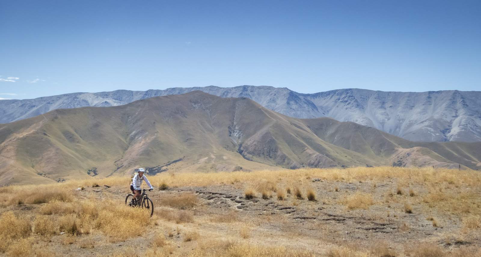

Views across the St Bathans Range from McPhies Ridge.
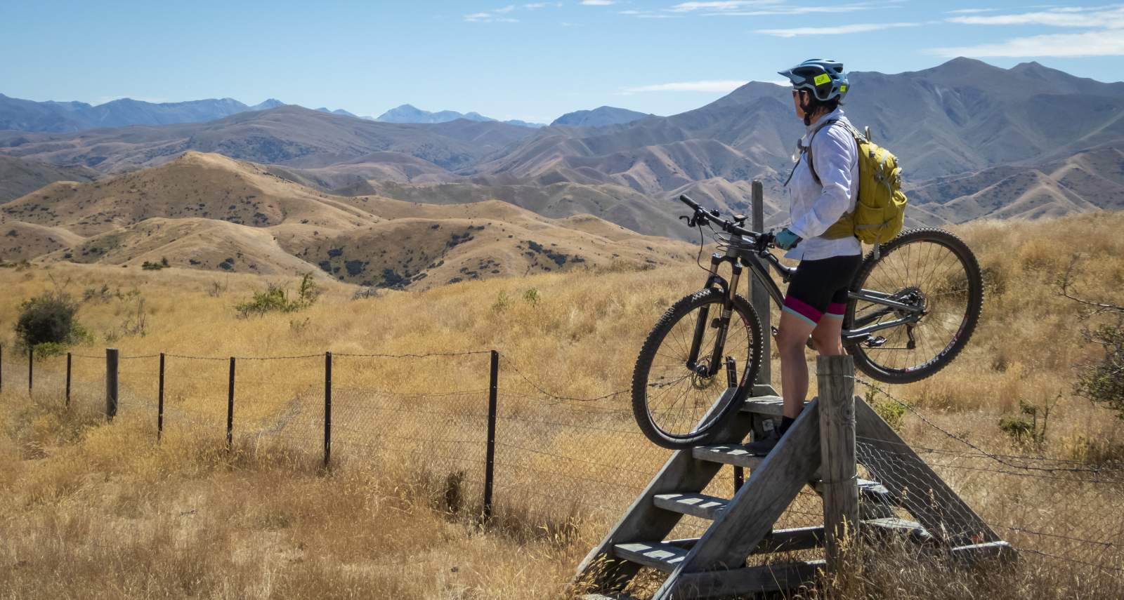
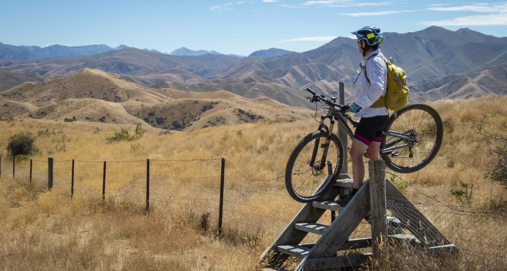
Crossing a fence with...ahem..style!
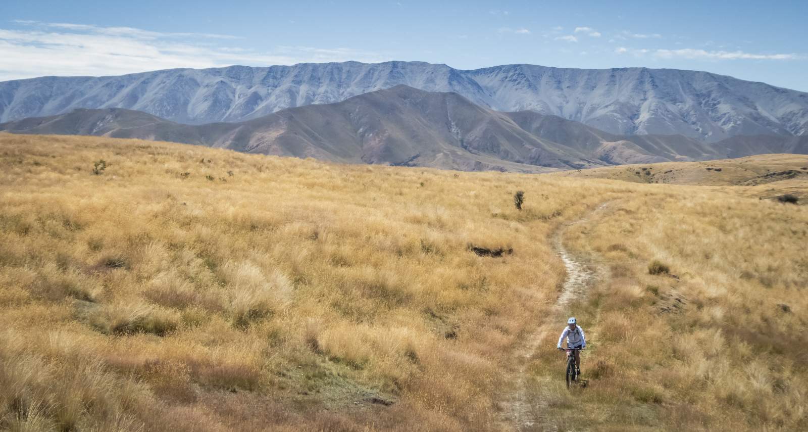

Iconic tussock-clad Central Otago highcountry landscape.
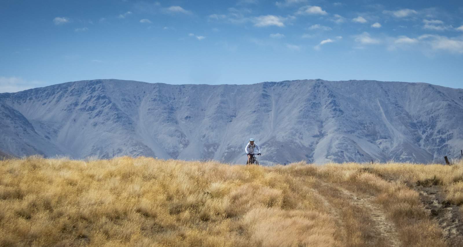

Big sky country (and big climbs)!...
Views from McPhies Ridge down to Cluden Creek Track & out to the Upper Clutha basin.

Final descent to the Lindis River.

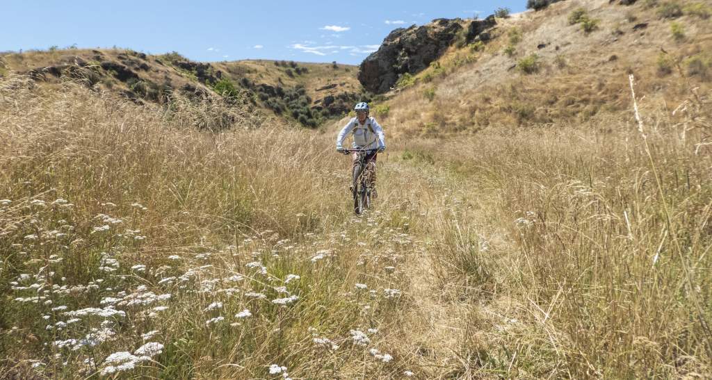
Head high grass along the Lindis River made for tricky riding.
BE PREPARED & STAY SAFE
Forewarned is forearmed, as they say, so it’s probably prudent to add a caveat to this trip description with a heads-up in terms of what to expect.
Firstly, the route is only suitable for fit, confident, and experienced intermediate or advanced riders. Whilst the trails described are generally well formed and easy to follow, they are rough in places, and you will almost certainly need to push your bike up some of the hills.
Public access and tracks are well marked and signed.
Important note: the distances provided are only estimates and ride times will vary depending on fitness and weather conditions.
The route is not suited to gravel bikes, and if you’re planning to ride an e-Bike make sure that you have sufficient range in your battery and be aware that there are several stream crossings to negotiate.
Very hot and dry conditions are common in summer - it was 32°C when this story was written - so carry plenty of water (there is no water on the ridges and the creek water is open to livestock) and wear adequate sun protection as there is little or no shade or shelter from the elements.
Alpine conditions may be experienced at any time of the year, and the high-country is subject to snow and ice during winter months. Check the forecast and carry warm and waterproof clothing as required. The terrain is also exposed and remote, so you’ll need to be fully independent and carry a toolkit and first aid kit. With no cell phone coverage, a personal locator beacon in case of emergencies is a good idea.
DOC describe the track grades as intermediate to advanced as below, and these were accurate for the Cluden Creek – McPhies Ridge Track loop route described (as of January 2023).
- Intermediate – steep slopes and/or avoidable obstacles, possibly on narrow track and/or with poor traction. There may be exposure at track’s outer edge.
- Advanced – a mixture of long, steep climbs, narrow track, poor traction, and difficult obstacles to avoid or jump over. Generally exposed at the track’s outer edge. Most riders will find some sections easier to walk.
Always follow the Outdoor Safety Code
- Plan your trip
- Tell someone your plans
- Be aware of the weather
- Know your limits
- Take sufficient supplies
Visit Adventure Smart for more information.

Related Stories
-

Credit Card Rides
A credit card ride is a “light” version of a fully self-supported bikepacking trip.
Read more about Credit Card Rides -
The Ride Between
It's not about the ride... it's what you ride between that makes Otago's trails special.
Read more about The Ride Between -
Quick Reference Guide to the Cycle Trails of Otago
A quick guide to help you choose the best cycle trail for your next holiday or adventure.
Read more about Quick Reference Guide to the Cycle Trails of Otago -
Otago's Signature Tracks
Best short rides on the Queenstown Trails
Read more about Otago's Signature Tracks


