

![]() History & Heritage
History & Heritage
![]() Walking
Walking
11 of the best gold mining heritage sites to explore along the Otago walking and cycling trails.

Gone Fossicking!
11 of the best goldmining heritage sites to explore on the Otago walking and cycling trails
Otago’s five Great Rides are more than just walking and cycling trails through some of New Zealand’s most spectacular landscapes, they’re also journeys which retrace Otago’s rich history along trails originally blazed by hardy pioneers and prospectors.
All the Otago Trails have stories to be told, but none are more dramatic and influential than the Otago Gold Rush of the 1860s. Some of the best heritage sites from Otago’s gold mining past can be found along the trails. Here are eleven of the best places to explore.
But first, a quick history lesson to provide some context…
The arrival of a young Australian prospector named Gabriel Read in 1861 changed the face of Otago forever when he discovered gold shining "like the stars in Orion on a dark frosty night" at Tuapeka, or Lawrence as we know it today.
As word of his discovery spread, prospectors flooded Otago in their thousands, many from the goldfields of Victoria in Australia. However, the initial rush was over almost as soon as it had begun, and men started drifting away once the most easily found gold had been won.
But the Otago Gold Rush was reignited when two Californians, Horatio Hartley and Christopher Reilly, dumped a staggering 32kg of gold on the receiver’s desk in Dunedin, which had been sewn up in scraps from their trousers (worth about USD $2 million on today's market). Hartley and Reilly had panned their gold from the Dunstan Gorge on the banks of the Molyneux – the river we now know as the Mata-au | Clutha.
By 1863, the Otago Gold Rush was at its peak with an estimated 40,000 diggers working claims from Kyeburn near Ranfurly all the way to the Kawarau River in Queenstown. The rip-roaring towns of the Junction (Cromwell), Upper Dunstan (Clyde) and Lower Dunstan (Alexandra) soon sprung up, cobbled together from whatever basic building materials were on hand. Among many other new towns were Hogburn (Naseby), Blacks (Ophir) and Oturehua where many relics from the gold days can still be found.
If these placenames seem familiar, then it’s because these towns are all now key hubs along the main Otago walking and cycling trails.
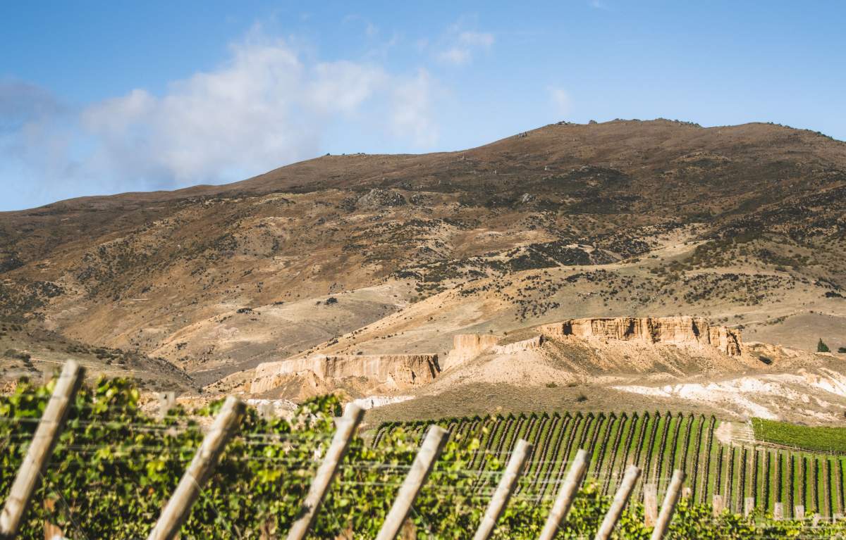
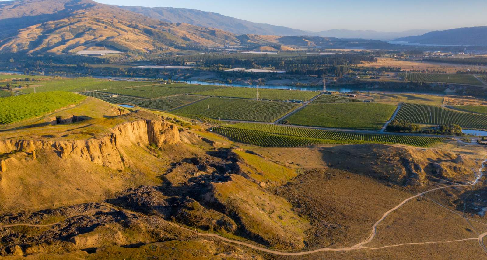
The Otago landscape has been shaped by gold mining. Photo: Te Kano Estate Vineyard and Bannockburn Sluicings.
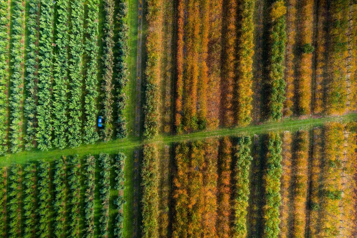
Central Otago's orchards and vineyards have their roots in gold mining, with old water races to this day irrigating the land. Photo: Jackson's Orchard
Gold mining quickly evolved beyond panning, but new hydraulic sluicing and quartz gold mining techniques required masses of water, triggering the frenzied construction of water races that tapped, re-routed and dammed countless creeks and streams. Built from stone, timber and sheet iron, these races stretched up to 80km. Many can still be seen snaking around the Otago hillsides, and some have even been converted into mountain bike tracks!
Gold mining dominated the Otago landscape until the early 1900s when the gold became harder to find. Orchardists and Chinese market gardeners then realised the potential for horticulture and growing stone fruit thanks to Central Otago’s dry climate, fertile soil and irrigation from the water races which were no longer used for mining. The orchards developed rapidly, and horticulture remains a major part of the Otago economy.
Today, and again because of Central Otago’s dry, continental climate, the region is thriving on new gold in the form of viticulture and winemaking. As with much of the region’s history, the roots of today’s wine industry can be traced back to gold mining – in this case a gold digger called John Desiré Feraud, a Frenchman who planted the region’s first grapes near Clyde in 1864. You can visit these original vines at Monte Christo Winery, just off the Rail Trail. It's also a great place for wine tasting, lunch or to stay the night.
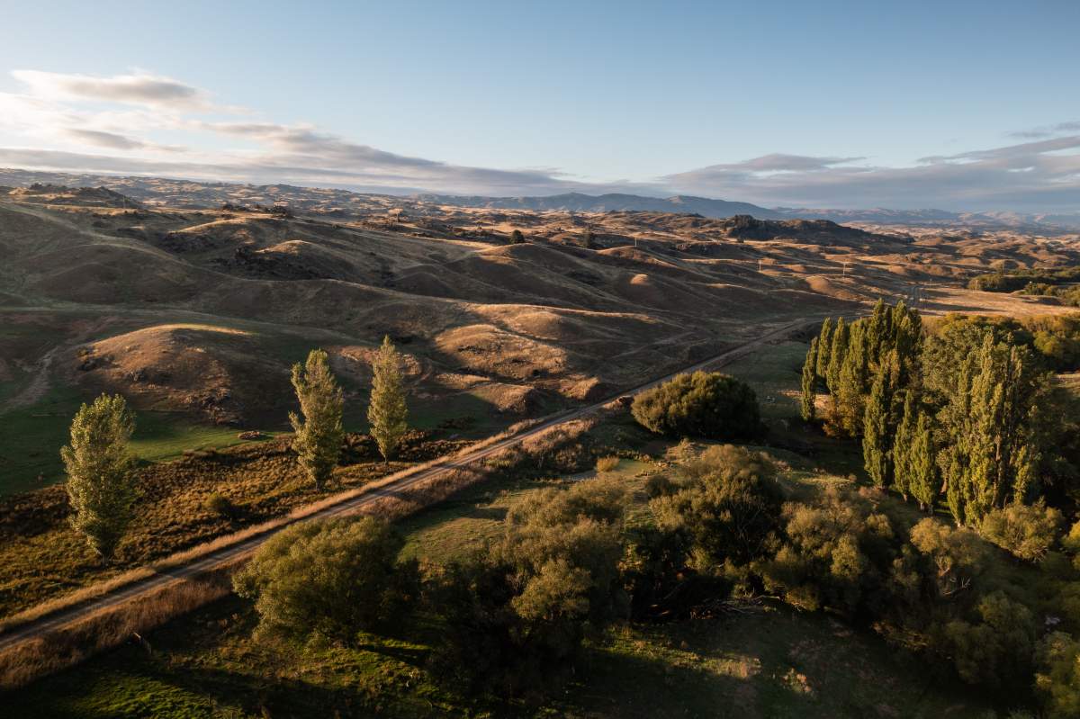
Lake Dunstan Trail
1. Bannockburn Sluicings
Otago’s alluvial gold comes from its mountains formed from schist rock. Over the course of multiple the ice ages, vast glaciers crushed and spread the schist through the valleys. Since then, the Mata-au | Clutha River has acted like a huge sluice, leaving behind fine particles of gold wherever its waters flowed.
As the easily won alluvial gold from the riverbanks started to run out, the prospectors moved up to the terraces and gullies where high-pressure water cannons were used to blast rock faces into washable gravel.
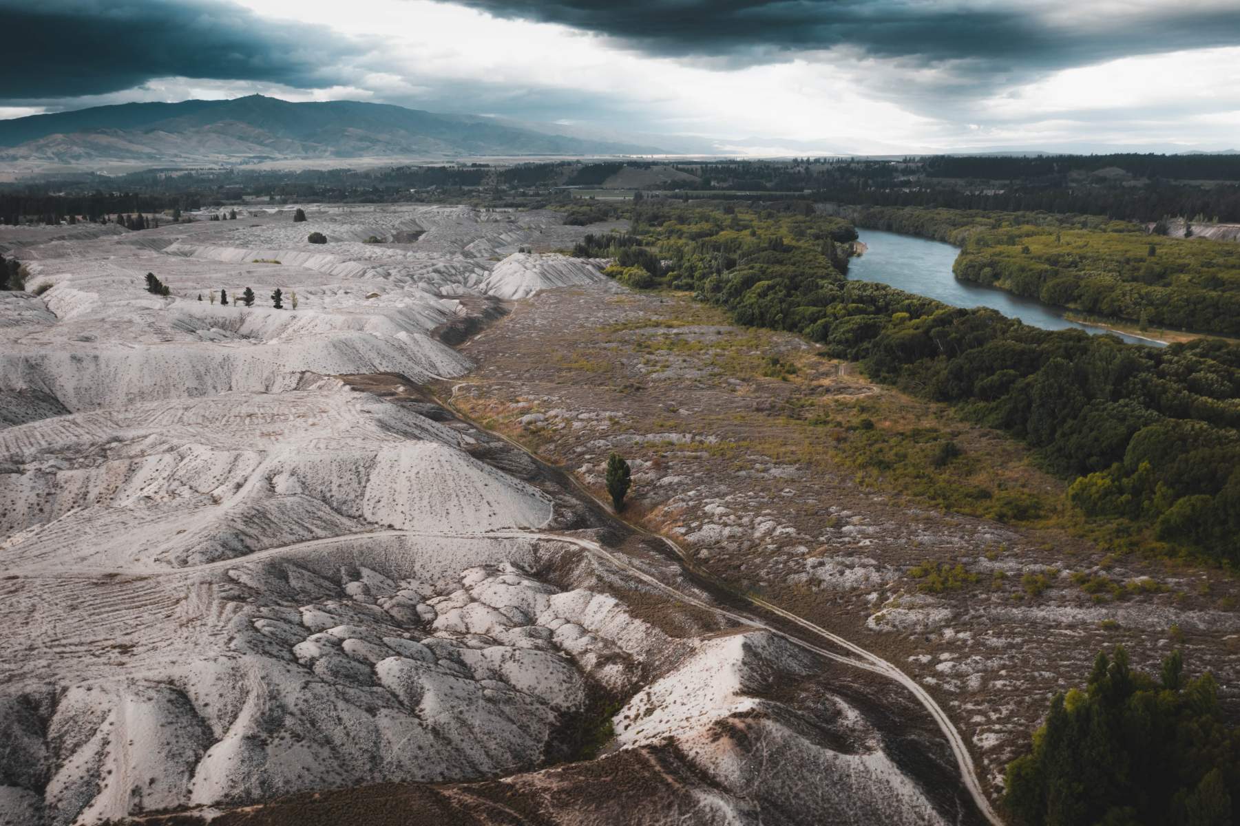
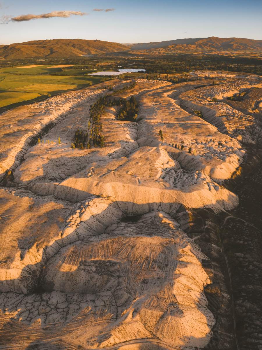
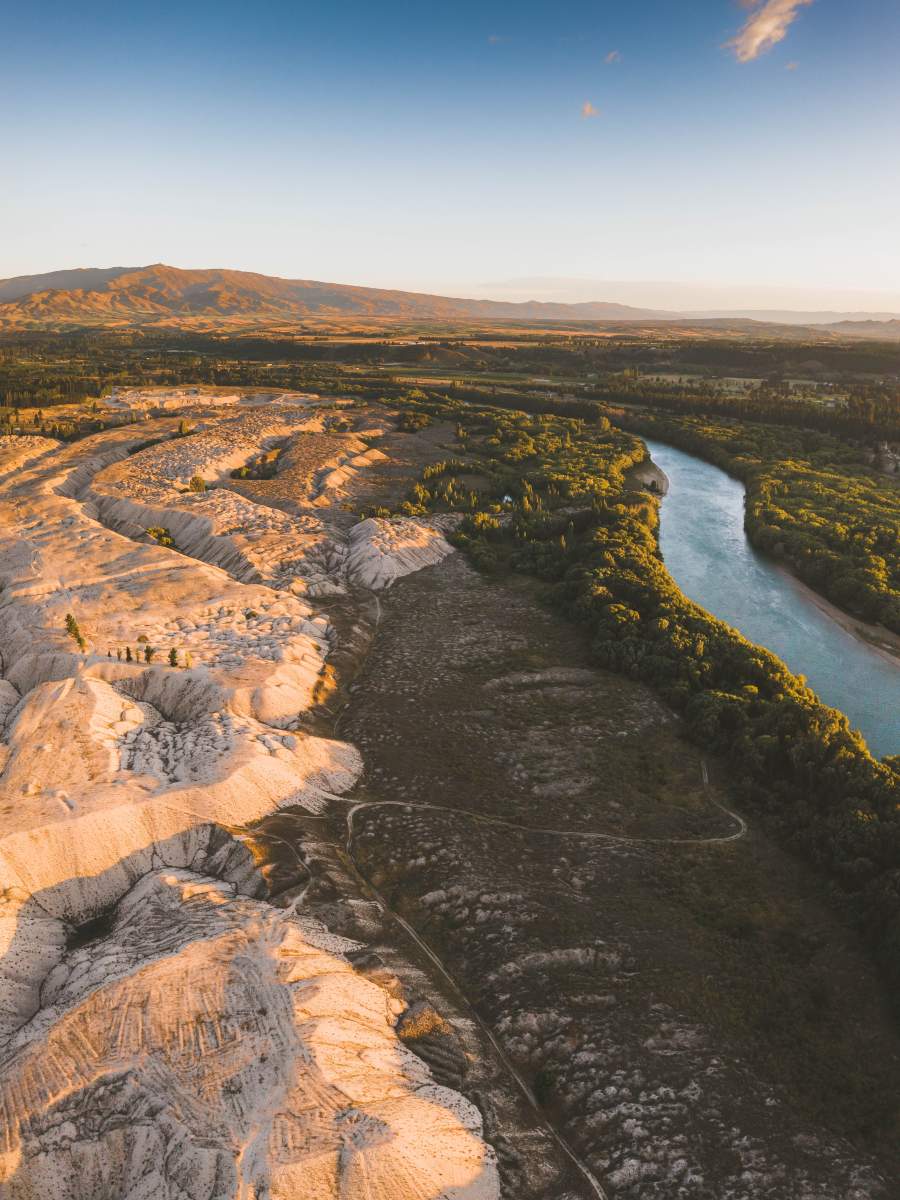
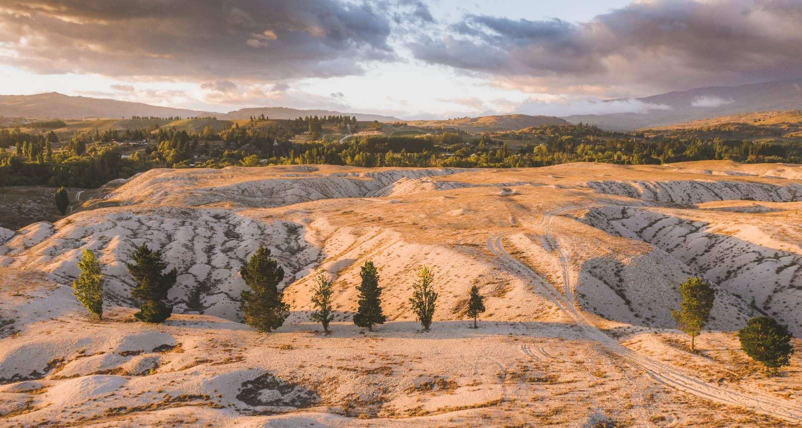
Called hydraulic sluicing, this mining method changed swathes of the Otago landscape beyond recognition. A classic example is Bannockburn Sluicings, a barren "badlands" landscape of tailings, caves and tunnels that blurs the lines between man-made landscapes and the natural world.
Bannockburn Sluicings - a Tohu Whenua site - is a short detour from the Lake Dunstan Trail along Felton Road. This is also the first section of the Kawarau Gorge Trail which is currently under construction and will ultimately connect Cromwell and Queenstown via a new cycle trail – also passing numerous old goldfield sites.
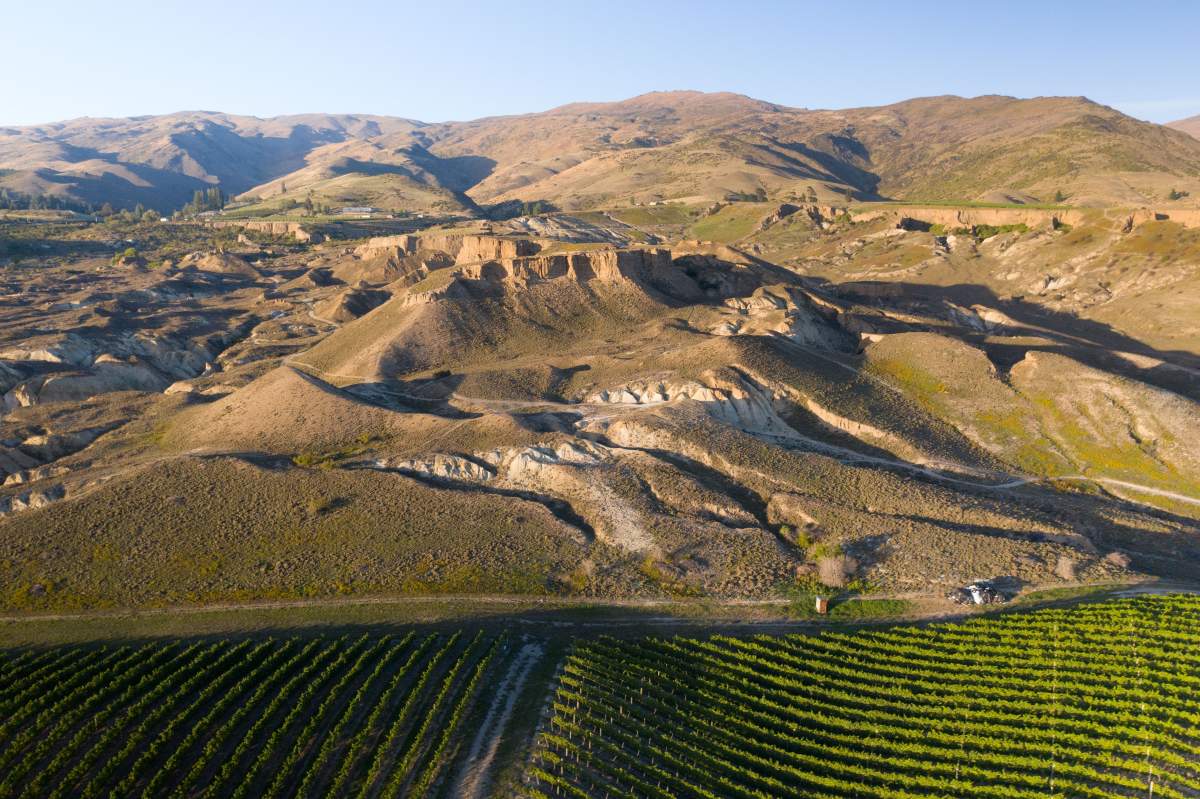
The man-made 'badlands' landscape of the Bannockburn Sluicings with Gate 20 Two Vineyward in the foreground.
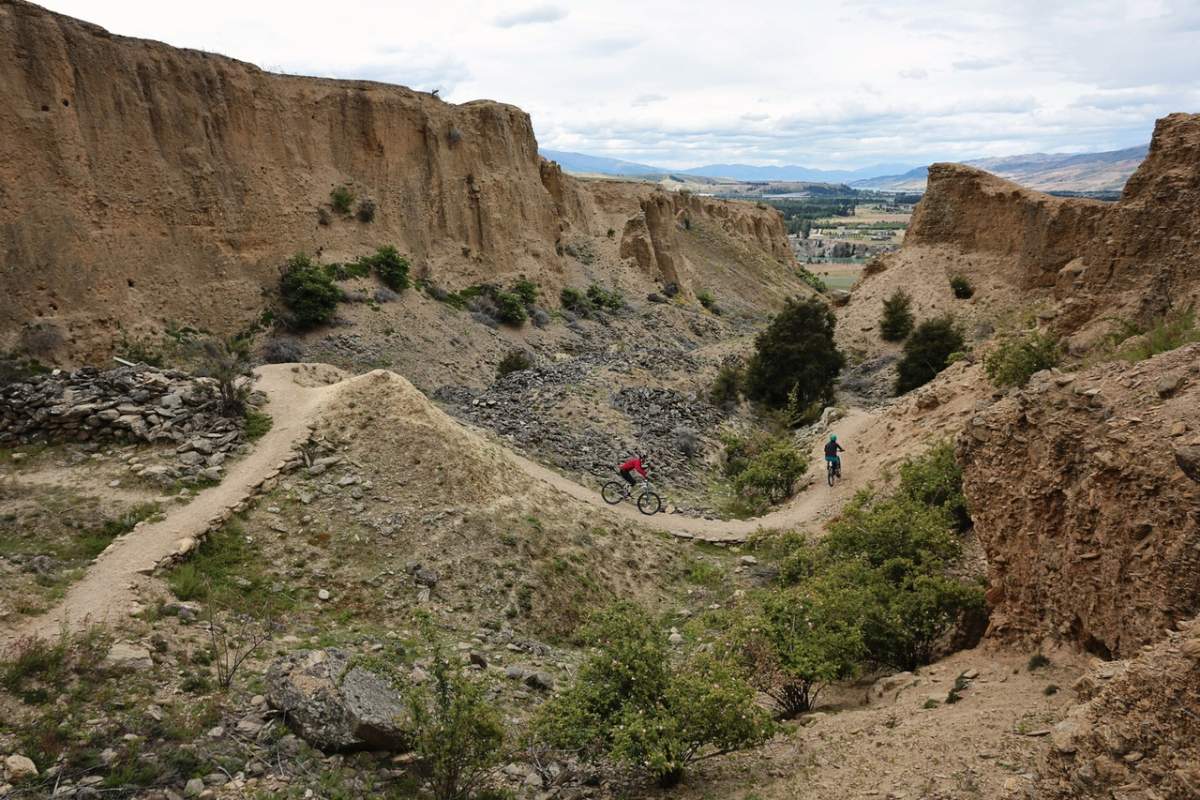
The Sluicings can be explored by mountain bikers or walkers and includes fascinating interpretation panels.
2. Earnscleugh Tailings
From the early days of the gold rush, simple dredges had been used to scoop up shingle from the riverbeds for panning or sluicing. The invention of a new dredge in the 1890s triggered a new boom on the Clutha and its tributaries. Locally designed and engineered, the steam-driven ‘standard’ or ‘New Zealand’ dredge made Alexandra the gold dredging capital of the world.
By 1900 Otago’s rivers were crowded with hundreds of dredges scouring the riverbeds for gold, leaving behind them a man-made moonscape of ‘tailings’. An excellent example of this can be found at the Earnscleugh Tailings along the Clyde to Alexandra River Track - a pleasant scenic walk or ride which connects the Lake Dunstan Trail to the Otago Central Rail Trail.
There are also numerous dredges lying wrecked along the riverbed of the Clutha which can be seen as you ride on the Clutha Gold Trail. Four dredges that can easily be spotted are Golden Treasure by Millers Flat, Gold Queen between Roxburgh and Millers Flat, Kohinoor by Coal Creek and Jubilee below Roxburgh.
The dramatic moonscape of the Earnscleugh Tailings, between Alexandra and Clyde [Photos by Will Nelson].
3. Pickaxe Bluff
Pickaxe Bluff on the Lake Dunstan Trail was so named for the pickaxe found buried deep in the rock during construction. Look out for it when you ride the trail.
The Chinese gold mining methods were unique; they worked methodically, leaving very little gold behind. Unlike the Europeans, the Chinese miners used pickaxes to break rock ready for sieving, sorting and washing through a sluice box.
Riffle, or sluice boxes, nicknamed Long Toms, were long, terraced wooden boxes, over which gold-bearing gravel was washed using the flow of the river. Each step of the box had a lip to trap the heavier gold, while lighter materials washed away. The heavy gravel and gold caught in the terraces was carefully washed again using a gold pan.
Look out for the miner's pickaxe still buried deep in the rock when you ride the Lake Dunstan Trail.
Roxburgh Gorge Trail
4. Roxburgh Gorge - Jet Boat Transfer
The barren, tree-less Central Otago landscape threw up major challenges for the miners. Without wood for buildings the gold miners turned to the schist stone that gives Central Otago its breath-taking scenery. They left a legacy of caves, huts, stores and gold workings, all hidden by the isolation and inaccessibility of the deep Roxburgh Gorge for more than 140 years.
Today, thanks to the development of the Roxburgh Gorge Trail, many of these remnants are now easily accessible to explore, especially by utilising the jet boat transfer on the trail between Doctor’s Point and Shingle Creek where dozens of Chinese and European miners' huts and rock shelters can be seen.
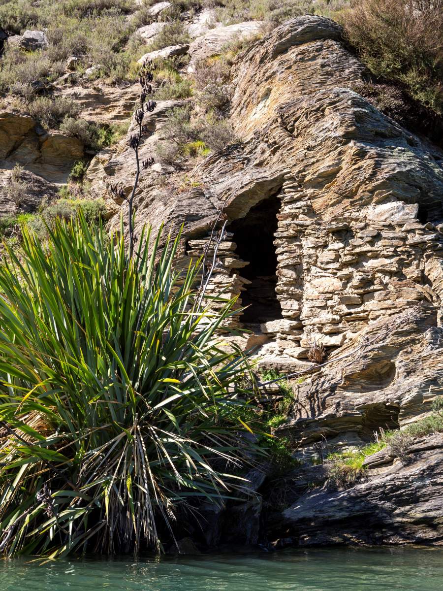
One of numerous gold miner's stone huts to be seen throughout the Roxburgh Gorge.
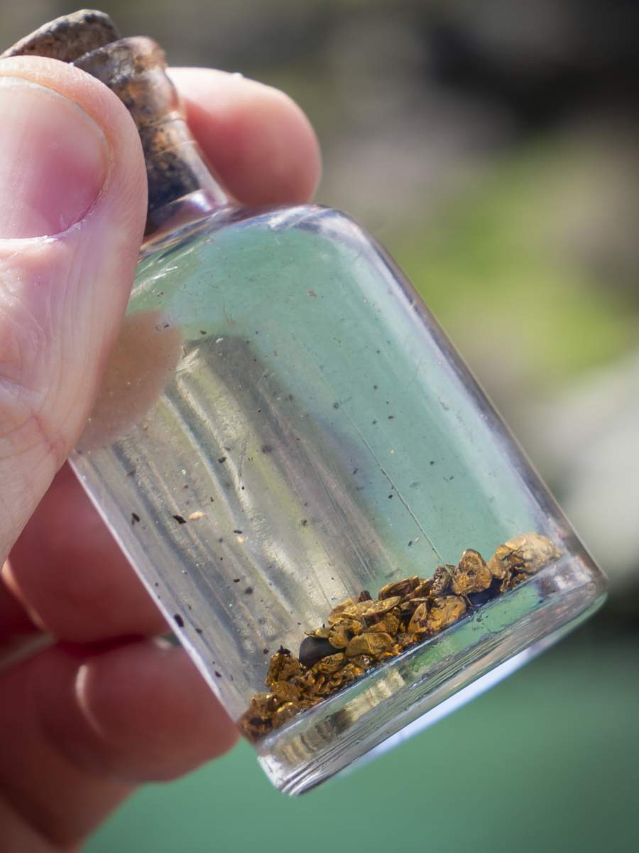
There's still gold to be found in the gravel deposits of the Mata Au | Clutha River!
As well as connecting the two ends of the Roxburgh Gorge Trail, the jet boat trip also offers a fascinating insight into the gold mining history.
CLUTHA GOLD TRAIL
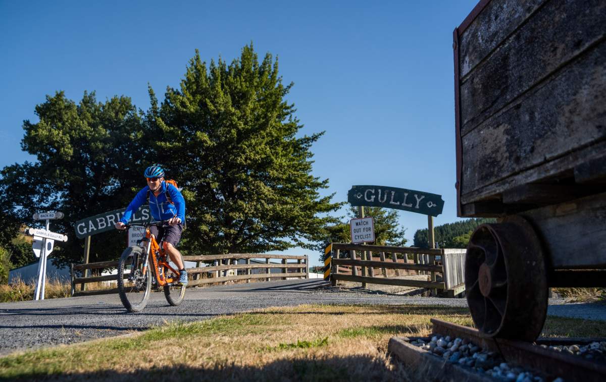
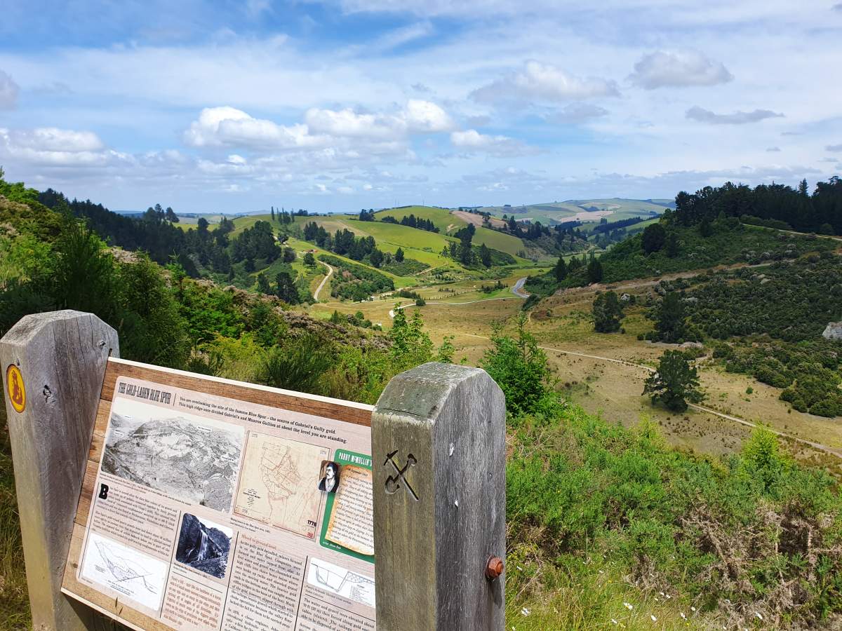
5. Gabriel's Gully, Lawrence
Lawrence marks the halfway point on the 135km Clutha Gold Trail, and a 3km detour from Lawrence to Gabriel’s Gully marks the spot where the original Otago Goldrush started.
Prospector Gabriel Read struck gold in the gully on 25 May 1861. Legend would have it that Read was only equipped with a tin dish, a butcher's knife and a shovel to dig in the creek bed. After working through about 3ft of gravel Read reached soft slate, and in his infamous words "saw the gold shining like the stars in Orion on a dark frosty night". His discovery determined the future of Otago.
It triggered the country’s first major gold rush with a wave of prospectors descending on the newly discovered gold fields. The population of Dunedin exploded, and Otago was transformed into the wealthiest province of New Zealand. The economic spin-off from gold mining was a massive boost to the burgeoning New Zealand economy.
However, life for the alluvial gold miner was not easy. First, there was the 100km walk between Dunedin and the Tuapeka (Lawrence) gold fields in often harsh conditions and carrying heavy supplies. Then there were the extremes of weather – freezing winters and scorching summer heat – not to mention the intense physical labour itself. It's little wonder that the legacy of these pioneers has shaped the identity of Central Otago - chasing the illusive ‘mother lode’, working hard, playing equally hard, and with a bold sense of adventure.
By 1863 Gabriel’s Gully was no longer a field suitable for individual miners as more elaborate technology was required to extract the gold. Companies were formed and sluicing and then later, blasting, became the dominant method of mining. By 1865 there were 542 miles of water races at the Tuapeka goldfields!
Today, you can explore Gabriel's Gully Historic Reserve and the stories of goldfield inhabitants on a short walk with a series of interpretation panels to guide you.
The entrance to Gabriel's Gully on the Clutha Gold Trail.
Gabriel's Gully today looks very different to the height of the 1860's gold rush.
Otago Central Rail Trail
As well as the history of the railway itself, the Otago Central Rail Trail has dozens of heritage sites to explore dating back to the gold rush era. The Rail Trail Trust has also developed a great online resource called Rail Tales which recounts stories from across the length of the 152km walking and cycling trail.
6. St Bathans and the Blue Lake
From the late 1870s, the hydraulic elevator helped keep gold fever alive. It enabled miners to sluice to greater depths by sucking the wash out of a field via a pipe and delivering it into sluice boxes above the mine.
This had a truly dramatic effect on the landscape, as evident at St Bathans. The peculiar Blue Lake was once upon a time the 120m high Kildare Hill. The hill was sluiced flat by the elevator which excavated a massive, 70 metre deep ‘glory hole’ – the deepest gold claim in the world at the time.
You can explore the Blue Lake via a 2km loop track that encircles the historic, man-made lake. This detour from the Rail Trail is a great opportunity to learn about the old sluicings and the remnants of the goldmining equipment that was used here - machinery that morphed Kildare Hill into a lake.
7. Ophir
Ophir was originally known as Blacks, when gold was discovered in Central Otago in 1863. Ophir's population grew to over 1,000 as it became the commercial and social centre of the district. It was renamed Ophir at this time which was where King Solomon obtained the gold to sheath the Temple in Jerusalem and is the genesis of the legendary "King Solomon's Mines".
When the Otago Central Railway was constructed in 1906, it was routed through neighbouring Omakau on the other side of the Manuherikia River. This had a positive effect for Omakau, which thrived, but Ophir's population rapidly declined.
Today, with a current population of around 50, Ophir is known for the many original surviving buildings including the restored post and telegraph office, the 1895 courthouse, and the 1870s police station. It's one of the 'must see' stops along the Rail Trail.
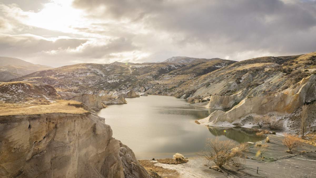
The Blue Lake, St Bathans (Photo: Morgan Potter).
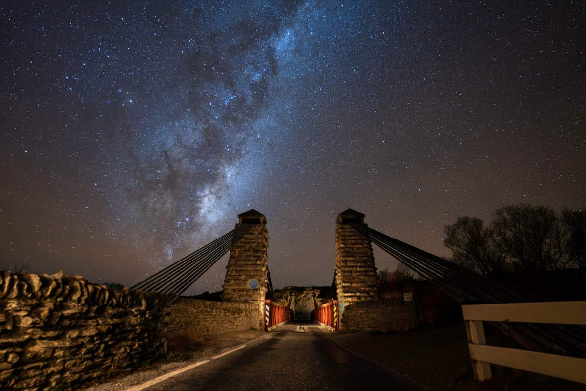
The historic Ophir Bridge under the stars of the Milky Way (Photo: Light Source Creatives).
8. Golden Progress Mine, Oturehua
The Golden Progress quartz mine, just off the Rail Trail in Oturehua, possesses a rare and impressive treasure - the only poppet head* still standing in Central Otago.
*A poppet head is the frame at the top of a mineshaft, supporting pulleys for the ropes used in hoisting.
The Golden Progress Mine was used for quartz mining and worked by three lignite-fired boilers, two for the poppet head to drive the winding gear and one to drive the battery further down the gully. The 14m high poppet head structure sits over a mine shaft 46m deep. It supports wheels, which once ran steel ropes that hoisted gold-bearing ore to the surface. The metal cage sitting beneath it was used to move people, equipment, and ore up and down the shaft.
Quartz mining is the process in which schist was blasted, crushed and mixed with mercury or cyanide to release the fine gold. The impressive stamper batteries and other rusty relics of this era can be discovered across Otago in remote, surprising places such as 'Come in Time Battery' near Bendigo on Thomson Gorge Road (an excellent backcountry mountain bike trip which connects to the Rail Trail in Omakau).
Please note: the Golden Prospect site is on private property and is closed during September and October for lambing.
9. Chatto Creek
Strangely, one of the few remaining gold dredges has found its final resting place in the paddock beside the Chatto Creek pub on the Otago Central Rail Trail. The original part of the old stone hotel at Chatto Creek was built in 1886 as a Cobb & Co. Coach stopover. Over the years it has been a popular watering hole for hundreds of miners, rabbiters, railway men, and irrigation workers… and today feeds and waters thousands of cyclists riding the Rail Trail each year.
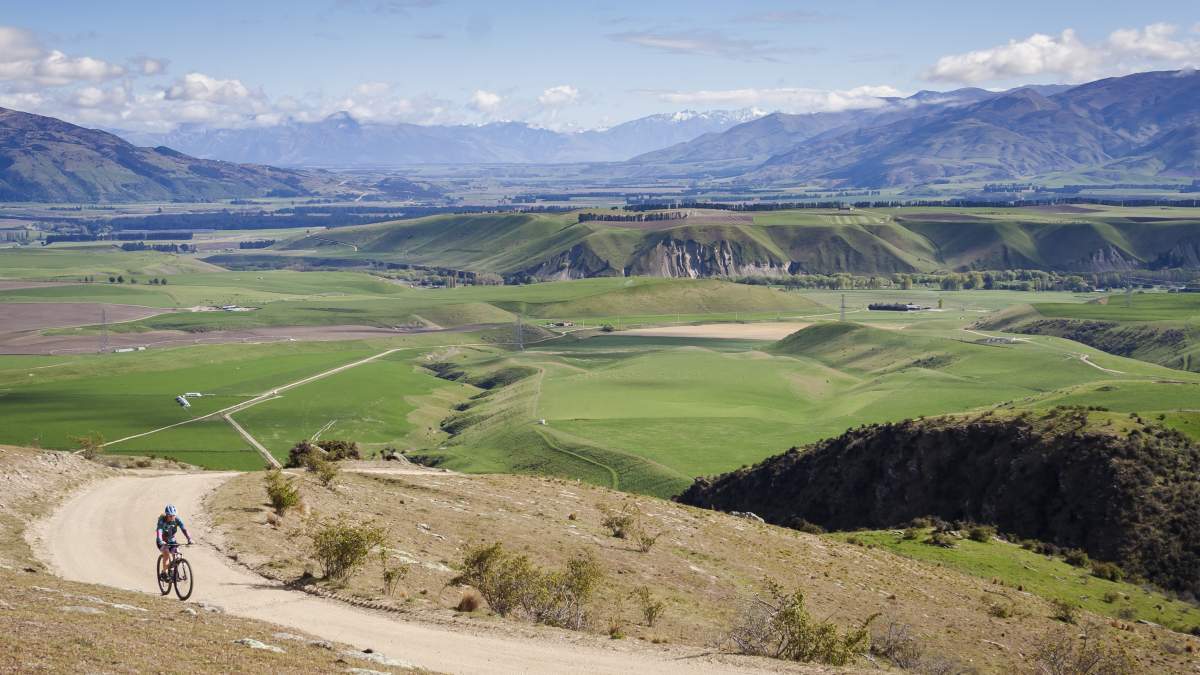
A mountain biker on Thomson Gorge Road, not far from the 'Come in Time' battery in Bendigo.
The Otago Central Rail Trail with iconic high-country views near Chatto Creek.
Queenstown Trails
10. Arrowtown Chinese Settlement
Located on the banks of Bush Creek, at one end of the Arrow River Bridges Trail - part of the Queenstown Trail network - is the partially restored Arrowtown Chinese Settlement. The settlement is a tribute to the contribution made by Chinese goldminers and businesspeople to the region’s gold mining, cultural and business history.
By 1866 many European miners had left Otago for the new gold rush sites on the West Coast and so the Otago Provincial Government encouraged Chinese miners, mainly from Guangdong, to replace the European miners. In Arrowtown, the Chinese were set up in a separate village to the European miners in much harsher conditions and lived in small huts upstream from the European village. Today, many of the huts have been restored, offering visitors the chance to step back into that 'golden' era and see up-close the toil and modest living conditions of the 'other half' in this prosperous town.
In the 1860s there was no jail at the Arrow diggings – or little law and order for that matter – so prisoners were often chained. The story goes that one wild, drunken Irishman awoke to find himself chained to a log:
"When he recovered, he was attacked by a violent thirst, and seeing that he could not release himself from the log he hoisted it to his shoulder and walked with it to the nearest pub where the police found him drinking heartily with the log still athwart his shoulder"!
There are still some great pubs, cafes and restaurants to be found in Arrowtown to thwart your thirst but thankfully the village is much more peaceful and civilised now days compared to the wild frontier town of the 1860s.
11. Macetown
For fit and experienced mountain bikers, a ride up to the “ghost town” of Macetown to explore one of the most intact historic goldfield towns in Otago is a highly rewarding day trip. It offers incredible scenery and a fascinating insight into the goldmining history of the region. Macetown's major historic structures have all been restored including Andersons Battery, Needhams Cottage, Smiths Bakehouse and building remnants such as the old schoolroom and stone fences.
From Arrowtown it’s 15km to Macetown along a narrow 4WD track with steep drop-offs, blind corners and 23 unbridged river crossings… so prepare and plan for your adventure carefully! From Macetown, you can connect to the Coronet Loop Trail (6-8 hours, grade 3), which offers more opportunities to explore goldmining remnants as well as one of the best backcountry bike rides in New Zealand.

Visiting the "ghost town" of Macetown is a good day ride for fit and experienced mountian bikers.
The Police Camp Cottage in Arrowtown, built at the height of the gold rush in 1863.

Be prepared for wet feet! There are multiple stream and river crossings on the trail to Macetown (Photo: Geoff Marks).
Visiting the Chinese Miner's Settlement in Arrowtown (Photo: Clare Toia-Bailey).

If you’d like to read more about Otago’s golden history, then check out the amazing online resources at Te Ara – the Encyclopaedia of New Zealand or at Central Otago’s World of Difference website.
Also check out the Otago Goldfields Heritage Trust website. The Trust develops, represents and promotes the historical sites, trails and events of Otago. And if you really want to enter into the spirit of this bygone era, then join the annual Cavalcade which retraces the journeys across Otago of the first goldminers and pioneers.
Gallery: A landscape defined by gold

Bannockburn Sluicings - Central Otago's vineyards and orchards have their origins in gold mining.
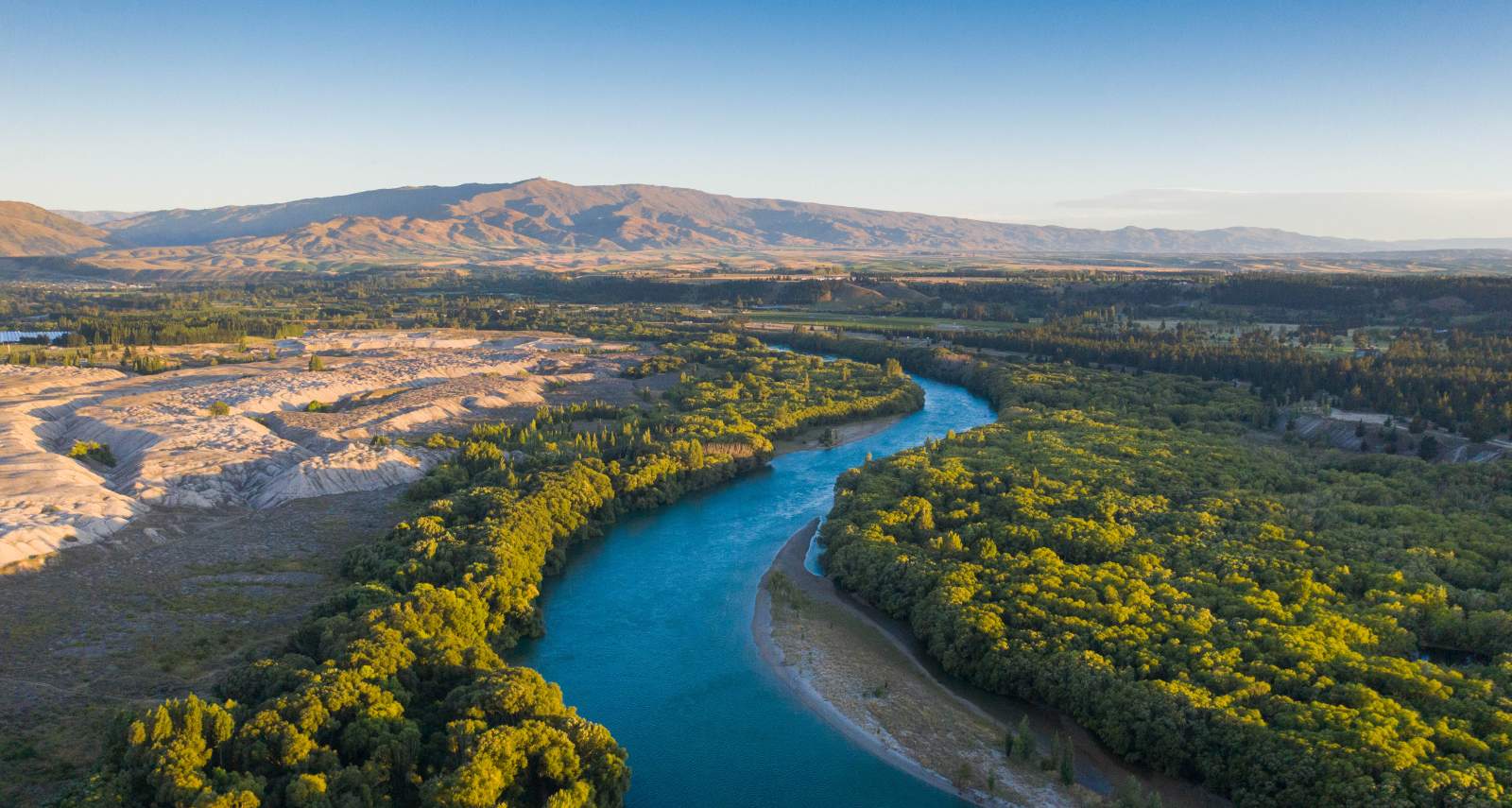

The mighty Mata Au | Clutha River near Alexandra was once at the heart of the Otago Goldrush

Moonscape. The Earnscleugh Tailings between Clyde and Alexandra.
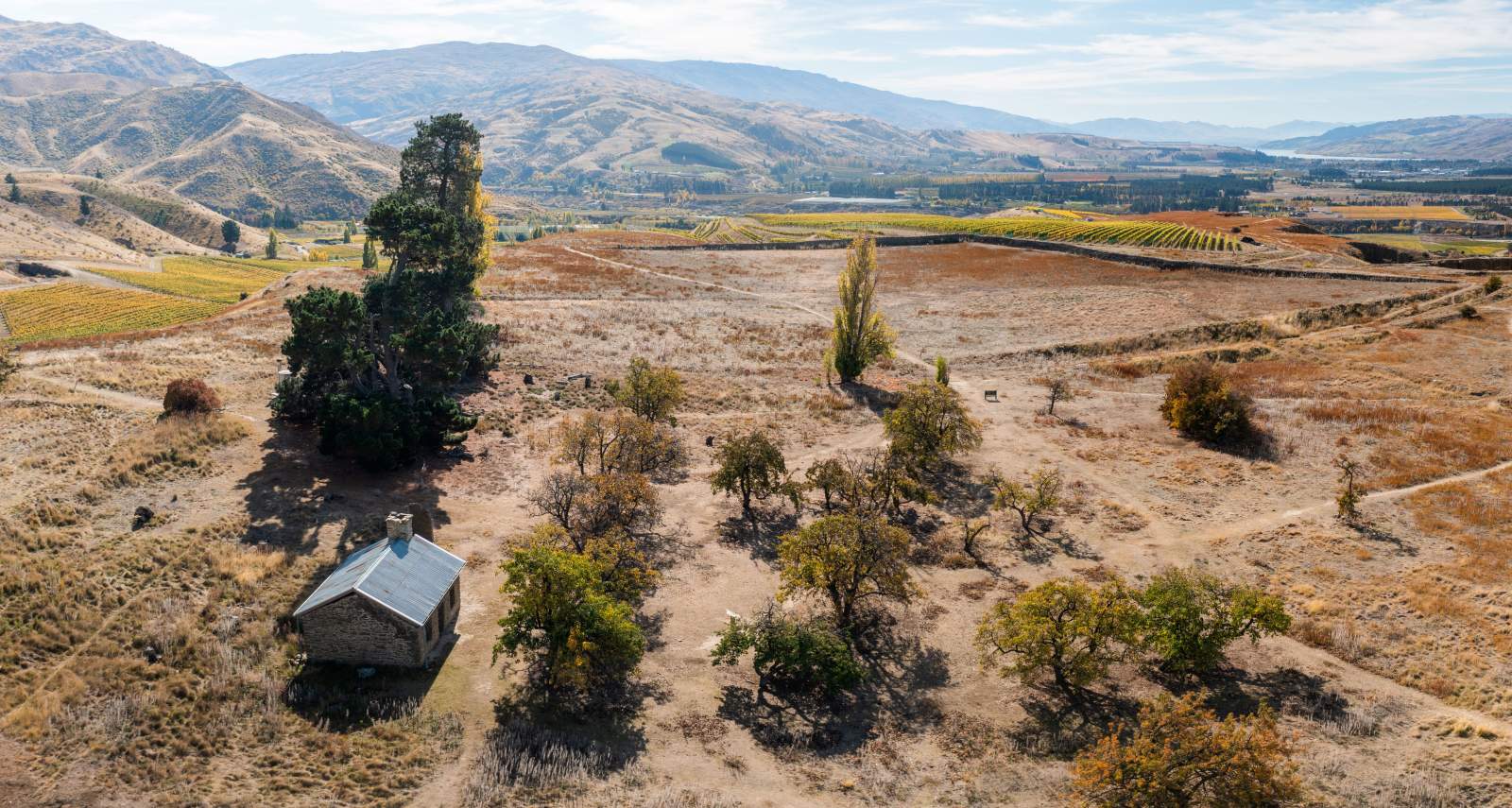

Stewart Town, Bannockburn Sluicings. Remnants of a large dam, several ruins of mud brick homes and fruit trees that still bear fruit from the 1860’s!
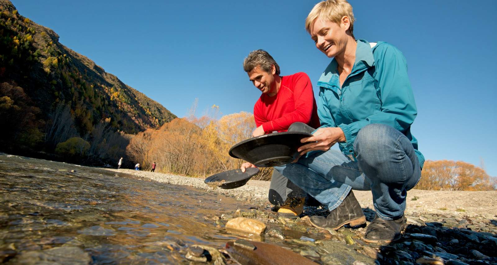

Panning for gold in Arrowtown is a popular activity for visitors to the historic town.