The Taniwhā's Tail
The Upper Taieri River Scroll Plain Wetlands
- words by Bill Morris, Tiaki Māniatoto
- photography by Will Nelson
One of the most spectacular and unique wetland landscapes in New Zealand can be found just a short detour south from the Otago Central Rail Trail near Ranfurly or Waipiata. If you follow the backcountry gravel roads towards Patearoa for about 15km you’ll find the Taieri (or Taiari) Scroll Plain, a large wetland in the Māniatoto and Styx Basins that is part of the upper reaches of the Taieri River. It’s the only one of its kind in New Zealand and the scroll plain’s unique status is recognised and protected as a significant wetland.
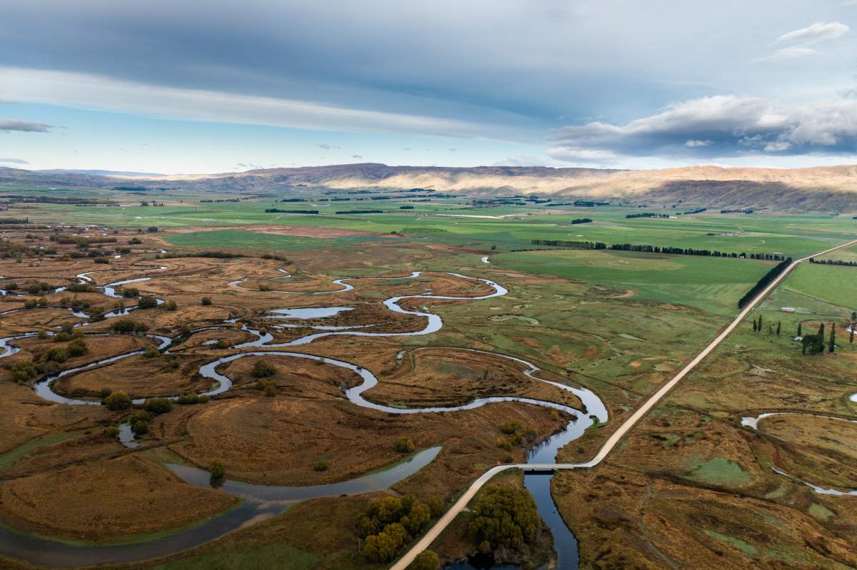
Not just significant within New Zealand, the Upper Taiari (or Taieri) River valley is one of the most unique landforms in the southern hemisphere. The river forms in the tussock country of the Lammermoor and Rock and Pillar Ranges, moving through once-great upland wetlands before emerging onto the Māniatoto Plain. Here, it meanders across a wide, flat floodplain to form spectacular scrolls.
In Māori mythology, the Taiari awa (river) was formed by the serpentine movement of the taniwha (monster) called Matamata through this landscape. The scroll plain was formed with a flick of his tail.
In modern hydrological terms, a scroll plain is formed when a river is free to wander across its floodplain on land of very gentle gradient, as occurs in the upper Taiari. Over hundreds of thousands of years, the river changes course countless times, leaving oxbow lakes and wetlands in its path.
The University of Otago has a fascinating website on the geology of the Otago Central Rail Trail including the Upper Taieri River catchment, click below for more information.
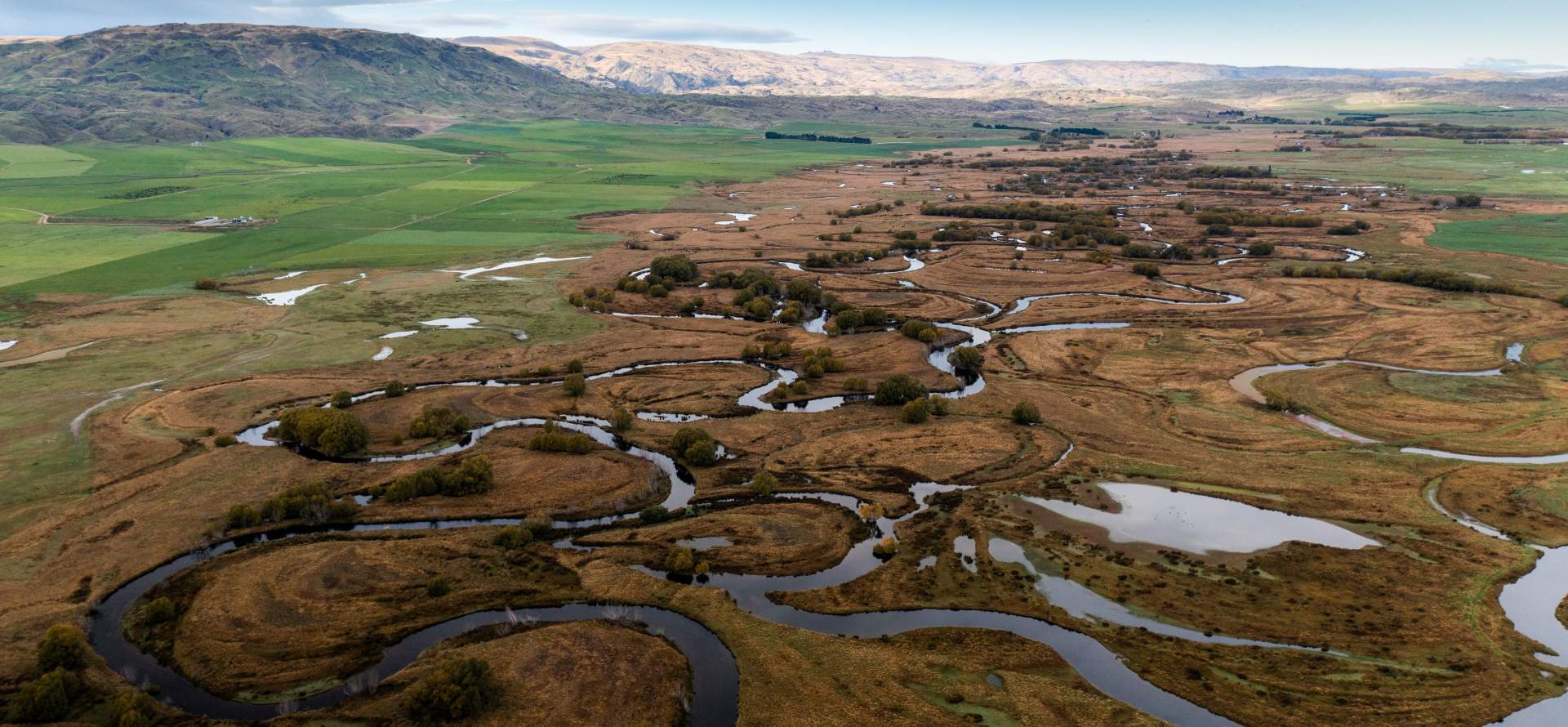
The meanders and oxbow lakes of the Upper Taiari Scroll Plain.
The Importance of the Scroll Plain to Māori
For hundreds of years, coastal Māori ventured into the upper reaches of the Taiari to harvest mahika kai, or wild foods, from the rivers and wetlands. The Taiari scrolls would have teemed with waterfowl like native ducks and swans, while the waters were full of kanakana (lamprey) and tuna (eels). Weka and other birds were also plentiful.
Māori also harvested kouka, or cabbage tree, from these upland plains. Moving with the seasons to follow the migrations of lamprey and tuna, Māori would pack the harvested food in kelp bags called poha and transport it down the Taiari on rafts called mōkihi.
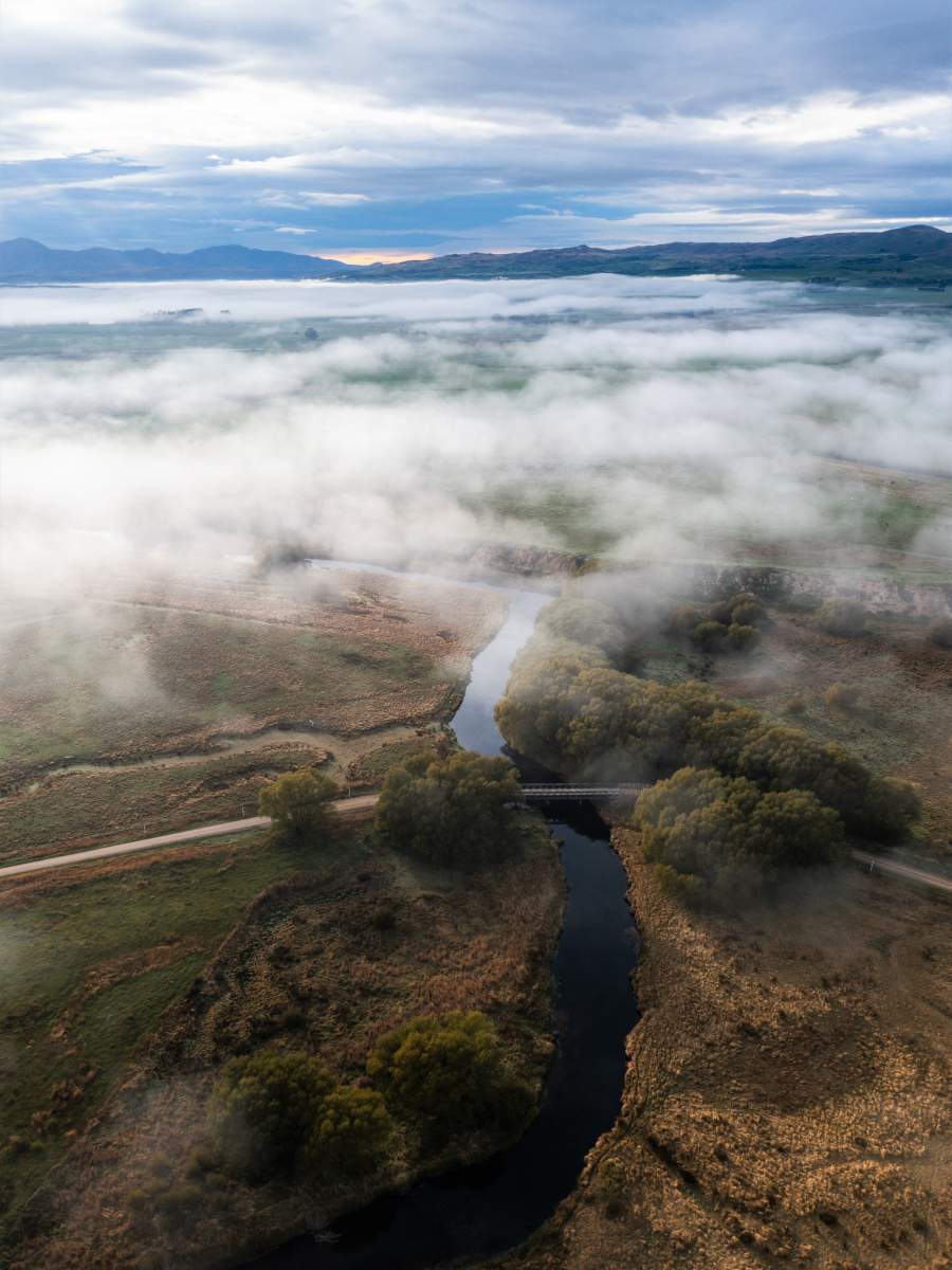
A misty morning on the Scroll Plain.
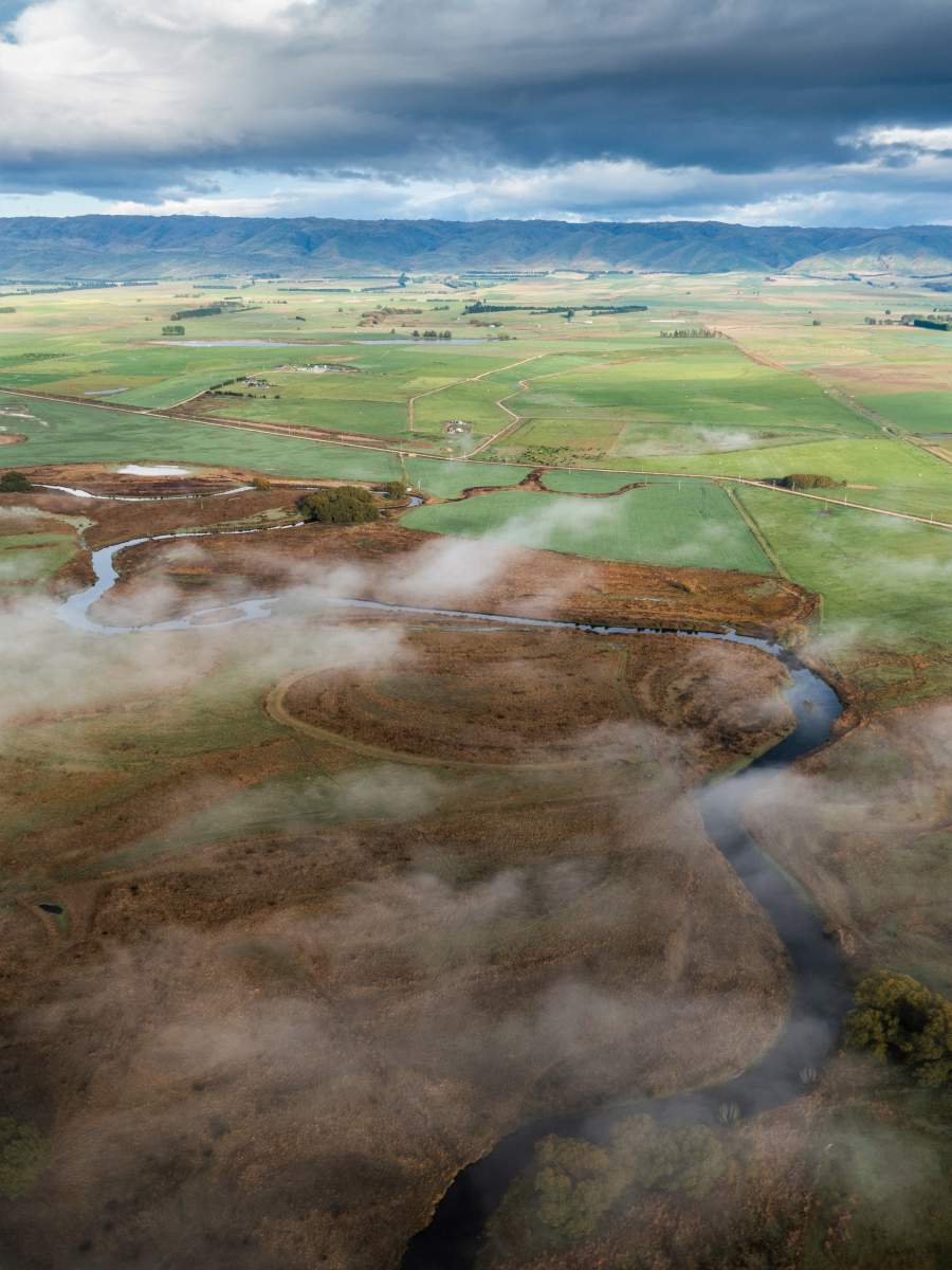
The Scroll Plain was an important source of food for coastal Māori.
A Refuge for Biodiversity
Today, the Taiari catchment remains home to several species of rare and endangered native fish, including the Central Otago roundhead galaxiid. These fish are found only in the Taiari and a couple of neighbouring catchments. They are an easy meal for introduced trout, and so are only found in good numbers in those small headwaters and tributaries which the trout can't reach.
There are also a number of threatened plants living on the scroll plain. Burgan's skinks, found only in this area, make their home in the tussock grasslands of the upper catchment. Salt pans and other small saline areas also naturally occur on the Māniatoto part of the scroll plain, as does the larger Patearoa Inland Saline Wetland. These rare ecological areas contain unique salt-tolerating plants. Some are endemic to Central Otago and found nowhere else in the world.
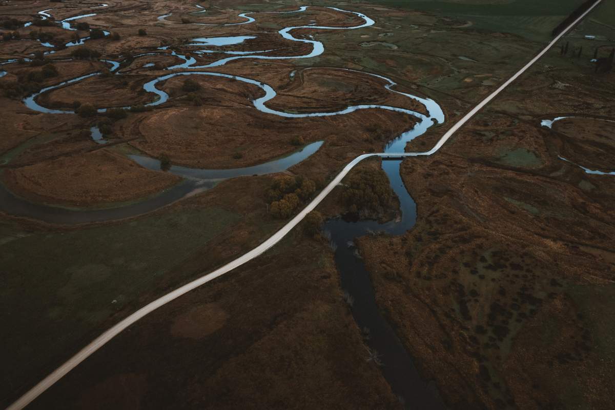
The Upper Taiari is a vital refuge for endangered native biodiversity.
The catchment is also an important water supply for agriculture.
Tiaki Māniatoto – Helping Wildlife and Farming Coexist Successfully
As in most river catchments in New Zealand, farming creates challenges for water quality in the upper Taiari. Intensive winter grazing and stock pugging can contribute to increased sediment load in the river, which has negative effects for flora and fauna. Nitrogen and phosphorous leaching off farmland can also contribute to algal blooms. The impacts of farming along the Taiari are felt in the ocean, where sediment damages kelp forest and the many animals that depend on these ecosystems.
However, a number of farmers in the region have been working to address these issues for years and are now supported by Tiaki Māniatoto; a group formed under the umbrella of the catchment group Upper Taieri Wai to implement Ministry for the Environment Jobs for Nature funding for the protection and improvement of the freshwater catchment in the Upper Taiari/Taieri river. The scroll plain wetlands are also protected in the Otago Regional Council’s Water Plan and Central Otago District Council’s district plan.
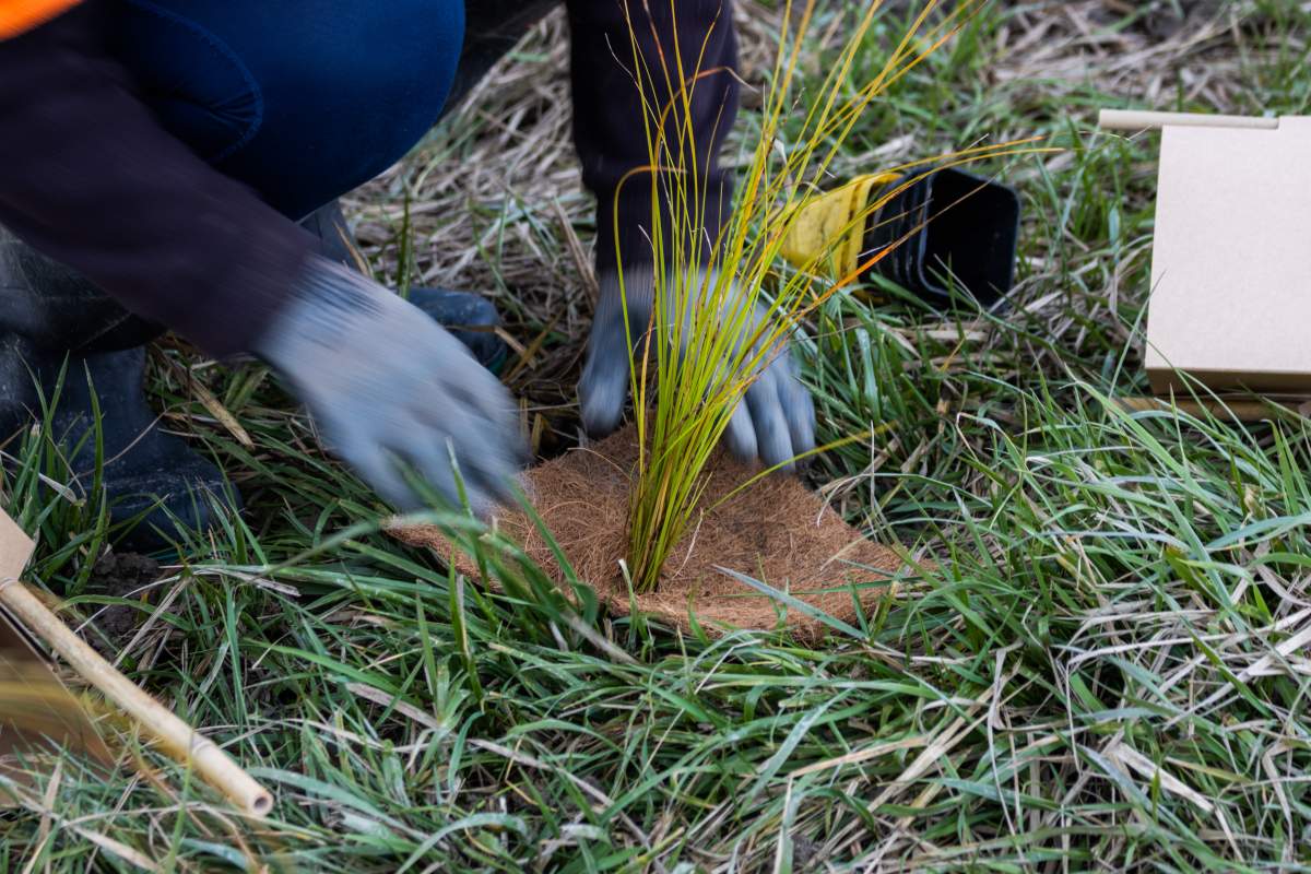
Since Tiaki Māniatoto has been funded, many more farmers have signed up to its planting and fencing programme proving that wildlife and farming coexist successfully. Through Tiaki Māniatoto, farmers can access subsidised fencing and the group takes care of the planting of natives in wet areas on their farms. So far, Tiaki Māniatoto has planted 30,000 plants and have fenced or are in the process of fencing 70 kilometres of vulnerable wetland areas.
One of the most tangible improvements of the project thus far has been the removal of large amounts of willows in the catchment, which is already allowing native ecosystems to regenerate. Improvement of water quality is a long-term project and increased monitoring is necessary before these gains will become apparent.
The Taiari river is precious to the local community. For farmers, it is the lifeblood of their operations, providing the water necessary to farm in this arid landscape. For them and others, it's also a place of recreation, valued for fishing and swimming. For visitors, the Taiari is a magical landscape, a place of peace and freedom. Cleaning up the river is essential to protecting all of these values.
Tiaki Māniatoto aims to continue apace with its planting and fencing programmes. The goal is to get up to 90,000 plants in the ground and have 200 kilometres fenced by the time its project funding comes to an end in 2026. There are also numerous community events planned in that time. Efforts are underway to improve fish passage for eels and lamprey. Recreation sites are being developed through the catchment, which will allow the public ease of access to the river and a signage programme is in place for people to learn more about it.
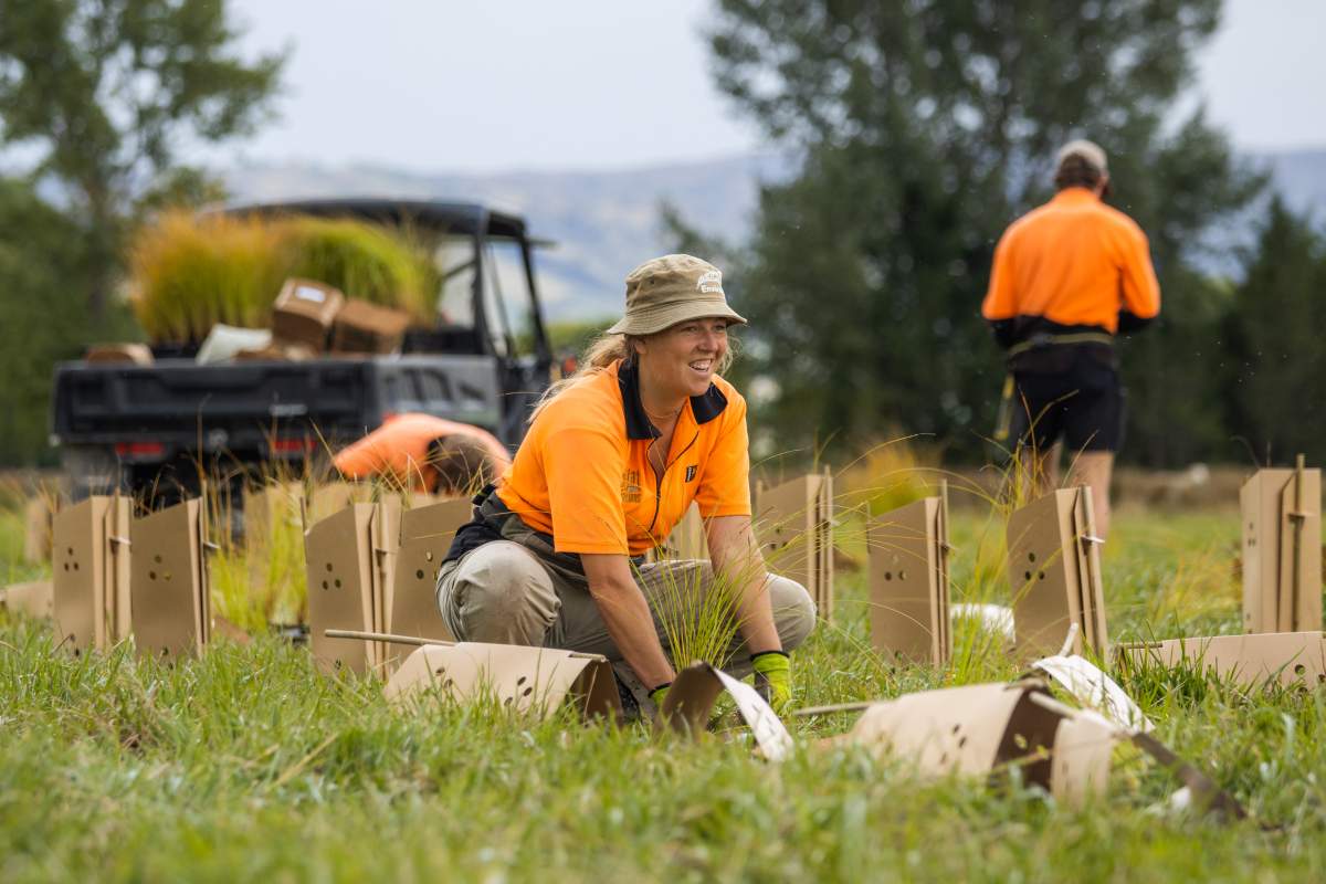
Riparian planting by Tiaki Māniatoto staff.
About Tiaki Māniatoto
Tiaki Māniatoto Communications Officer, Bill Morris, has a background as a documentary filmmaker, wildlife cameraman and science journalist. He started as a communications officer with Tiaki Māniatoto in mid-2023. Having grown up in the high country alongside a river, he feels that coming into this role feels a bit like coming home.
Tiaki Māniatoto members include farmers, landowners and representatives from the Department of Conservation, Fish and Game and Herenga ā Nuku Aotearoa. All are united by a passion for the Māniatoto area and a shared desire to improve water quality in the Taiari catchment. The organisation’s primary work is the fencing and planting of waterways in the catchment, as well as weed and pest control and the improvement of passage and habitat for native fish. Another key component of its mission is communication of freshwater values to the Māniatoto community and the wider public. The project is overseen by a volunteer governance committee and employs six people on a part-time basis in its working group.
Tiaki Māniatoto is always looking for volunteers, so please get in touch via email or check out the Facebook page.
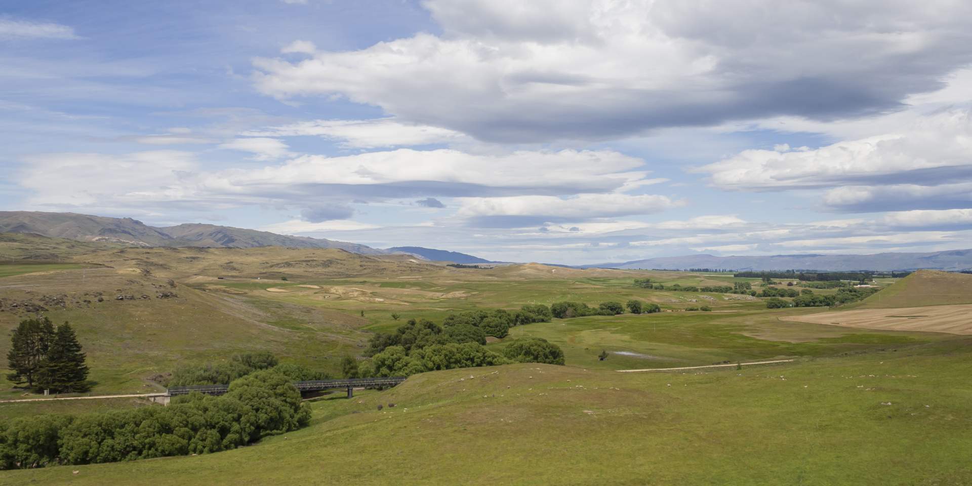
The Otago Central Rail Trail following the Taiari River valley near Waipiata. (Photo: Geoff Marks)
Accessing the Scroll Plain
Whilst approx. 500ha of the wetlands are managed by the Department of Conservation, most of the area is privately owned. Herenga ā Nuku Aotearoa, the Outdoor Access Commission, is currently working on improved access to the Taieri Scroll Plain, but in the meantime, please respect private landowners’ property when visiting the area.
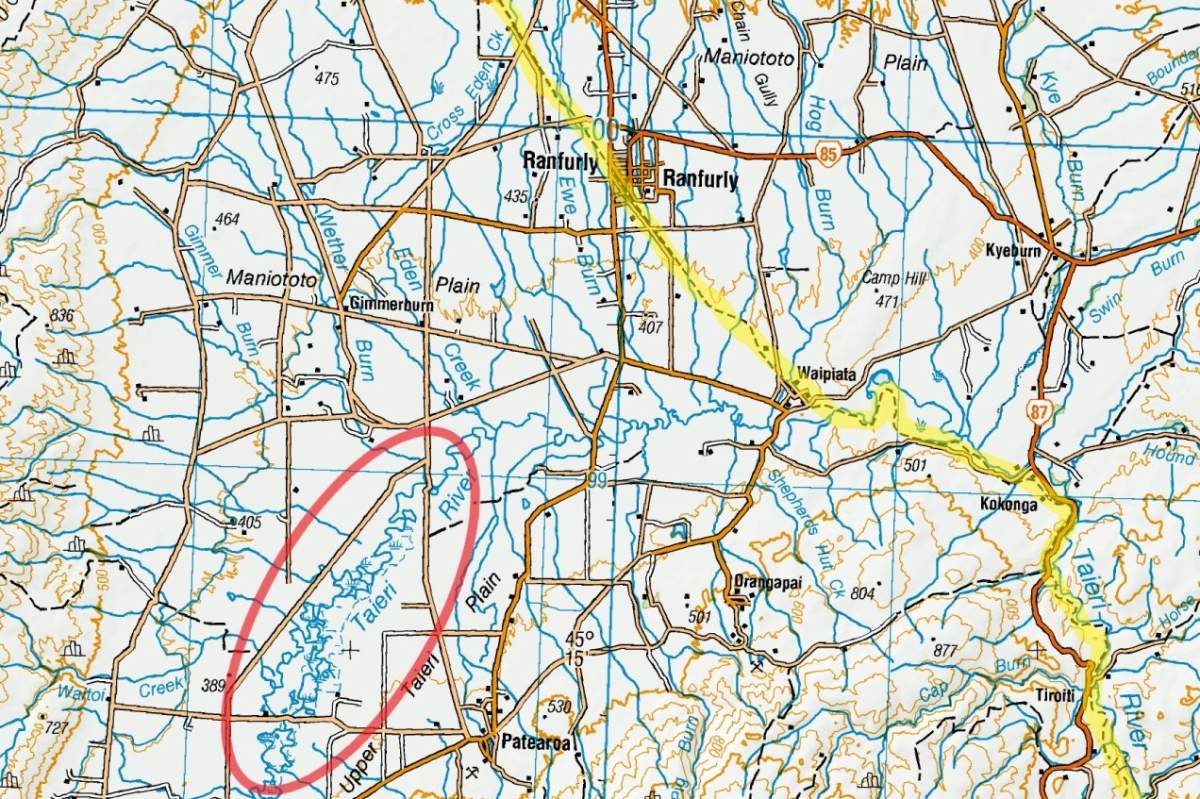
The Scroll Plain is a 15-20km detour from the Otago Central Rail Trail (highlighted in yellow).
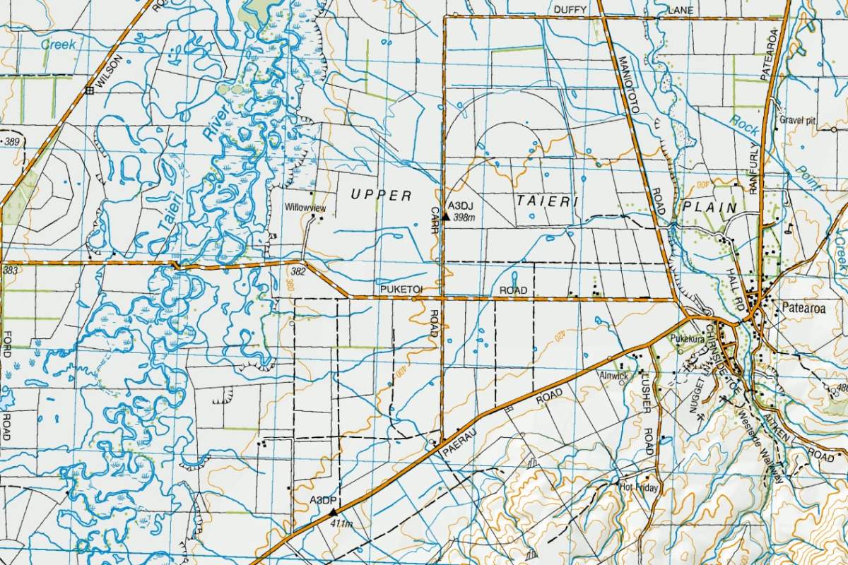
The oxbow lakes and meanders of the Scroll Plain (NZ Topo Map images sourced from LINZ - Crown Copyright Reserved)

Related Stories
-

Best Bakeries in Otago
From cinnamon scrolls to cheese rolls - a guide to the best trailside bakeries in Otago.
Read more about Best Bakeries in Otago -

25 Years On Track
The old and the new - celebrating 25 years of the Otago Central Rail Trail
Read more about 25 Years On Track -

Neat Trail Places
An insider's guide to the neatest places along Central Otago's bike trails.
Read more about Neat Trail Places -

-

Introduction to Trail Running
An introduction to trail running on Otago's Great Rides.
Read more about Introduction to Trail Running -

Bridges of the Otago Trails
Otago Bridges - a travel guide for walkers and cyclists
Read more about Bridges of the Otago Trails -

Best Things Along Dunedin Harbour Cycleway
11 of the best things to see and do along the new Dunedin Harbour Cycleway.
Read more about Best Things Along Dunedin Harbour Cycleway -

11 of the Best Short Walks in Otago
11 of the best short walks in Otago and close to the cycle trails, ranging from 30 minutes up to 3 hours.
Read more about 11 of the Best Short Walks in Otago -

Otago's Signature Tracks
Best short rides on the Queenstown Trails
Read more about Otago's Signature Tracks -

Otago's Classic Hits
Highlights of the Otago Central Rail Trail and Lake Dunstan Trail
Read more about Otago's Classic Hits -

Otago’s Greatest Hits
Highlights of the Clutha Gold and Roxburgh Gorge Trails
Read more about Otago’s Greatest Hits -

Otago Central Rail Trail Pub Guide
A guide to the pubs along the Otago Central Rail Trail
Read more about Otago Central Rail Trail Pub Guide -

Beginners Guide to the Otago Central Rail Trail
A beginner's guide to the Otago Central Rail Trail
Read more about Beginners Guide to the Otago Central Rail Trail


