11 of the Best Short Walks in Otago
A selection of the best short walks close to Otago's cycle trails, ranging from 30 minutes up to 3 hours.
The Otago region’s network of five Great Rides, covering over 500kms, are all designed as multiuse, shared walking and cycling trails. But, if you stray just a short distance from the manicured gravel surfaces of these trails, you might just find some of Otago’s most interesting and best short walks...
So to get you started, here’s 11 of the best short walks in Otago ranging from around 30 minutes up to about 3 hours, and all easily accessible from the cycle trail network which links Queenstown to Central Otago, Clutha and Dunedin.
Short Walks near the Queenstown Trails
The Queenstown Trails are a 135km network (and growing!) of purpose-built, off-road walking and biking trails which meander along the shores of Lake Whakatipu connecting Queenstown to the Gibbston Valley via historic Arrowtown.
There are lots of great walks connecting to the Queenstown Trails, but here are three local favourites to check out:
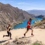
1. Queenstown Hill Time Walk
Distance: 3km return
Time: 2-3 hours return
Grade: Medium to hard
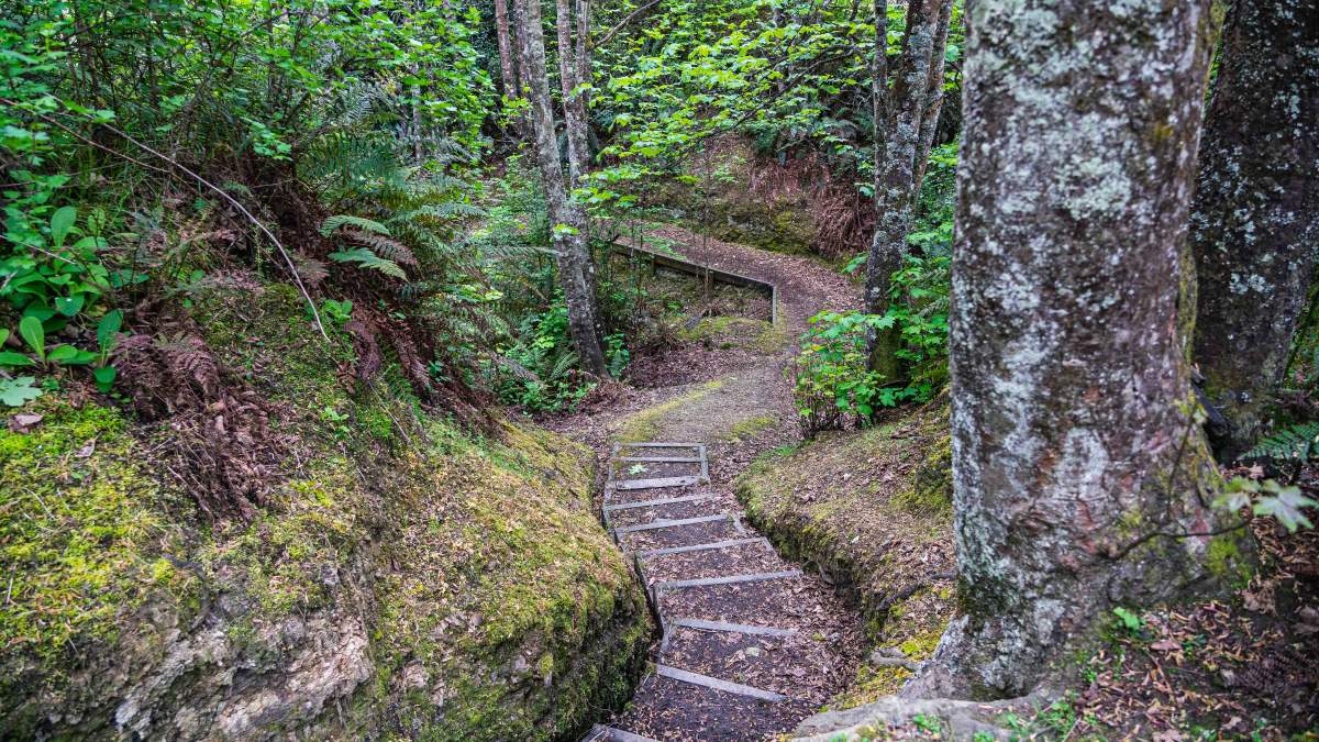
Not far from the Frankton Track and located in central Queenstown, the Queenstown Hill Time Walk is one of the most popular and accessible walks in town, and a local’s favourite.
Starting at a small car park off Belfast Terrace, the hike up Te Tapunui | Queenstown Hill might only be 1.5km long, but it’s quite steep and demanding. Along the track are six information panels which illustrate different periods of time in Queenstown’s history including historic Māori settlements, the goldrush and the development modern-day Queenstown, now an international resort town.
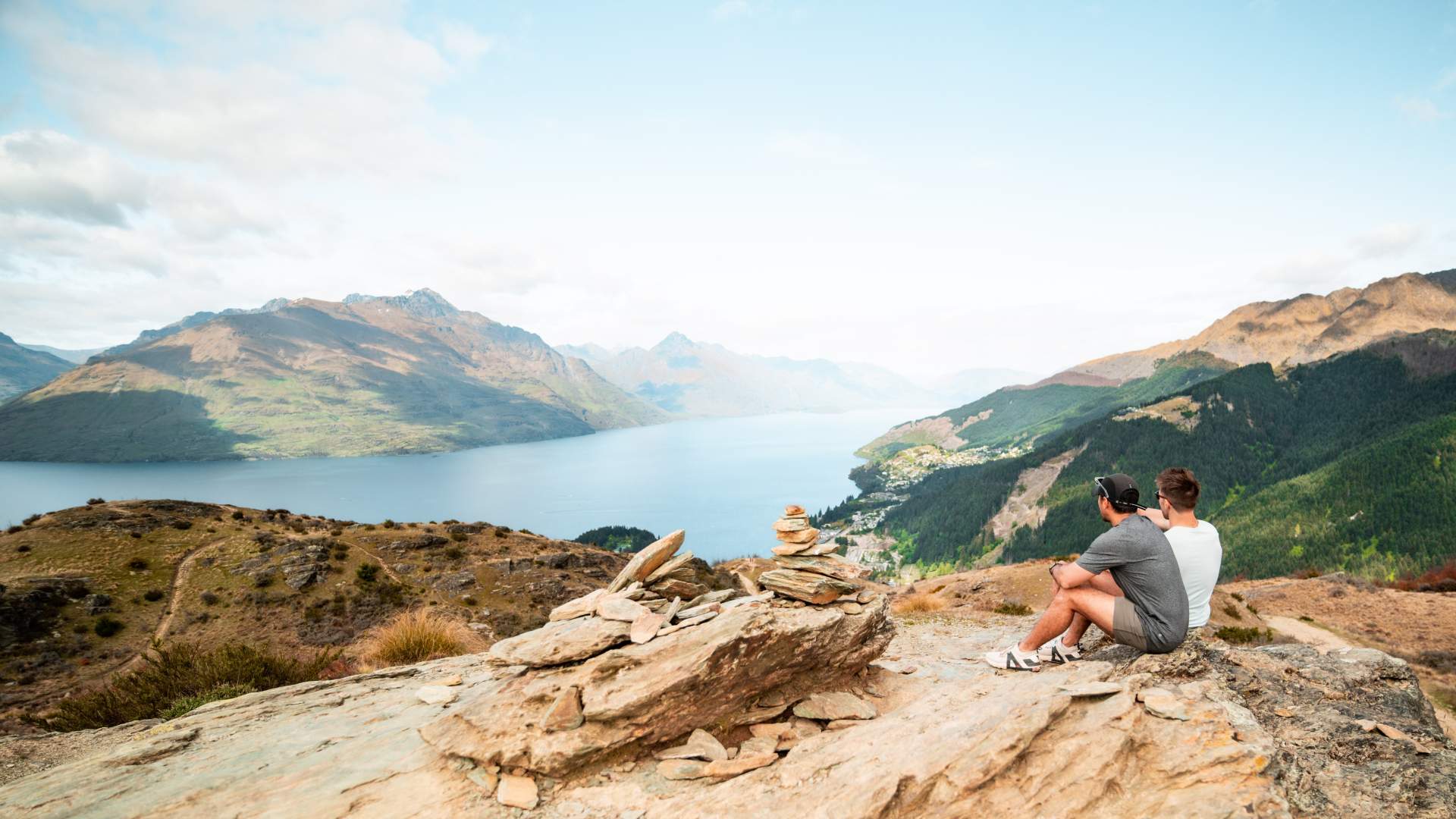
The short, steep climb up the Queenstown Hill Time Walk is well worth the epic views. [Photo: Destination Queenstown].
2. Sawpit Gully Trail, Arrowtown
Distance: 8km loop
Time: 2-3 hours
Grade: Moderate
NOTE: In wet conditions, numerous crossings of the small creek are necessary and good hiking boots are recommended.
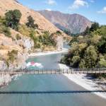
A good choice for a longer walk is the Sawpit Gully Trail which starts at Butler’s Green in Arrowtown, at the intersection of the Arrow River Bridges Trail, Countryside Trail and Coronet Loop at the top end of Buckingham Street. This is a moderately hard loop track through mostly open country with a variety of scenery and some great views across Arrowtown, Lake Hayes and the Whakatipu basin to the Remarkables mountain range.
The easiest way to tackle this loop walk is in an anticlockwise direction by following the Arrow River Bridges Trail first (a lovely short walk in its own right, especially in autumn). The Arrow River trail sidles above the river before you reach the turn off to Sawpit Gully which partly follows an old water race with old gold mining tailings visible down near the creek.
From here, there’s a steeper climb up through beech forest to more open, tussock country to the saddle between German Hill and Brow Peak. From the saddle, the track heads downhill past the Big Hill Trail towards Arrowtown providing magnificent views of the Whakatipu basin.
The autumn colours in Arrowtown make it an ideal location for walking. Photo: Arrow River.
3. Mount Crichton Loop Track
Distance: 6.4km loop
Time: 2hrs 30mins
Grade: Easy
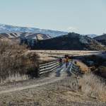
12km from Queenstown on the Glenorchy-Queenstown Road, is the Mt Crichton Loop Track, another walk popular with locals. This loop track follows part of Twelve Mile Creek through impressive stands of red beech forest. As the track climbs, it passes through mountain beech and mānuka, offering great views of Lake Dispute and glimpses of Lake Whakatipu.
The carpark is on your left as you head towards Glenorchy just after the Twelve Mile Delta Campground. At the start of the trail, you can go left over the bridge or right, but turning left offers an easier climb with a more gradual incline.
The Twelve Mile Creek Gorge was intensively worked by goldminers, and signs of sluicing can still be seen, as well as Sam Summers old stone hut (about halfway around the loop). Built on the site of a Chinese goldminers camp in the 1930s, Sam lived here with his family while prospecting for gold. A short sidetrack below historic hut leads to an impressive rock tunnel once used as a tail race.
The trail is well maintained and can be walked year-round, but if it’s been raining, wear good boots for the muddy sections. Insect repellent is also recommended if you don’t want to donate too much blood to the attentive sandflies!
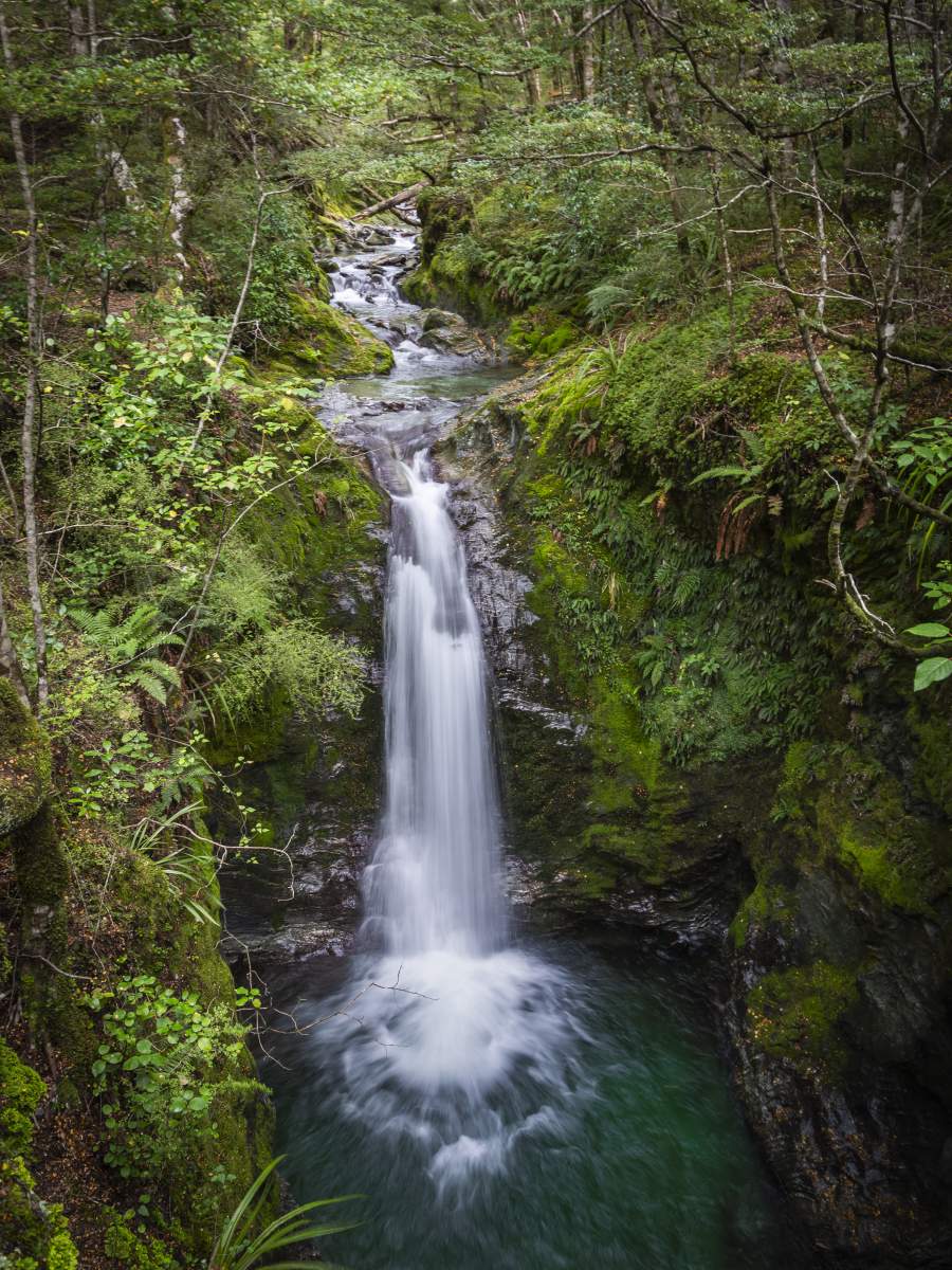
An impressive waterfall in the beech forest on the Mt Crichton Loop. [Photo: Geoff Marks]
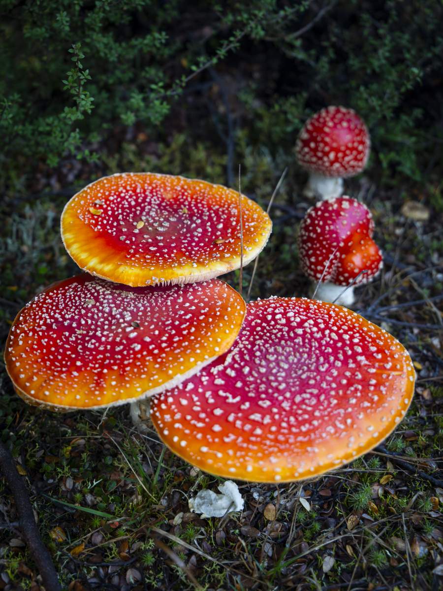
In autumn the forest floor is a carpet of brightly coloured (and poisonous) fly agaric mushrooms. [Photo: Geoff Marks]
The Best Walk near the Lake Dunstan Trail
The 55km Lake Dunstan Trail is the latest trail in the Ngā Haerenga Great Rides of New Zealand network and links the townships of Clyde and Cromwell.
4. Bannockburn Sluicings
Distance: 3.5km loop
Time: 1hr 30mins
Grade: Easy
Caution. There are old mining shafts throughout this area, children should be closely supervised.
This fascinating Tohu Whenua site is the legacy of goldmining activity which radically transformed the landscape 150 years ago. Through a technique called ‘hydraulic sluicing’ water was blasted at the hills to release gold leaving behind the barren, desert-like Badlands landscape visible today.
The Bannockburn Sluicings are located on Felton Road in Bannockburn and situated amongst the wineries and vineyards of this prolific wine growing region. A newly developed cycle trail (the first open section of the Kawarau Gorge Trail, currently under construction) runs parallel to Felton Road and is a short detour from the Lake Dunstan Trail.
The Sluicings are best experienced up-close and the easy 3.5km loop walk reveals a valley of caves, tunnels, rock tailings and mining artefacts left untouched since they were abandoned by the last goldminers. The trail is generally well-marked and maintained, making it accessible to a wide range of walkers, including families and people of various fitness levels.
Wine tasting or lunch at one of the winery restaurants before or after your walk is a must do!
If you’ve got time and a wee bit more energy, you can trace the water source back up to the Menzies Dam in Stewart Town. Here you’ll find the remains of a stone cottage, an early 19th century orchard (with amazing stone fruit in the summer – if you’re lucky!), and great views across Cromwell and Bailey’s Gully.
Read more about Otago’s best gold mining heritage sites here.
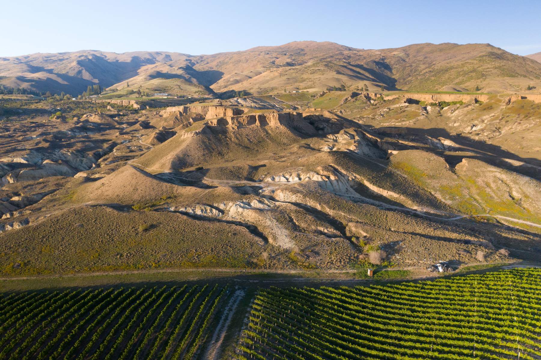
Aerial view of the Bannockburn Sluicings with Gate 20 Two Vineyard in the foreground. [Photo: Will Nelson]
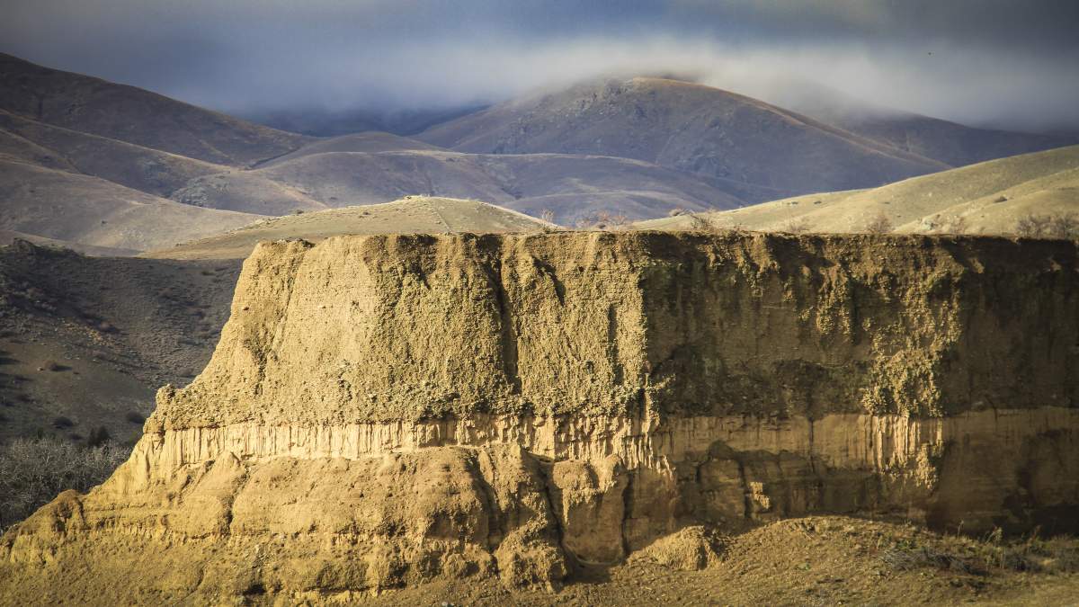
The Bannockburn Sluicings "badlands" look like they're straight out of a spaghetti western. [Photo: Geoff Marks]
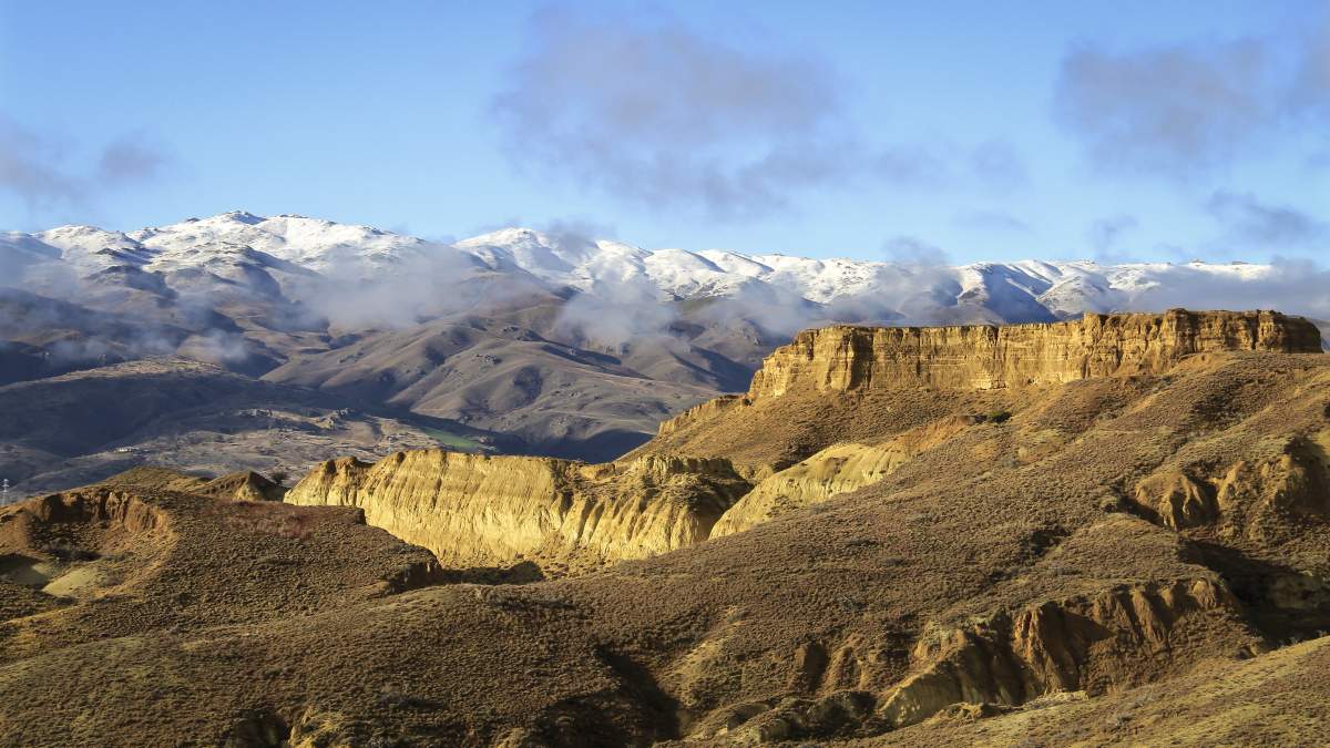
The manmade landscape contrasts dramatically against the mountains of Central Otago. [Photo: Geoff Marks]
Otago Central Rail Trail
At 152km long, there are a multitude of short walks along the Otago Central Rail Trail, with each trail town offering tracks and trails for visitors. We’ve selected three of the most unique options, although you can find more tracks and trails across Central Otago here.
5. Sutton Salt Lake, Middlemarch
Distance: 3.5km loop
Time: 1 hour
Grade: Easy
Located about 11km from Middlemarch, the eastern terminus of the Rail Trail, Sutton Salt Lake is New Zealand's only inland salt lake, and which has water about half as salty as seawater.
Situated amongst the dramatic parallel rock ridges of Sutton, with a backdrop of the Rock and Pillar Range, the lake has formed in an enclosed shallow basin within the schist rock surrounds. With no outlet, Sutton Salt Lake has concentrated salts from the soil as it has repeatedly filled, evaporated, and then refilled. Although often dry, salt tolerant herbs and grasses occupy the lake margins and a range of water birds and waders use the lake, feeding on salt-adapted aquatic invertebrates.
A 3.5 km self-guided loop walk around the lake is an easy way to enjoy the natural history of this stunning landscape. To get here, head south from Middlemarch for about 9 km along SH87, the lake is then 2.5 km along the unsealed Kidds Road.
6. Blue Lake, St Bathans
Distance: 2km – 3km
Time: 1 – 2 hours
Grade: Easy
Like the Bannockburn Sluicings, the Blue Lake in St Bathans is a dramatic manmade landscape created by goldmining and is a worthwhile detour from the Rail Trail (approx. 25km from Lauder or Wedderburn).
St Bathans was established in 1863 to service the gold rush and at the time the site of the Blue Lake was the deepest mine in the southern hemisphere. In fact, the lake was once the 120m high Kildare Hill. The hill was sluiced flat by the elevator which excavated a massive, 70 metre deep ‘glory hole’.
There are two tracks to explore here, the 2km return Blue Lake Loop Track or the Around Blue Lake Track at 3km return. Regardless of which trail you follow, refreshments at the historic Vulcan Hotel afterwards are a must.
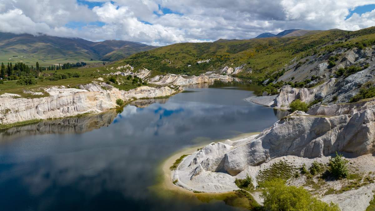
Spot the difference!.... The Blue Lake, St Bathans [Photo: James Hustler | Southern Way].

... and Sutton Salt Lake near Middlemarch. [Photo: Enterprise Dunedin].
7. Manuherikia River Track and Alexandra Clock Lookout
Distance: 1.5km return
Time: 40 mins return
Grade: Easy
Between Little Valley Road (off SH85) and Kerry Street in Alexandra, the Manuherikia River Track leads to popular swimming and fishing spots, and links directly to the Rail Trail as well as providing access to the iconic Alexandra Clock on the Hill. The trail follows the scenic river gorge between the Shaky Bridge and the Old Railway Bridge in Alexandra.
To get to the Clock on the Hill, follow the Manuherikia River Track and cross the river at Shaky Bridge. From here, an uneven, rocky path leads up to the 11m tall clock built in 1968 and offers panoramic views of Alexandra and along the Otago Central Rail Trail.
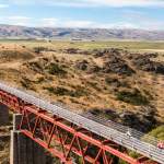
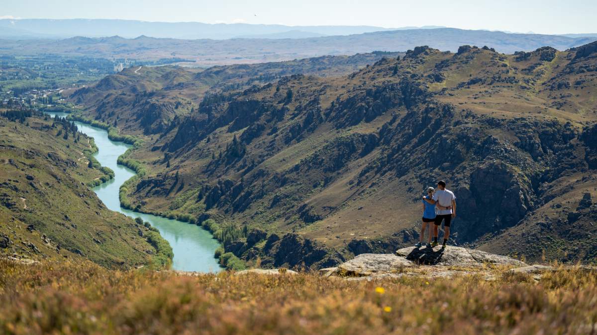
Roxburgh Gorge Trail
The Roxburgh Gorge Trail offers a wilderness walking or cycling experience that follows the spectacular Roxburgh Gorge and Mata Au | Clutha River through some of Central Otago’s most iconic landscapes.
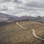
8. Butchers Dam and Flat Top Hill, Alexandra
Distance: 1.5km – 13km
Time: 30mins – 4h 30mins
Grade: Easy - Hard
7km from Alexandra along SH8 you’ll find the Flat Top Hill Conservation Area where there’s an extensive network of walking, hiking and mountain biking trails. The area is particularly good for families with highlights including Butcher’s Dam, a lake, historic huts, skinks and a taste of the area's geology, dry vegetation and animals that live in it. For those with good fitness, the Basin View Track offers sensational views of the Roxburgh Gorge.
Popular walks include:
- Butchers Dam Loop Track: 30 min loop, 1.5 km (easy)
- Basin View Track: 3 hr, 7.5 km return (moderate)
- Flat Top Hill Track: 4 hr 30 min, 13 km (advanced)
All times are from the car park.
The entire Flat Top Hill Tramping Track and Basin View Tramping Track loop from the car park is 13km (return loop) via the Butchers Dam Loop Track. This takes approximately 4-5 hours to complete and can be very hot in summer with little shade or shelter. Take plenty of water with you.
You can also connect Flat Top Hill to the Roxburgh Gorge Trail by following the 2.5km long Roxburgh Faces Tramping Track (also called Haul Road East). Allow 1hr 30 min - 2hr from Flat Top Hill Tramping Track to the Roxburgh Gorge Trail. This track steeply descends 400m.
For more information on tracks in Alexandra and Cromwell, download the Department of Conservation brochure.
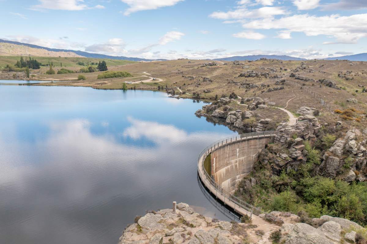
The Butchers Dam and Flat Top Hill area offer a network of walking and mountain biking tracks. [Photo: Morgan Potter].
Epic views of the Roxburgh Gorge and Alexandra from Flat Top Hill. [Photo: James Hustler | Southern Way].
Clutha Gold Trail
The 135km Clutha Gold Trail showcases the rich history of the Central Otago and Clutha regions, following the path once traversed by gold miners during the 19th-century gold rush.
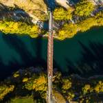
9. Horseshoe Bend Bridge, near Millers Flat
Distance: 500m return
Time: 30mins
Grade: Easy
An 8km drive downriver from Millers Flat along Craig Flat Road – or by bike along the Clutha Gold Trail - is Horseshoe Bend Bridge. A track from an information kiosk leads to this historic suspension bridge over the Clutha River which makes for an interesting detour from the cycle trail.
At 70.2 metres long, spanning New Zealand’s largest river the Clutha | Mata Au, it’s one of the most substantial and impressive footbridges in NZ. For New Zealand’s early settlers, a major problem was the safe crossing of the country’s wild rivers and one of the commonest causes of death in the early period was from drowning. So, bridges were a vital piece of pioneering infrastructure. Today, very few of the countless suspension bridges built between the 1840s – 1930s remain.
In the early days, the Horseshoe Bend community had to cross the river by punt or by an arrangement of a chair attached to a manually hauled cable, particularly scary for children attending school at Raes Junction. So, a bridge was eventually constructed in 1913.
Whilst in this area, drive or cycle 1km further downstream and view the Lonely Graves, located beside the road with a car park adjacent. There are two graves here. According to legend, in 1865 William Rigney found the body of an attractive young man in the river. He buried it here with the headboard inscribed ‘Somebody’s Darling lies buried here’. When William died in 1912, he was buried beside ‘Somebody’s Darling’.
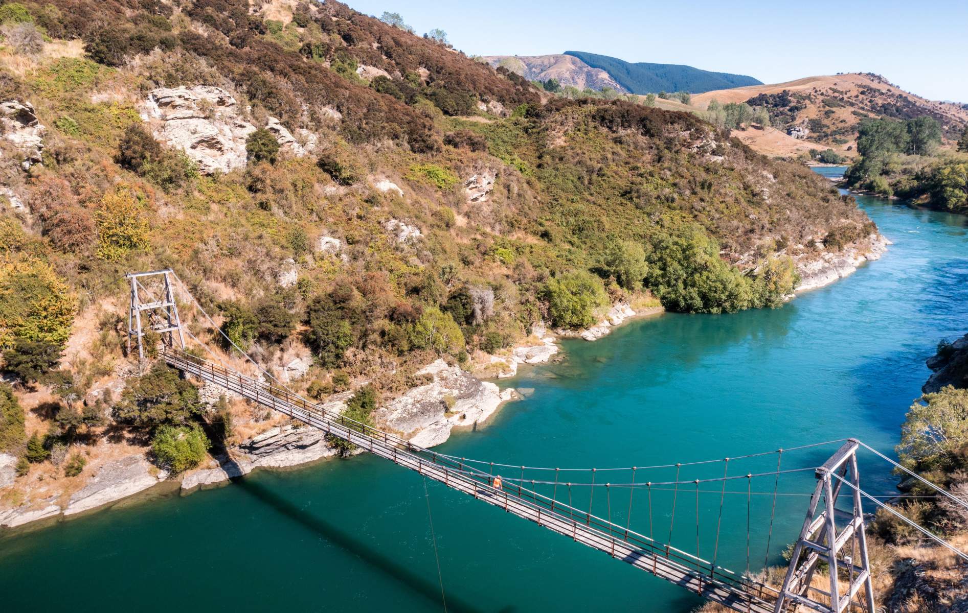
Horseshoe Bend Bridge crossing the might Clutha River | Mata Au. [Photo: Will Nelson].
10. Gabriels Gully Interpretation Walk
Distance: 2.8km loop
Time: 1hr 30mins
Grade: Easy
Lawrence marks the halfway point on the 135km Clutha Gold Trail, and a 3km detour from town to Gabriel’s Gully marks the spot where the original Otago Goldrush started when Gabriel Read struck gold in 1861.
A self-guided loop walk incorporating a series of interpretation panels lets you explore Gabriels Gully and recounts the stories of the old goldfield occupants.
After the loop walk, the Gray’s Dam area beyond the main car park is ideal for a picnic, or if you’re feeling energetic you can follow the Otago Dam Track which begins at Grays Dam. The track takes about 2 hours (return) and includes several stream crossings. This track requires a reasonable level of fitness and sturdy footwear.
11. Woolshed Valley, Mount Stuart
Distance: 1.5km (return)
Time: 40mins (return)
Grade: Easy
The Mount Stuart Recreational Reserve is a great rest stop for cyclists on the Clutha Gold Trail, especially in summer with the shade of mature trees, or a lovely picnic spot for those driving between Dunedin and Central Otago on SH8. The area features a range of significant specimen trees including sequoia, oak, lime, poplar and Dutch elm, some of which were planted more than 100 years ago when the reserve was part of the adjacent homestead garden.
Meander the reserve then take a pleasant stroll along the Woolshed Valley Track a 40-minute return walking track from the reserve that follows the Tokomairiro River through bush to Woolshed Valley at Glenore. Woolshed Valley was the original name given to the Glenore area by goldminers in the 1860's after timber from a farmer's woolshed was removed by miners for use on their gold claims.
Once you reach Woolshed Valley (Glenore) return via the same track.
The short loop walk at Gabriels Gully includes fascinating interpretation panels about the goldrush of the 1860s. [Photo: Clutha Development].
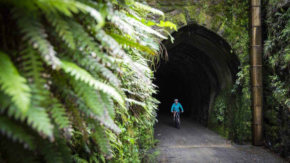
Cycling through the Mount Stuart Tunnel, a short ride along the trail from the reserve. [Photo: Geoff Marks].

Related Stories
-

Introduction to Trail Running
An introduction to trail running on Otago's Great Rides.
Read more about Introduction to Trail Running -
Bridges of the Otago Trails
Otago Bridges - a travel guide for walkers and cyclists
Read more about Bridges of the Otago Trails -
Best Things Along Dunedin Harbour Cycleway
11 of the best things to see and do along the new Dunedin Harbour Cycleway.
Read more about Best Things Along Dunedin Harbour Cycleway -
Otago's Signature Tracks
Best short rides on the Queenstown Trails
Read more about Otago's Signature Tracks -
Beginners Guide to Queenstown Trails
A beginner's guide to biking the Queenstown Trails
Read more about Beginners Guide to Queenstown Trails -
In Pictures - The Shotover Gorge Trail
Images of the new Kimi-ākau | Shotover Gorge Trail in Queenstown
Read more about In Pictures - The Shotover Gorge Trail -
One Day Winter Wonders
The best bike rides on the Otago cycle trails in winter.
Read more about One Day Winter Wonders -
Otago's Classic Hits
Highlights of the Otago Central Rail Trail and Lake Dunstan Trail
Read more about Otago's Classic Hits -
Otago Central Rail Trail Pub Guide
A guide to the pubs along the Otago Central Rail Trail
Read more about Otago Central Rail Trail Pub Guide -
25 Years On Track
The old and the new - celebrating 25 years of the Otago Central Rail Trail
Read more about 25 Years On Track -
Beginners Guide to the Otago Central Rail Trail
A beginner's guide to the Otago Central Rail Trail
Read more about Beginners Guide to the Otago Central Rail Trail -
Hawksburn - Thomsons Gorge Gravel Bike Double
An epic 12hour, 210km gravel bike mission through Central Otago.
Read more about Hawksburn - Thomsons Gorge Gravel Bike Double -
Clyde Dam Tour
A tour of the Clyde Dam is a unique opportunity to explore this icon of the Lake Dunstan Trail.
Read more about Clyde Dam Tour -
Otago’s Greatest Hits
Highlights of the Clutha Gold and Roxburgh Gorge Trails
Read more about Otago’s Greatest Hits -
Wheel Life
Rob McFarland of Explore Magazine on cycling New Zealand's latest spectacular Great Ride
Read more about Wheel Life -
Clutha Gold Trail Beginners Guide
A beginners guide to the Clutha Gold Trail
Read more about Clutha Gold Trail Beginners Guide