No Bridge Too Far...
A travel guide to iconic bridges along the Otago cycle trails.
Otago’s bridges are an integral part of the region’s rich history, serving as an essential means of transportation, commerce, and communication. But these bridges are not just connectors of people and places, they’re also storytellers of Otago’s heritage.
Today, there are dozens of iconic bridges connecting the network of walking and cycling trails across the Otago region. As well as being the much-photographed scenic highlights on a road trip or journey by bicycle through Otago, they’re also a metaphor for the freedom that travel can bring.
Beyond their practical function, bridges have also come to symbolise new beginnings, transition or change, overcoming fear, a meeting point, or a symbol of travel and new experiences… Similar it would seem to the feelings of freedom, progress, renewal, and of promising times ahead which are associated with riding a bike.
So, with that in mind and to help connect you to new travel experiences and to embrace the freedom of cycling, here’s a travel guide to some of the most famous and photogenic bridges along the Otago walking and cycling trails.
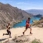
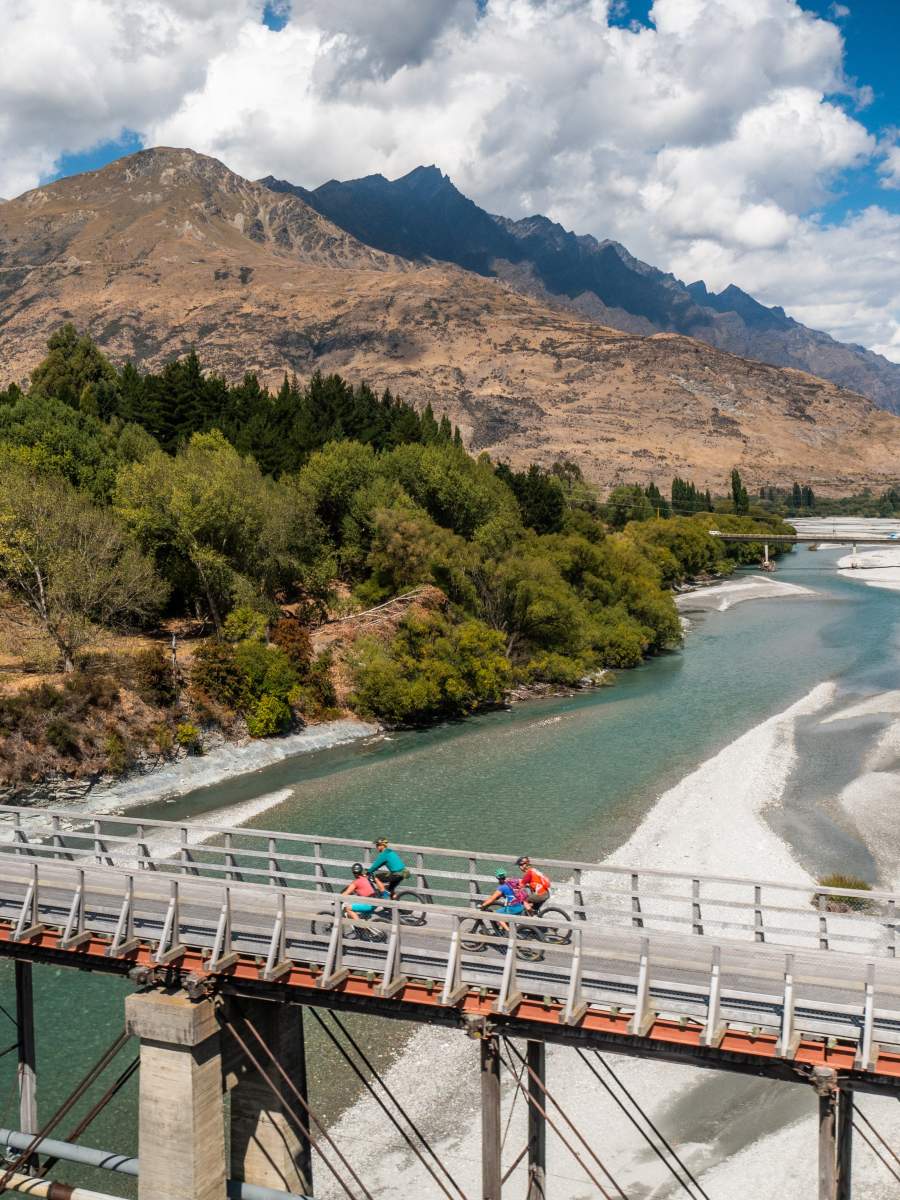
And, where better to start, than the mighty Mata Au | Clutha River, the longest river on the South Island…
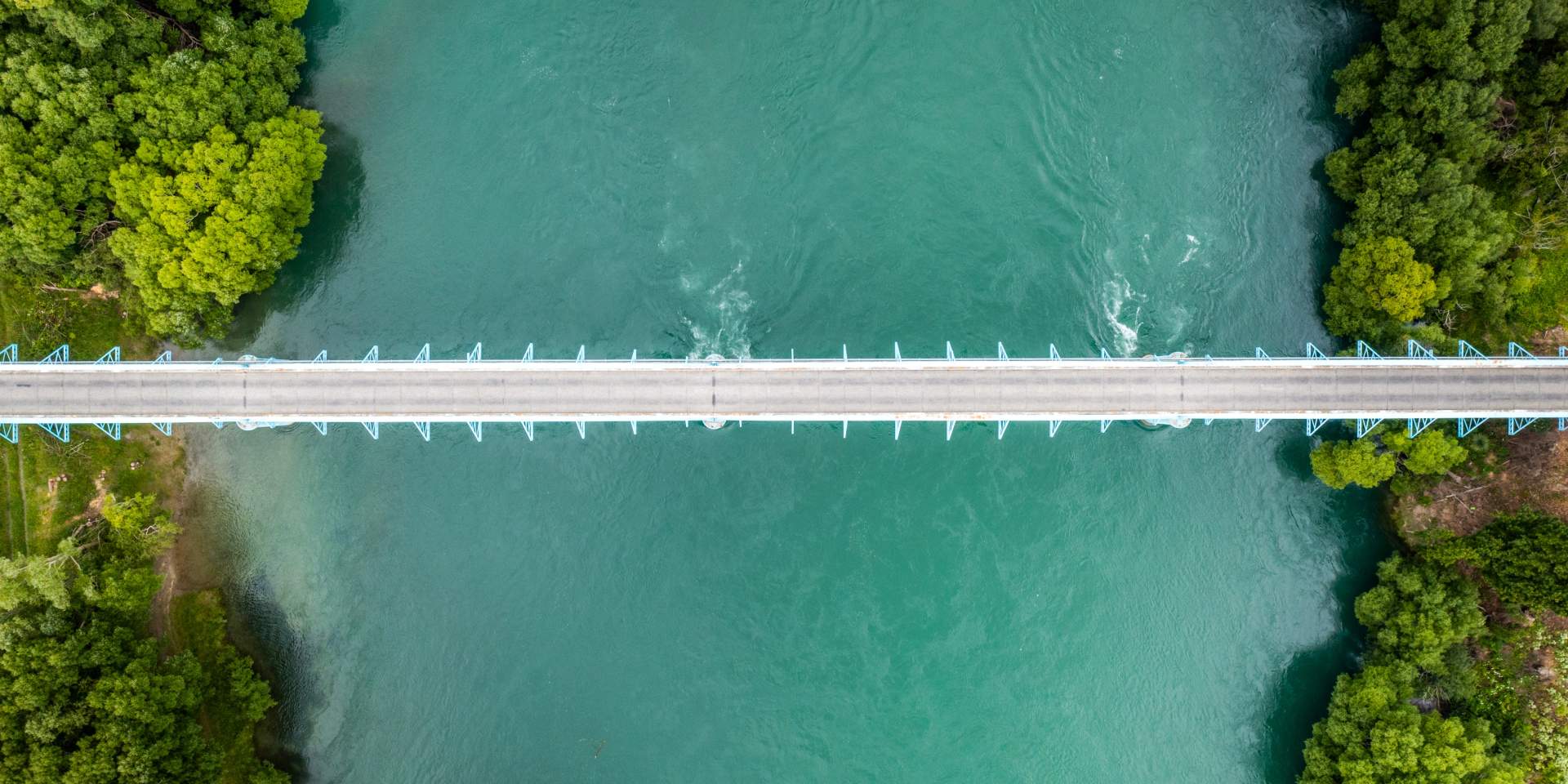
The mighty Mata Au | Clutha River at Millers Flat, Central Otago.
Bridges of the Clutha River
The Clutha River | Mata Au is New Zealand’s second longest river (338km) and the largest river by volume with an average flow of 614 cubic metres per second, which is almost double the flow of NZ’s longest river, the Waikato.
Throughout New Zealand’s history, safely crossing the swift, deep waters of the Clutha | Mata Au has been a challenge, and so bridges and safe places to ford the river have always been critical. For Māori, the Mata Au provided direct access from the east coast through Central Otago into lakes Wānaka, Hāwea and Whakatipu and then onto the West Coast across via alpine passes of the Southern Alps. For the European pioneers a very common cause of death was from drowning, and the river was especially treacherous for the gold prospectors of the 1860’s who risked crossing the river in search of their fortune. Many early bridges were destroyed in floods and with great distances to travel between bridges, transport and communication in Otago was not easy.
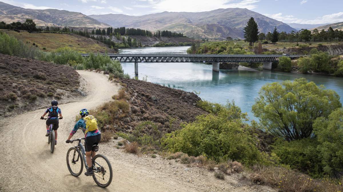
Today, the Clutha River is a major feature of the Lake Dunstan, Roxburgh Gorge and Clutha Gold Trails and its historic bridges remain key trail attributes with new bridges having been constructed to service the needs of the ever-growing cycle trail network.
Hugo Bridge, Lake Dunstan Trail
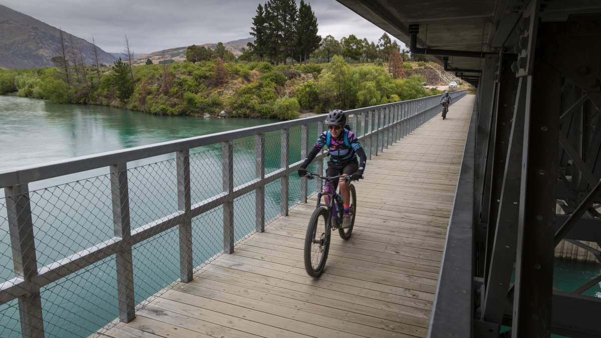
Lake Dunstan was formed on the Clutha River by the construction of a hydroelectric scheme and the Clyde Dam. The lake was filled in four controlled stages from April 1992.
Along with the gravity-defying walkways which flank the steep rock cliffs through the Cromwell Gorge, the 85.5m long and 29m high Hugo Bridge is one of the most iconic features of the Lake Dunstan Trail. The suspension bridge is named after Irish philanthropist and businessman the late Hugh Green, known in Ireland as Hugo. The Hugo Charitable Trust has donated millions of dollars to charitable causes around New Zealand and generously supported the Lake Dunstan Trail by paying for the construction of this spectacular bridge.
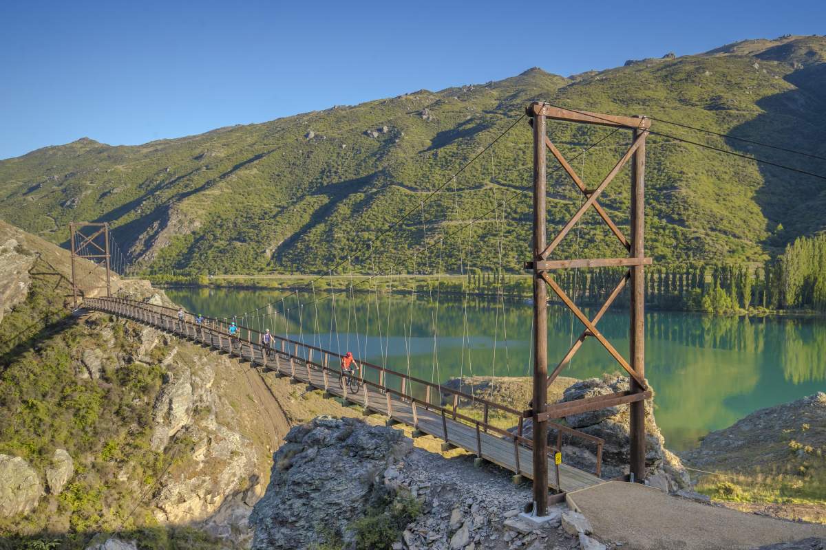
The Hugo Bridge, Lake Dunstan Trail.
The Earnscleugh Bridge with the Clyde Dam in the background.
The Earnscleugh Bridge, Clyde
The Earnscleugh Bridge was originally a suspension bridge which was twice destroyed by floods. This existing bridge across the Clutha River linking Clyde to Earnscleugh was opened in 1934. It replaced a bridge built in 1881 but still partially sits on the original bridge’s piers.
Earnscleugh Bridge was part of the first wave of bridge building in this area of Otago and the piers are a legacy of the work of Vincent County Engineer Leslie Duncan Macgeorge, a prominent bridge designer in Central Otago during the 1870s.
For cyclists the bridge connects the Lake Dunstan Trail with the Otago Central Rail Trail which both begin / end in the historic town of Clyde.
The Alexandra Bridge
Downstream from Clyde on the Clutha River is another of Macgeorge’s bridges, or rather the remnants. Lying parallel to the existing road bridge on State Highway 8 are the just the piers, abutments, and towers of the original suspension bridge built in 1882. At that time, the Alexandra Bridge was one of New Zealand's biggest and strongest. It was a vital piece of infrastructure for the region because 4-years earlier the nearest bridge, located at upstream at Clyde, was destroyed in a flood. The current steel truss arch bridge opened on 5 July 1958.
Cyclists can connect from the Otago Central Rail Trail to the Roxburgh Gorge Trail at the Alexandra Bridge.
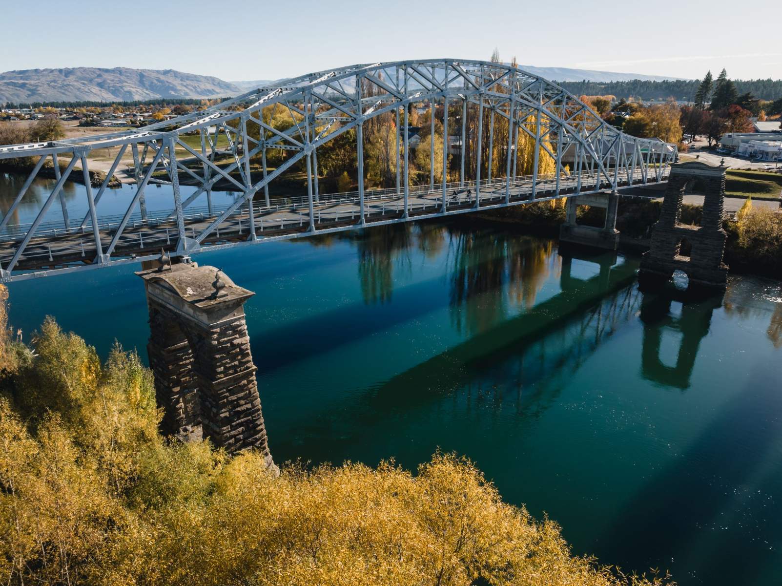
The Alexandra Bridge across the Clutha River next to the original towers from the 1882 bridge.
Roxburgh Dam
OK, so whilst technically not a bridge per se, the Roxburgh Dam is an important feature of the trails network, where hikers and bikers cross from the Roxburgh Gorge Trail to connect with the Clutha Gold Trail.
Roxburgh Dam was part of the first hydroelectric project to be constructed in the South Island and was officially opened on 3 November 1956. It was commissioned between 1956 -1962. The dam is 76m high and a total of 993,921 cubic metres of concrete was used in its construction and the spillway. The hydro scheme generates 1,650 GWh of electricity annually.
Roxburgh Bridge
The Roxburgh Bridge Pier (1875) and the Roxburgh Suspension Bridge towers (1887) are all what survive of the first two bridges constructed to span the Clutha River at Roxburgh.
Prior to the construction of the first bridge Roxburgh residents used punts to cross the Clutha River. By 1869 there were calls for a bridge to be built but it was not until 1875 that a bridge was installed. The bridge, designed by the Otago Provincial Engineer David Simpson was a very early example in New Zealand of laminated arch span construction.
In September 1878 a severe flood destroyed the Roxburgh Bridge. A new bridge was completed in May 1887. The structure had a single span of 82m supported by 28 cables to which the superstructure was attached.
By 1901 lack of maintenance of the suspension bridge was already a concern of Roxburgh residents. However, the bridge remained in use until 1974 when a replacement steel arch bridge was built alongside it. The 1887 bridge was dismantled leaving only the towers on the Roxburgh side of the river as a monument to early building efforts.
Roxburgh is a popular trail town along the Clutha Gold Trail and is also widely used by cyclists as the end point of a day ride along the Roxburgh Gorge Trail.
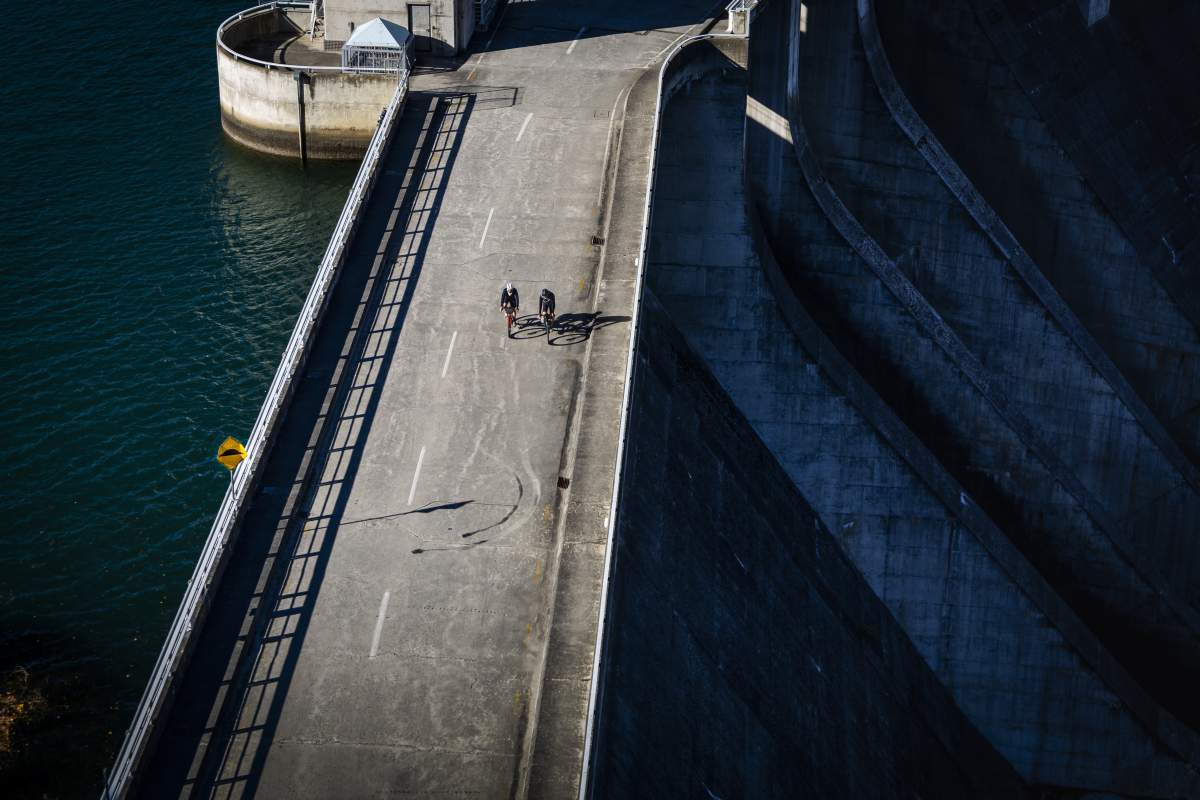
Not a bridge, but dam close... crossing the Clutha River at the Roxburgh Dam.
The Roxburgh Bridge connects town to the Clutha Gold Trail. The masonry towers from the original bridge can be seen on the left.
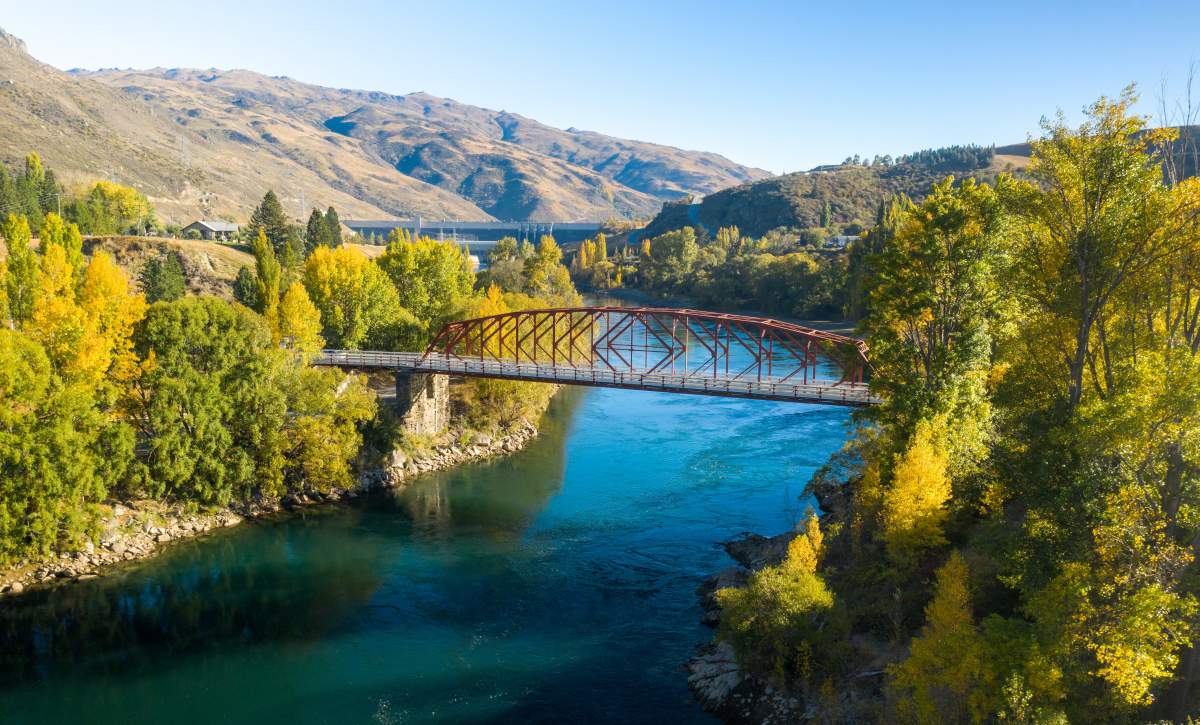
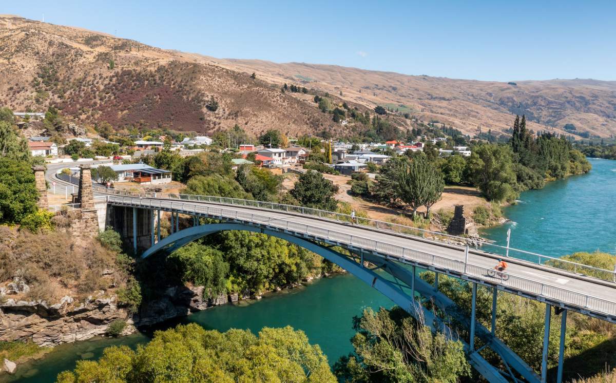
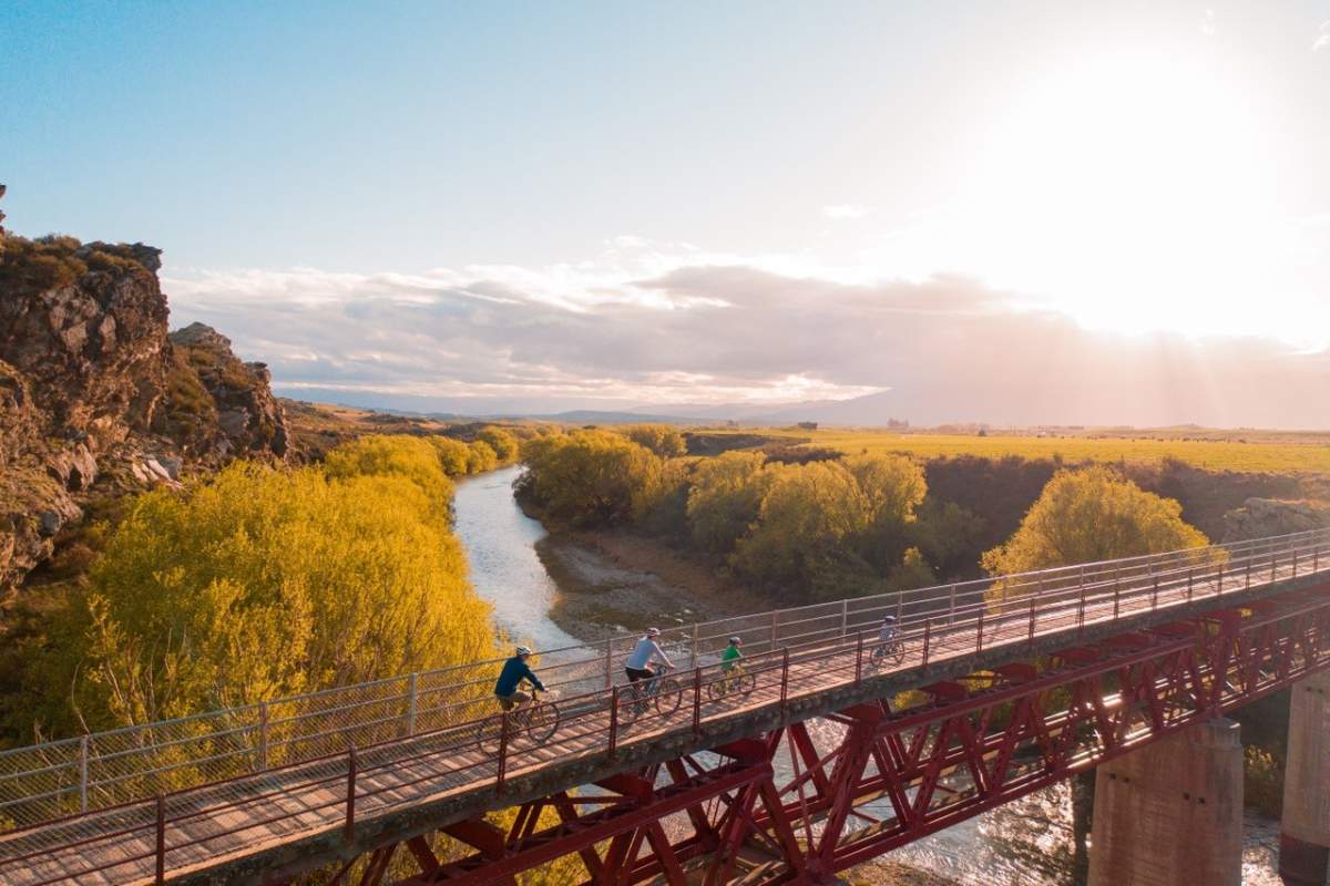
Millers Flat Bridge
The attractively painted blue bowstring arch road bridge at Millers Flat was designed by Robert Hay and construction started in 1897. It was opened in 1899. The heritage-listed bridge is still used as the main road bridge today. It’s a four span steel truss bridge, 176.2m long with four steel 4.9m high bowstring arch spans. The piers comprise of concrete-filled cast iron cylinders which are driven down 9m into the riverbed.
Cyclists on the Clutha Gold Trail can cross the blue bridge to access the Millers Flat Tavern, a great country pub.
Horseshoe Bend Bridge
The Horseshoe Bend Bridge at 70.2m long is one of the most substantial and impressive footbridges in the country and one of the few suspension bridges remaining that were built between the mid-1800’s and 1930’s.
Following the discovery of gold in Otago, both sides of the river were prospected, and gold was discovered in many sites in the Teviot area, one being Horseshoe Bend. The Horseshoe Bend community had to cross the river by punt or by an early sort of ‘chairlift’ – a precarious arrangement by which a chair attached to a manually hauled cable was used to pull people across the river. Whilst the community lobbied for many years for a bridge to be built, this did not happen till 1913.
Restored in 2003, the bridge is a short walk from the Clutha Gold Trail.
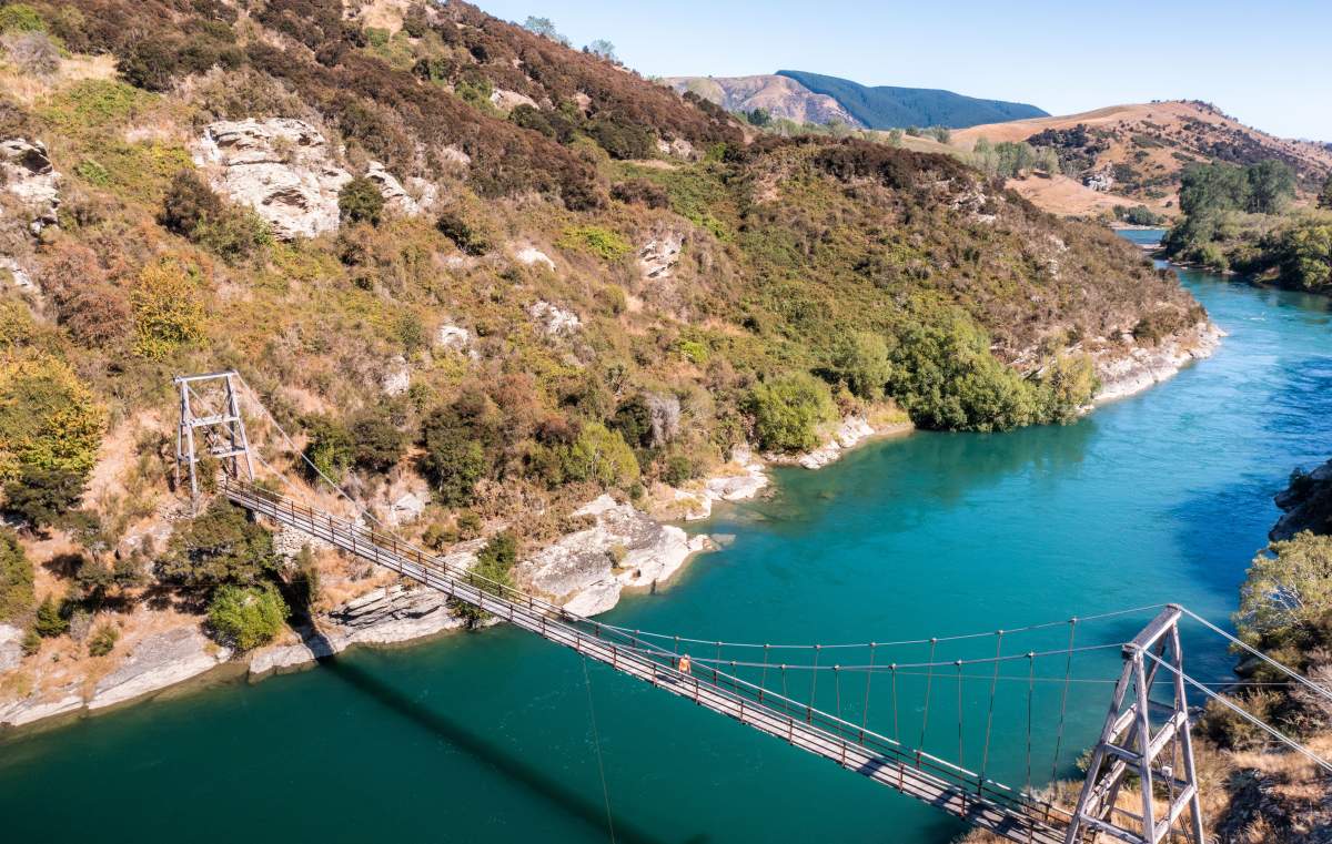
Horseshoe Bend Bridge is one of the few remaining suspension bridges built between the late 1800s - early 1900s.
Millers Flat Bridge, Clutha Gold Trail.
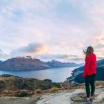
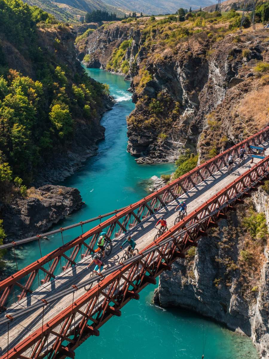
Queenstown and Kawarau River Bridges
Fed by the waters of Lake Whakatipu in Queenstown, the 60km long Kawarau River passes through the steep Kawarau Gorge until it joins Lake Dunstan near Cromwell. The Shotover River and Arrow River are tributaries and enter the Kawarau from the north.
Kawarau is a Māori name meaning "channel between rocks”.
Both the Kawarau and Shotover Rivers are prominent features of the Queenstown Trails, and an exciting new trail is currently under construction through the Kawarau Gorge to connect the Lake Dunstan Trail to the Queenstown trail network. The first part of this trail is already open along Felton Road in Bannockburn and passes through numerous vineyards and wineries.
Keep an eye out for passing jetboats when crossing the Shotover River in Queenstown.
Queenstown's iconic "Bungy Bridge" across the Kawarau Gorge.
Lower Shotover Bridge
Situated 10km from Queenstown the original Lower Shotover Bridge was built in 1871 but was washed away by flooding in 1878. The bridge was rebuilt by the Public Works Department and re-opened in 1915. The bridge is 172m long and stands 16m high.
Now closed to vehicles, it’s part of the Queenstown Trails cycling and walking network and provides panoramic views of the Shotover River and surrounding mountains including the Remarkables and Coronet Peak. The bridge also acts as a viewing platform for the commercial jet boat trips that pass underneath. Four of the Queenstown Trails intersect or connect at the bridge.
The Kawarau Gorge Suspension Bridge
Perhaps better known these days as the “Bungy Bridge”, the Kawarau Gorge Suspension Bridge was completed in late 1880 as a key access route to the Central Otago goldfields. Engineer Harry Higginson had a significant challenge in designing the bridge as the steep rocky gorge funneled very strong winds. His solution was to combine a range of innovative strengthening measures which resulted in the 42m high and 120m long bridge that remains today.
In 1963 road traffic to and from Queenstown was redirected to a new bridge on State Highway 6, and since 1988 the bridge has been used by AJ Hackett as the world's first commercial bungy jumping site. The bridge also carries walkers, runners and bikers on the Queenstown Trail over the river. The Bungy Bridge connects the Arrow River Bridges Trail and Gibbston River Trail.
A photo stop on the Southern Discoveries Bridge is usually compulsory!...
A head for heights is required if you chose to ride across the Edgar Bridge over the Arrow River Gorge!
Southern Discoveries Bridge and the Edgar Bridge
One of the most photographed places on the Queenstown Trail network is midway across the awe-inspiring Southern Discoveries suspension bridge on the Arrow River Bridges Trail, which connects Arrowtown to the Gibbston Valley.
Yet another impressive feat of engineering built specifically for the Arrow River Bridges Trail is the graceful 80m Edgar Suspension Bridge which seems to float in mid-air over the Arrow Gorge. The bridge is named after Sir Eion and Lady Edgar. Sir Eion was a prominent New Zealand philanthropist with a keen interest in sport.
The Bannockburn Bridge
Bannockburn has had more than its fair share of bridges since Stuarts Ferry operated to transport goldminers across the Kawarau River in the 1860’s. In 1874, John Richards and the Kawarau Bridge Company commissioned the original bridge (#1). That bridge was washed away in the great floods of 1878, and its wreckage destroyed the Earnscleugh bridge at Clyde, which in turn ruined the Roxburgh Bridge, about 100kms downstream…
Another bridge was erected using the original piers and wire ropes (#2), but in the 1890s the bridge was in poor repair and was then badly damaged by fire. It reopened again in 1897 as bridge #3.
The saga ends when a modern replacement bridge (#4) was erected alongside #3 in 1964. It was made of prefabricated steel girders. Then in 2021 an additional ‘clip on’ cycle lane was added to the bridge to service the newly constructed Lake Dunstan Trail and will soon connect to the Kawarau Gorge Trail which is currently under construction (due for completion in early 2026).
In 1991 the Stone Pillars from the original bridge were salvaged and erected as a monument that welcomes visitors to Bannockburn, “the heart of the desert”…
The new 'clip on' cycleway for riders on the Bannockburn Bridge.
Bannockburn Bridge on the Lake Dunstan Trail - gateway to multiple vineyards and some of NZ's best pinot noir.
The Manuherikia River and the Otago Central Railway
The source of the Manuherikia River lies in northern Maniatoto, with its West Branch draining the eastern catchment of the St Bathans Range, and the East Branch draining the western side of the Hawkdun Range (which also happens to be a great mountain biking destination). The river flows southwest for 80km to its confluence with the Clutha River at Alexandra. During the 1860s the Manuherikia was one of the centres of the Central Otago Gold Rush.
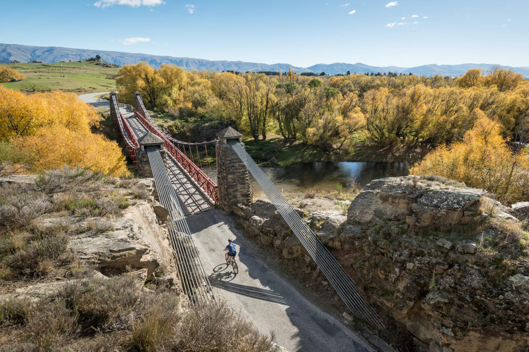
Shaky Bridge, Alexandra
Believe it or not, wagons and horses once used this suspension bridge but today it’s strictly for pedestrian use only. Like many other river crossings, prior to the bridge the only way across the Manuherikia River was by punt - a risky operation when the river was high.
One of Leslie Duncan Macgeorge’s designs, the bridge was opened in 1879 and the suspension bridge was the sole Alexandra crossing of the Manuherikia River for 20-years. The construction of a road rail bridge in 1906 made the existing bridge redundant.
The structure subsequently fell into disrepair, earning the name 'Shaky Bridge' but was eventually repaired by a specially formed committee in 1952. At this time the bridge was narrowed to foot traffic only.
The Shaky Bridge is just a short detour from the Rail Trail in Alexandra and is a good access point for the popular walk to the Alexandra Clock on the Hill.
Alexandra's Shaky Bridge was once used by wagons and horses! The Clock on the Hill is top right of the photo.
The source of the Manuherikia River below the Hawkdun Range - a great mountain bike destination.
Poolburn Viaduct
At the eastern entrance to the Poolburn Gorge (between Lauder and Auripo), the 37m tall Poolburn Viaduct is the highest bridge on the Otago Central Rail Trail, and counting from the Dunedin end is bridge number 69 on the line. Built between 1901 to 1904, the 108m long viaduct was the last of the big masonry pier bridges with steel trusses built on the Otago Central Railway. The piers and abutments were constructed from schist quarried from outcrops close to the railway.
Manuherikia No 1 Railway Bridge
Shortly after exiting the Poolburn Gorge, bridge number 70 on the Otago Central Railway is the Manuherikia Bridge (No.1) which crosses the Manuherikia River. This concrete pier bridge is the longest (110.6m long and 14m high) on the line and was completed in 1903. It is one of only two curved bridges on the rail trail, the other being in Hyde.
Daniel O’Connell Bridge, Ophir
Another Leslie Duncan Macgeorge gem, the Daniel O’Connell Bridge in Ophir was constructed across the Manuherikia River between 1879 and 1880. It’s another classic example of Central Otago suspension bridges with schist masonry towers. The bridge is named after a 19th century Irish nationalist - a tribute to the many Irish gold miners who came to the area.
The Daniel O’Connell Bridge is not directly on the Rail Trail but it's a worthwhile detour from Omakau to Ophir for lunch and has good options for overnight accommodation and dinner.
Manuherikia Bridge No.1 is the longest on the Otago Central Rail Trail.
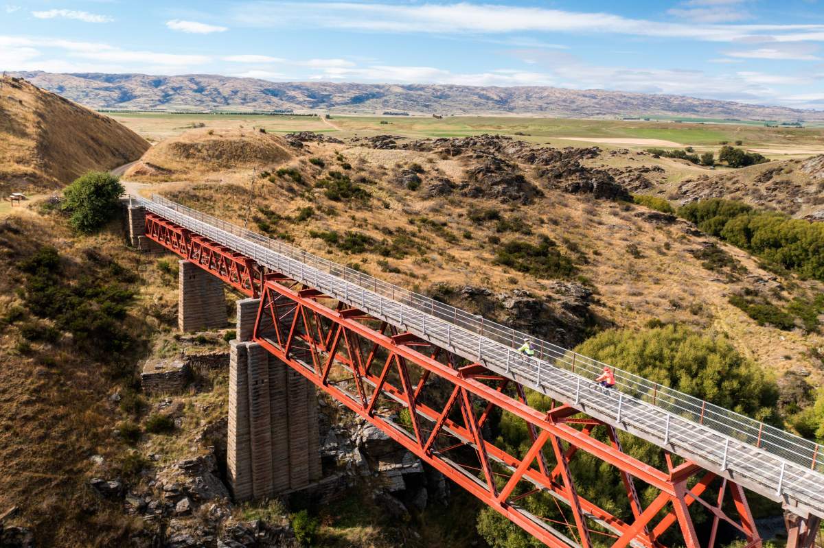
The Poolburn Viaduct and neighbouring tunnels are a highlight of the Rail Trail.
The Daniel O’Connell Bridge between Ophir and Omakau.
Clutha District and Dunedin
Bruce Stewart Bridge, Clutha Gold Trail
At the time of writing, the Bruce Stewart Bridge on the Clutha Gold Trail between Milton and Waihola is the newest bridge on the Ngā Haerenga Great Rides of New Zealand network. Its contemporary design makes it perhaps one of the most striking of all Otago’s trail bridges. You can’t help wondering what Leslie Duncan Macgeorge would make of it!
Named after Bruce Stewart the founder of Calder Stewart - a major property and building solutions company based in Milton – the company designed, constructed, and installed the bridge and provided it as a generous gift to the trail for walkers and cyclists to enjoy.
Waihola Boardwalk, Clutha Gold Trail
If we take Wikipedia’s definition of a bridge as a “structure built to span a physical obstacle without blocking the way underneath” then the impressive boardwalk through the Waihola Wetlands and around the shoreline of Lake Waihola must warrant inclusion in this guide.
One of the highlights for walkers or cyclists riding the brand new section of the Clutha Gold Trail between Lawrence and Waihola (which opened in August 2023) is an extensive boardwalk around the spectacular wetlands of Lake Waihola, 15km north of Milton on the East Coast of the South Island.
Lake Waihola is a 9km² freshwater lake and surrounded by wetlands which are a critical refuge for many threatened and endangered species of plant, fish and bird. The boardwalk allows trail users to walk or ride through this incredible environment without disturbing the native habitat – a habitat which is being restored through an exciting project called Te Nukuroa o Matamata.
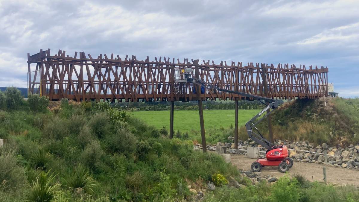
Constructing the striking Bruce Stewart Bridge on the Clutha Gold Trail near Milton.
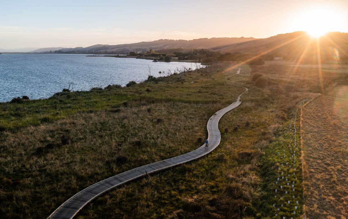
The impressive boardwalk around Lake Waihola and through its wetland habitat.
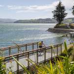
Te Ara Moana | Otago Harbour Cycleway
This is another slight stretch of the definition of a “bridge”, but the new 610m long boardwalk at Blanket Bay, on the Te Ara Moana (The Ocean Path) cycleway between Dunedin and Port Chalmers is noteworthy.
Engineers tasked with constructing the country’s latest cycleway between St Leonards and Port Chalmers faced massive challenges as there was simply no room to build it! Given the lack of space in the historic coastal environment, land needed to be reclaimed, sections of the main trunk rail line were realigned, retaining walls were built plus a boardwalk was built to carry the path around the edge of Blanket Bay. The resulting boardwalk with its distinctive blue surface is quite spectacular.
The full trail from Port Chalmers to beyond Portobello is known as Te Aka Ōtākou (The Otago Vine), referring to the winding path of the trail around the Otago Harbour.
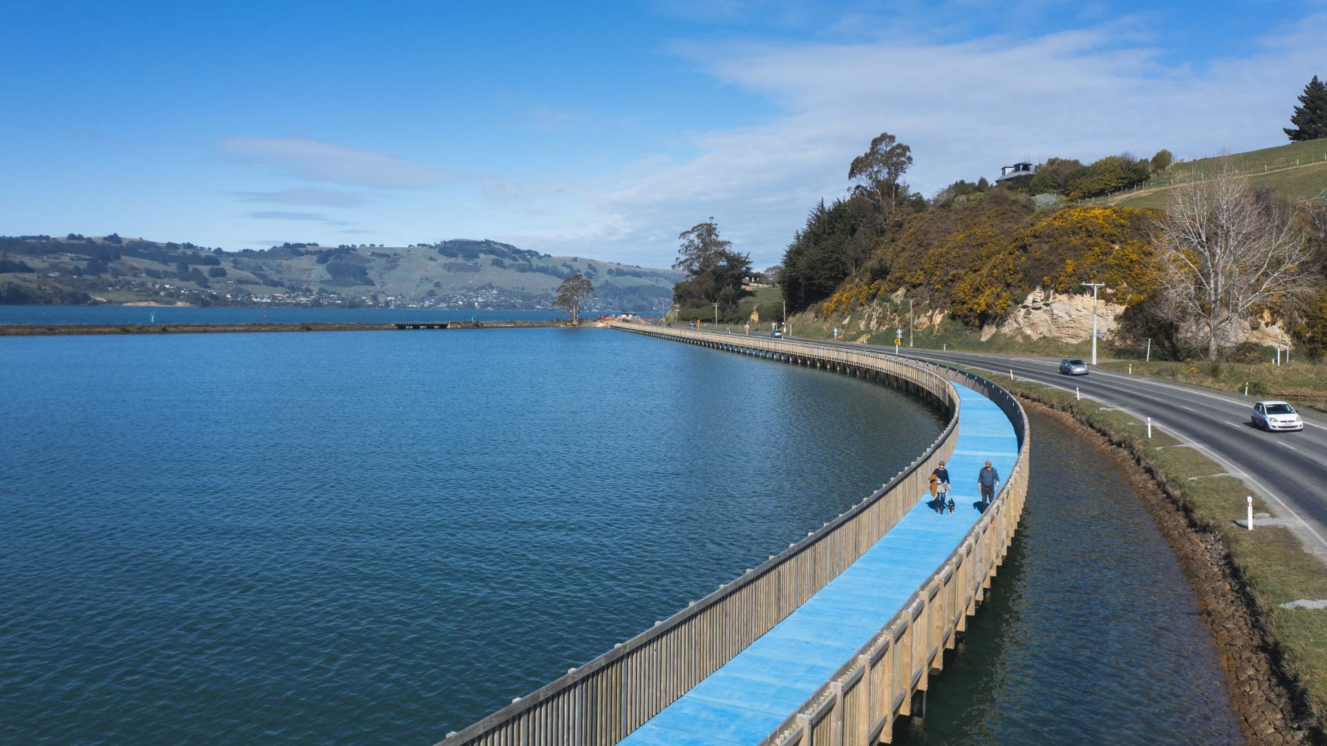
Te Ara Moana (The Ocean Path), the new shared path between Port Chalmers and Dunedin.

Related Stories
-

Credit Card Rides
A credit card ride is a “light” version of a fully self-supported bikepacking trip.
Read more about Credit Card Rides -
The Ride Between
It's not about the ride... it's what you ride between that makes Otago's trails special.
Read more about The Ride Between -
Quick Reference Guide to the Cycle Trails of Otago
A quick guide to help you choose the best cycle trail for your next holiday or adventure.
Read more about Quick Reference Guide to the Cycle Trails of Otago -
Otago's Signature Tracks
Best short rides on the Queenstown Trails
Read more about Otago's Signature Tracks -
Easy self-guided cycling holidays in New Zealand
The growth in easy, self-guided cycling holidays in New Zealand.
Read more about Easy self-guided cycling holidays in New Zealand -
Introduction to Trail Running
An introduction to trail running on Otago's Great Rides.
Read more about Introduction to Trail Running -
Best Things Along Dunedin Harbour Cycleway
11 of the best things to see and do along the new Dunedin Harbour Cycleway.
Read more about Best Things Along Dunedin Harbour Cycleway -
11 of the Best Short Walks in Otago
11 of the best short walks in Otago and close to the cycle trails, ranging from 30 minutes up to 3 hours.
Read more about 11 of the Best Short Walks in Otago -
Otago's Classic Hits
Highlights of the Otago Central Rail Trail and Lake Dunstan Trail
Read more about Otago's Classic Hits -
Otago’s Greatest Hits
Highlights of the Clutha Gold and Roxburgh Gorge Trails
Read more about Otago’s Greatest Hits -
Reclaiming Wild
Two gutsy girls on an epic bikepacking mission to celebrate their 50th birthdays.
Read more about Reclaiming Wild