The Cairnmuir Circuit
Distance 70km | Ride Time 4-6 hours | Vertical Ascent 1,300m
This 70km loop around the Cairnmuir Mountains on backcountry gravel roads and the Lake Dunstan Trail is an epic day ride for experienced cyclists with good fitness and a sense of adventure!
- Words and pictures by Geoff Marks
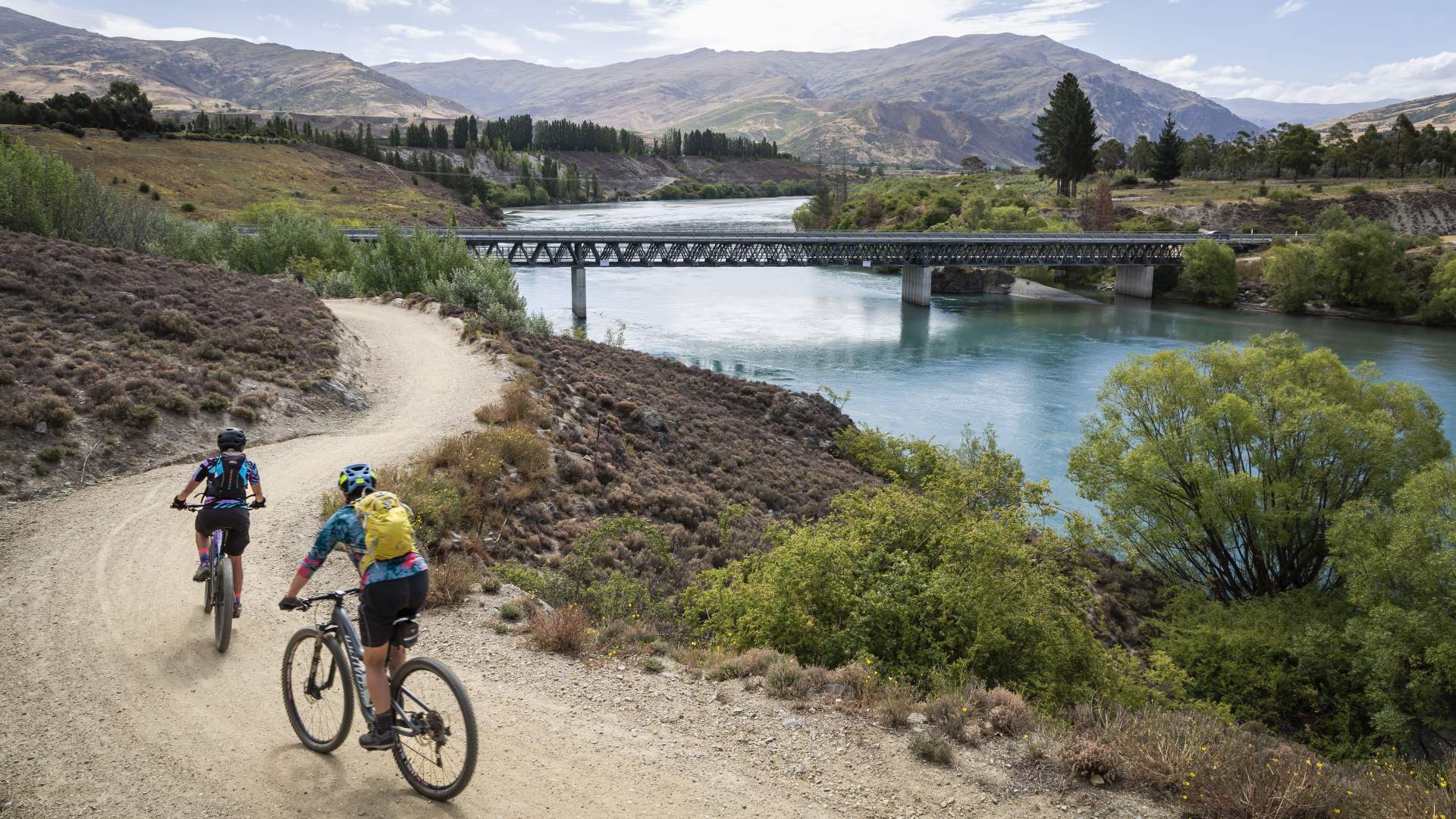
The Lake Dunstan Trail has quickly become one of New Zealand’s most popular Great Rides. The spectacular 55km, grade 2-3 trail through the Cromwell Gorge between Clyde and Cromwell is usually ridden one-way with cyclists often booking a shuttle to transfer them back to their car or accommodation at the end of their journey.
But, for experienced and fit cyclists, a challenging 70km loop ride is possible which includes some of Central Otago’s finest gravel roads through iconic high-country landscapes, with a handful of long climbs and steep descents, as well as all the best bits of the Lake Dunstan Trail. Coupled with strategically located country pubs, wineries, and coffee shops this classic Central Otago mountain bike or gravel bike ride needs to go straight to the top of your to-do-list!
The Cairnmuir Circuit includes some classic Central Otago gravel roads...
...and all the best bits of the Lake Dunstan Trail.
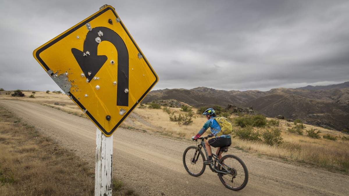
The circuit around the Cairnmuir Mountains can be ridden in either a clockwise or anticlockwise direction, but riding in an anticlockwise direction is recommended to avoid the very steep (and we mean VERY steep) climb from Clyde up Hawksburn Road from Earnscleugh Road…. You’ve been warned!
In this account, we started and finished in Bannockburn from the car park at the end of Pearson Road, but it could also be ridden from Clyde or Cromwell, although from Cromwell it would add another 8km (ish) to the round trip.
The logic of starting in Bannockburn and riding over the Hawksburn Road in the morning is that a) it gets the hardest climbs out of the way when you have fresh legs, and b) by riding earlier in the morning you can ‘beat the heat’ and ride the longest hills when it’s cooler. Also, by tackling the Lake Dunstan Trail after lunch, you can avoid peak trail traffic as most people ride the trail from Cromwell to Clyde in the morning.
For this article, we rode the trail in early January on an overcast day with a light southeast breeze, which was a good decision because the following day the temperature soared to over 30°C with a hot, gusty nor’ west head wind which would have made very unpleasant riding conditions. So, check the weather before you head out and take plenty of water if you’re going in summer. Spring or autumn are probably the optimal times for riding this loop.
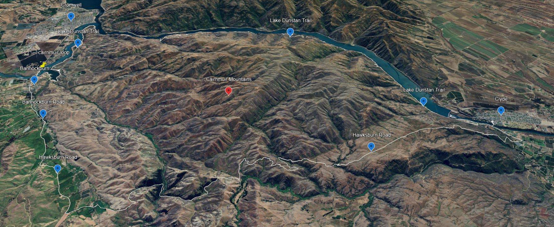
Map of the Carinmuir Circuit, showing the Hawksburn Road and Lake Dunstan Trail (Source: Google Earth).
Ride Description
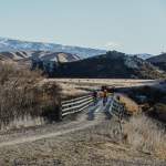
From the car park on Bannockburn Road / end of Pearson Road, follow the Lake Dunstan Trail and cross the Bannockburn Bridge using the clip-on cycleway. A short way up the hill, the Black Rabbit Kitchen & Bar is your first coffee stop of the day (#NoCoffeeNoRide). From here follow the sealed Bannockburn Road for approximately 8km until you hit the gravel and reach the fork with the Hawksburn Road and Nevis Road. Bear left and take the Hawksburn Road.
(Take a mental note to come back and the ride up the Nevis Road to Duffers Saddle and the Old Woman Range on another mission)….
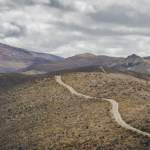
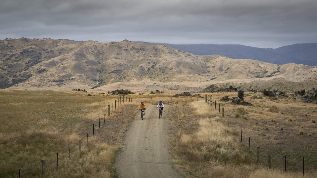
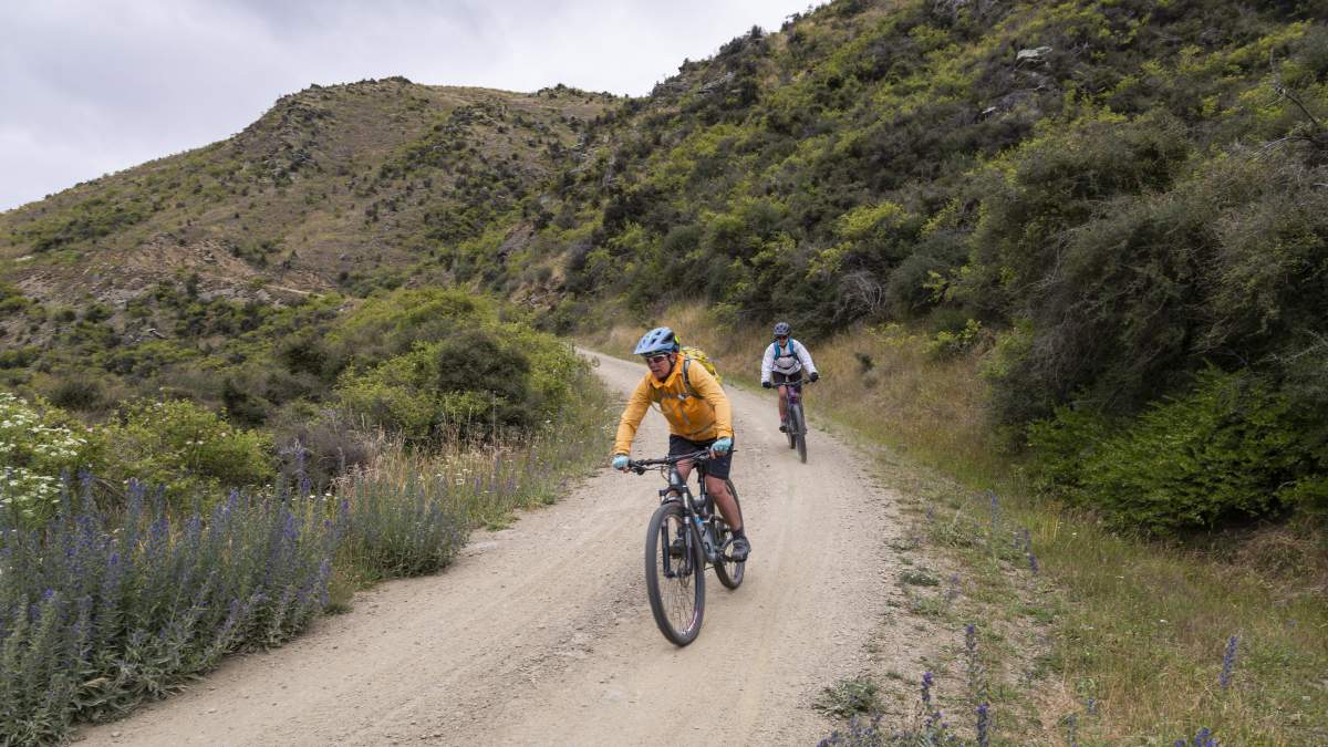
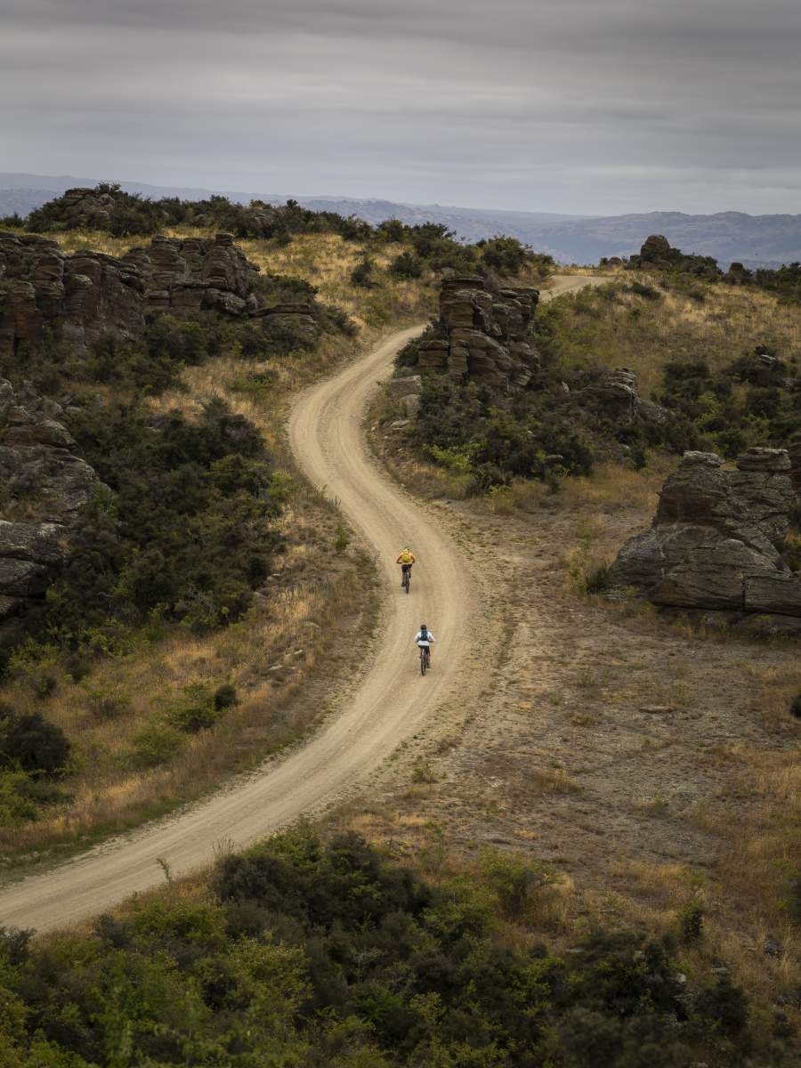
The Hawksburn Road offers some of Central Otago’s finest gravel riding. Whilst it’s generally quiet, remember that it is a public road so follow the usual rules and look out for motorbikes, recreational 4WD’ers and farm vehicles. Leave any gates as you found them and beware of stock, especially along the tops of the Cairnmuir Mountains.
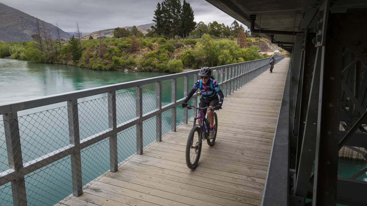
Crossing the Bannockburn Bridge on the purpose-built cycle path.
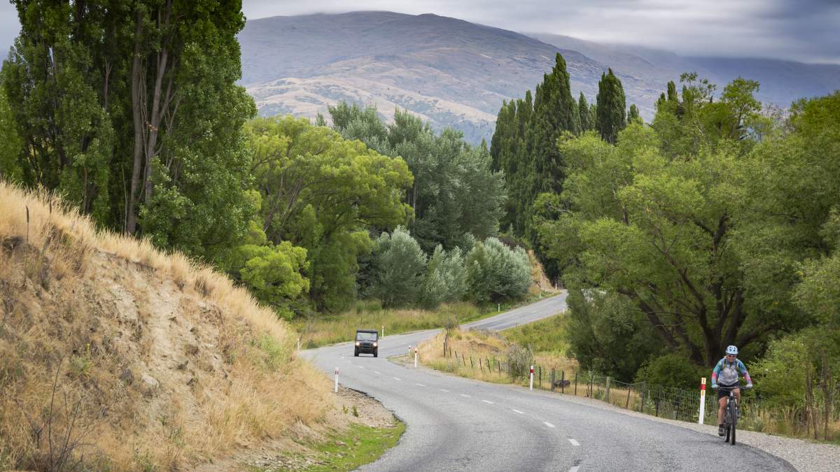
The Bannockburn Road is the only sealed section of this loop ride.
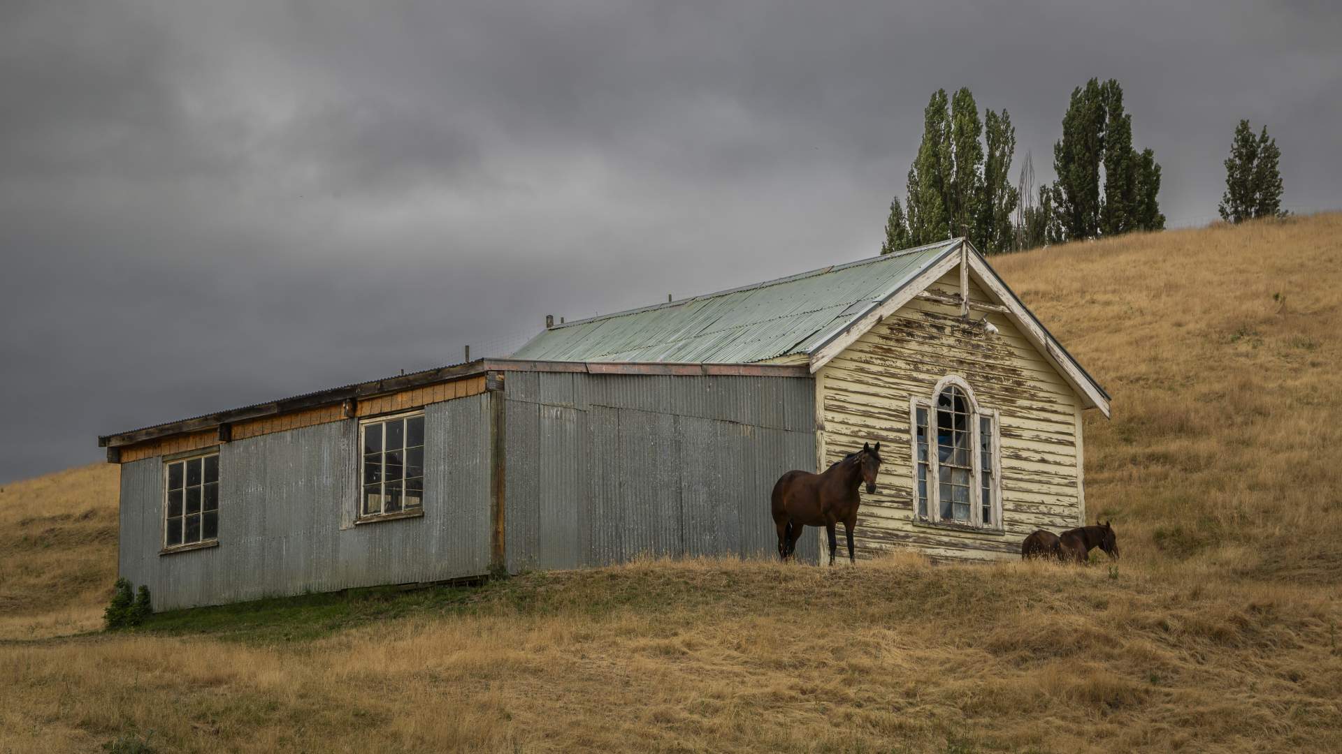
Bannockburn could once be described as a 'one horse town', but times have changed!
The gravel section begins with steady climb up to Happy Valley, but then you quickly lose all that hard-gained elevation with a descent down to the Bannock Burn creek. From here you have the longest climb of the day up to the top of the Cairnmuir Range to the Cairnmuir Flats, including some quite steep pinches.
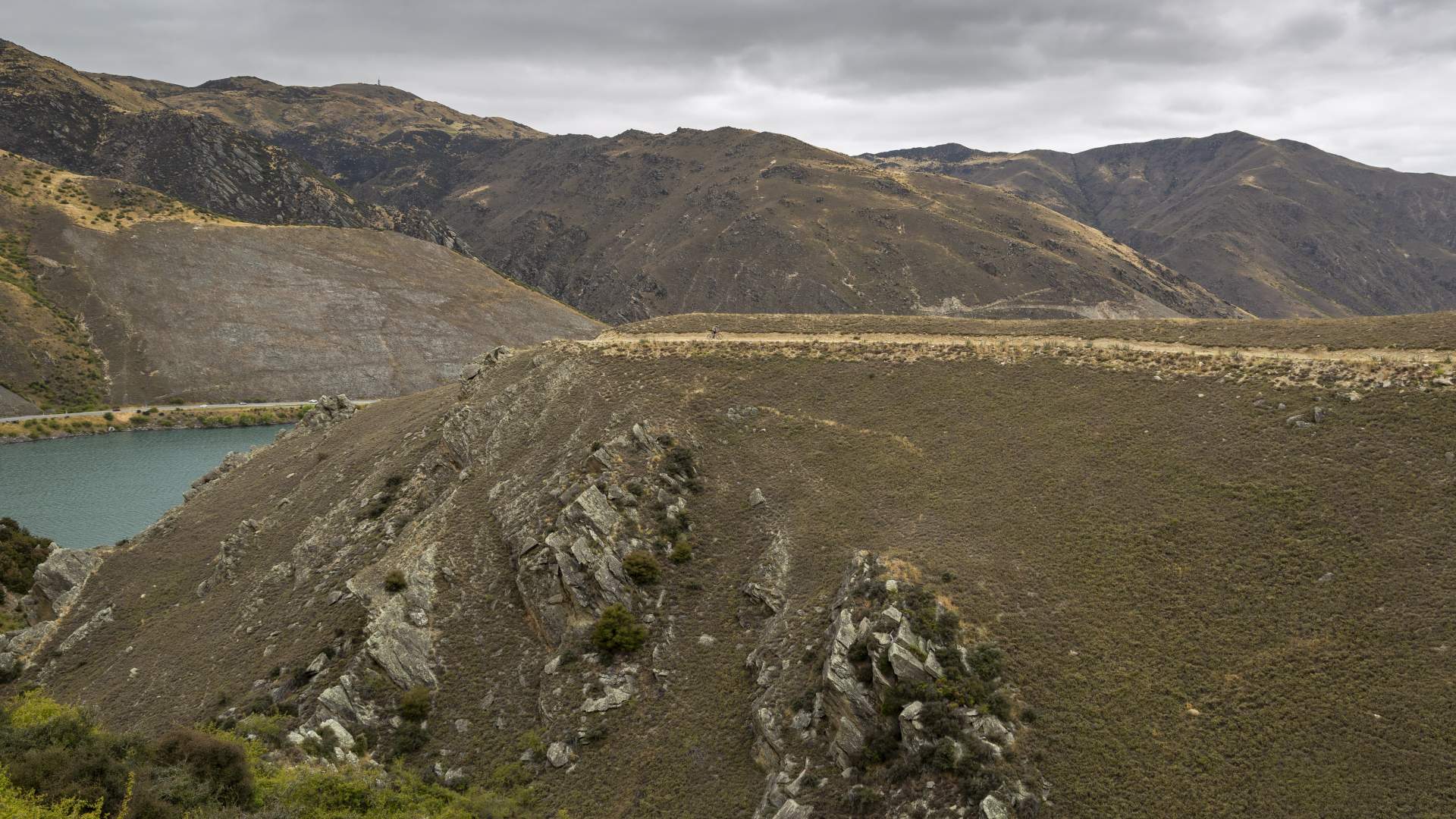
Towards the top of the climb, the road begins to sidle along the contours and follows the line of pylons in a generally westward direction. Look out for karearea | NZ falcon which nest in the rock tors along the tops.
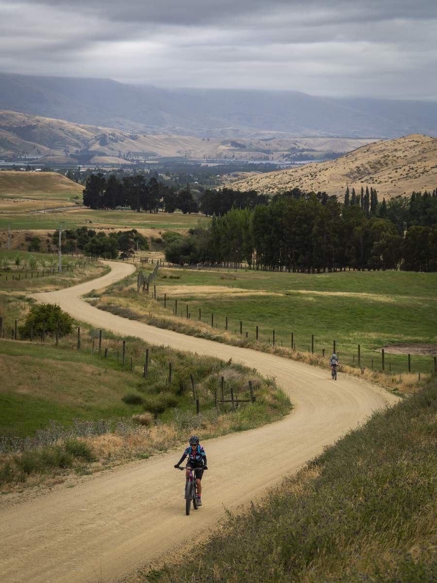
Hawksburn Road climbs gradually at first.
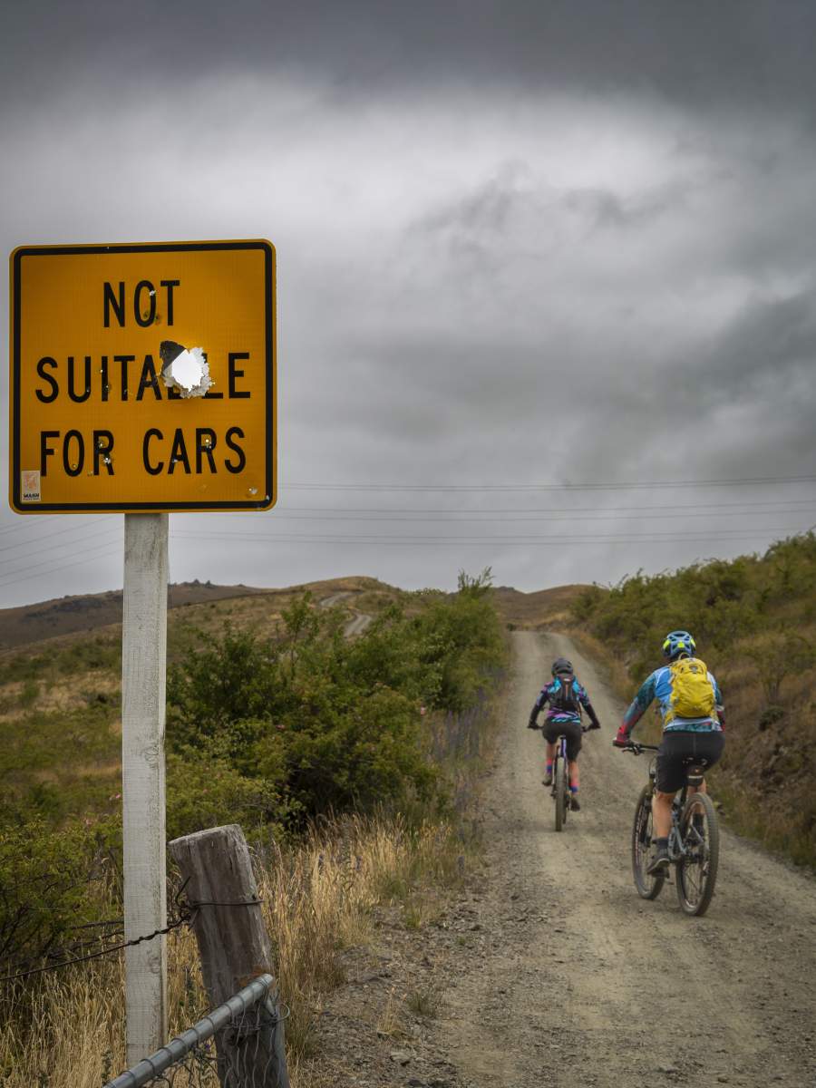
It might not be suitable for cars, but look out for motorbikes, 4WDs and farm vehicles.
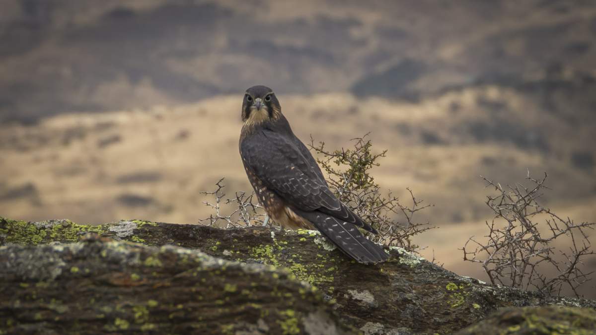
Karearea | NZ Falcon nest in the rock tors at the top of the Cairnmuir Mountains.
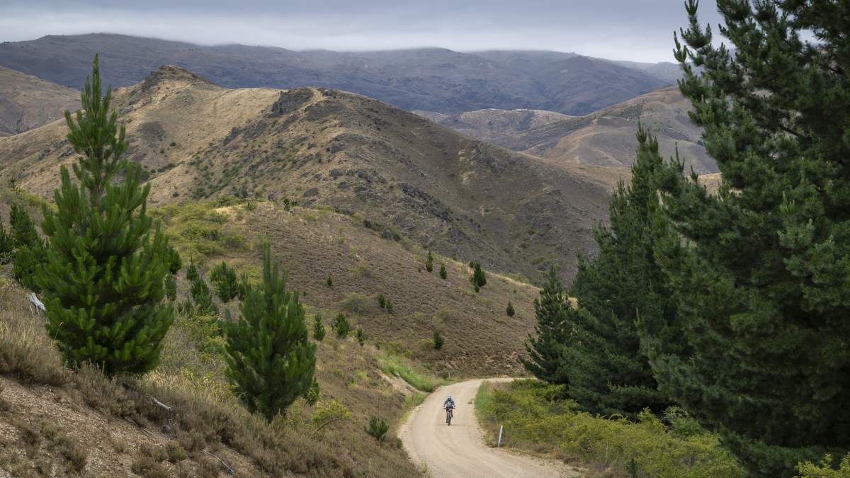
It's an unrelenting climb up to Cairnmuir Flats, with no shade from the sun.
Isn't it always the way?... The steepest part of the climb is at the end!
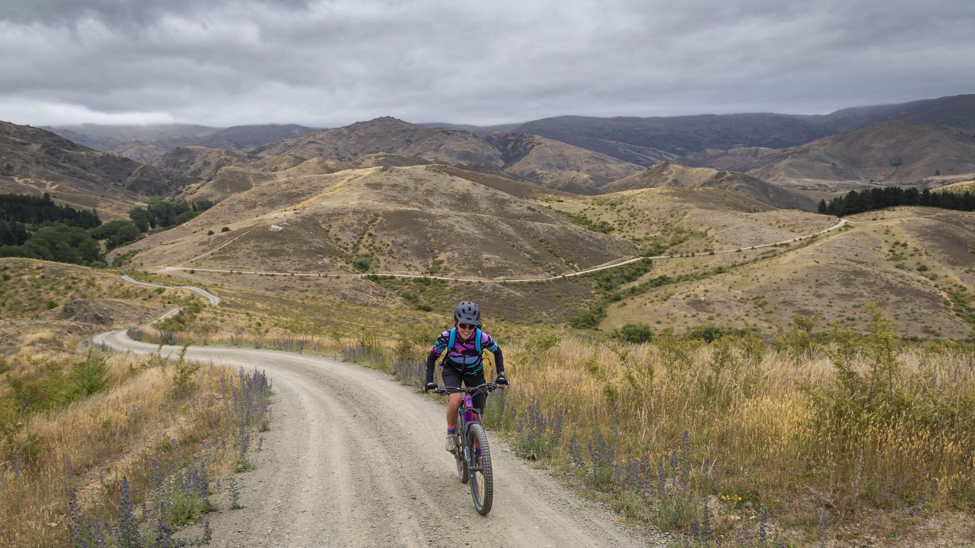
A fast section along the Cairnmuir Flats leads to a spectacular view across Clyde, Alexandra and the Clutha River | Mata Au. It’s then a long descent down into Clyde. The descent is steep, rutted and in summer can be lose and dusty so take it easy and be aware of oncoming vehicles. Turn left at the bottom of the hill onto Earnscleugh Road and then cross the bridge into Clyde for lunch or a well-earned coffee stop.
After refueling in Clyde - we had lunch at the Post Office Cafe & Bar - it’s time for the Lake Dunstan Trail section. Ride back across the bridge and turn right following the river and cycle trail signs heading towards the Clyde Dam. The trail proper starts at the Rowing Club, from where it's about 36km back to the car park in Bannockburn.
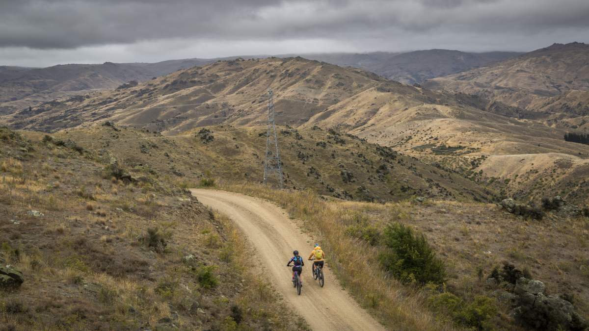
Following the pylons along the top of the Cairnmuir Mountains.
The Cairnmuir Flats offer some respite after a morning of climbing.
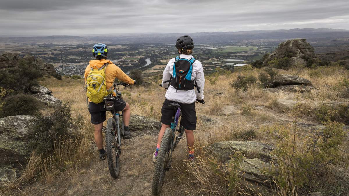
Views for miles across the Mata Au | Clutha River, Clyde and the Alexandra Basin.
Respect the descents which can be lose, dusty and rutted. Be prepared to meet oncoming vehicles.
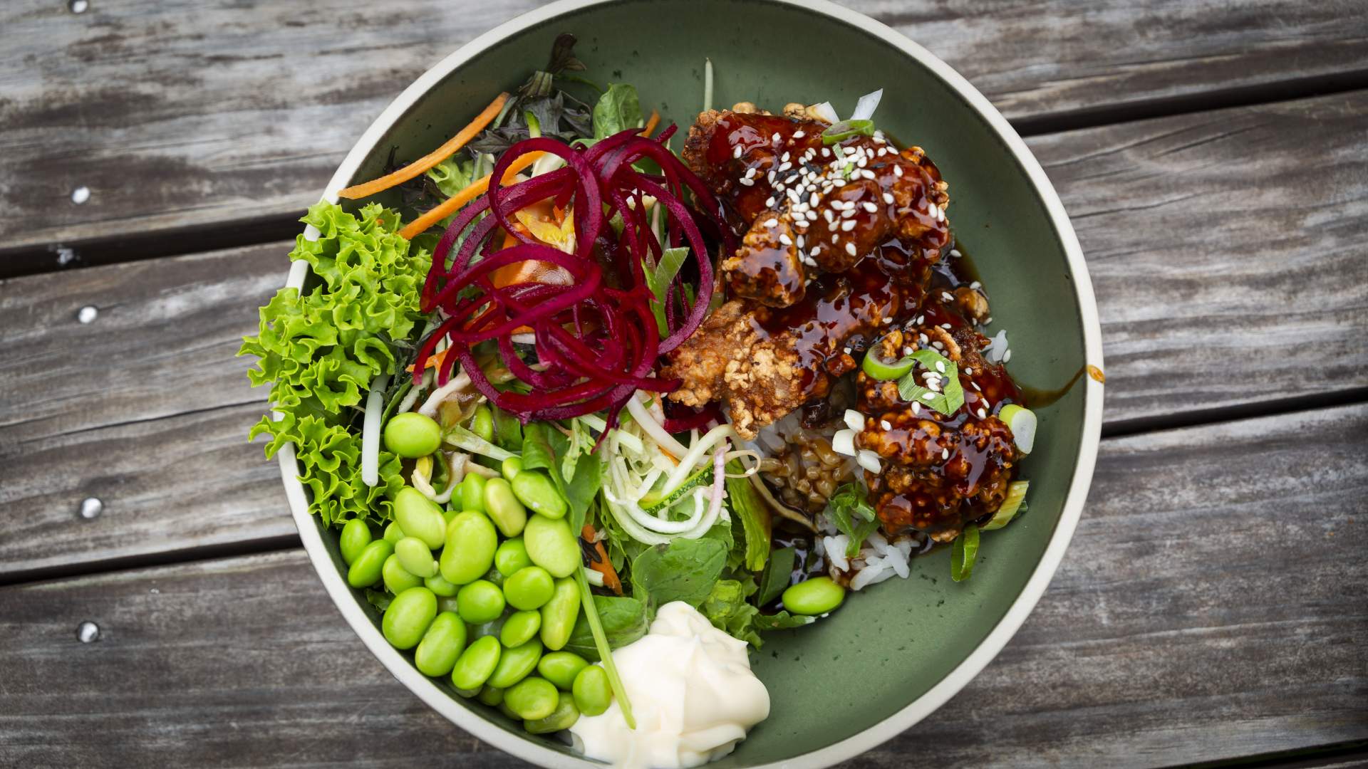
A healthy, hearty lunch at the Post Office Cafe & Bar in Clyde... but they also bake sensational pies (just sayin') ...
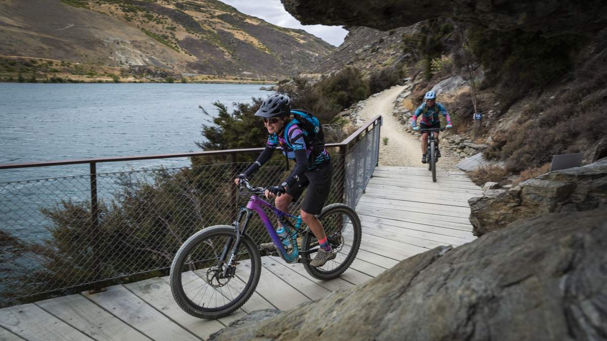
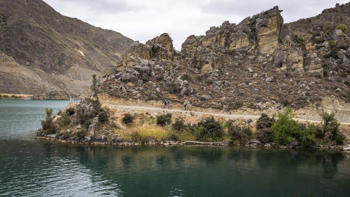
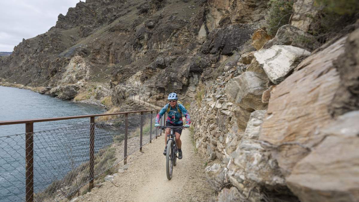
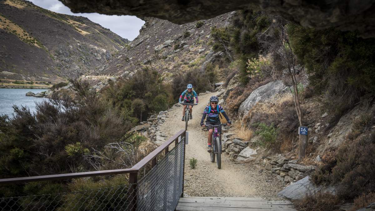
Whilst the Lake Dunstan Trail doesn’t have the same amount of uphill as the Hawksburn Road, you’ll still have around 500m of vertical ascent to climb and some narrow, exposed grade 3 sections of trail to navigate and tight, switchback corners. Be aware that the trail can be busy at times, and courtesy and etiquette towards other trail users goes a long way to ensure that everyone has a good day out. Take your time riding along the trail to appreciate the craftsmanship and engineering which went into its construction.
Your next opportunity for coffee – or lunch if you’re making good time – is at Coffee & Burger Afloat at the base of the ‘Cairnmuir Ladder’. The floating coffee shop has become a Lake Dunstan icon and somewhat the darling of social media, but far more importantly, their burgers are sensational!
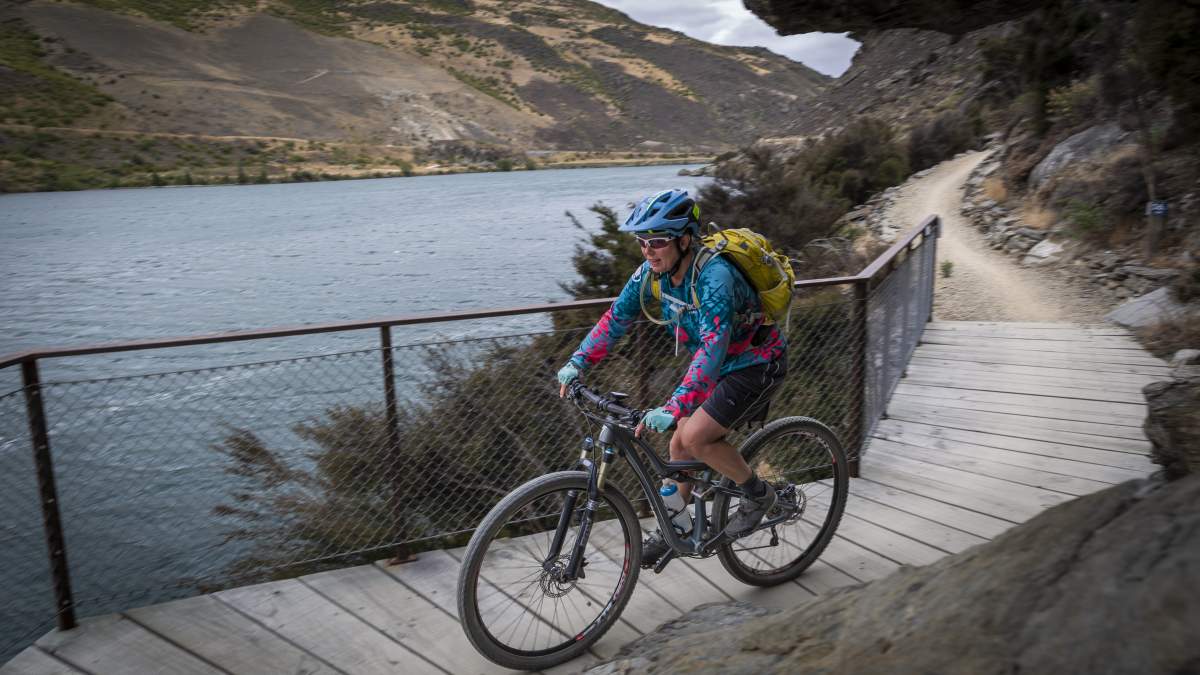
From Coffee Afloat the trail flattens out and includes some impressive gravity-defying, cantilevered walkways and more highly Instagrammable photo ops!
The Lake Dunstan Trail has become one of NZ's most popular day rides.
Impressive stonework along the Lake Dunstan Trail.
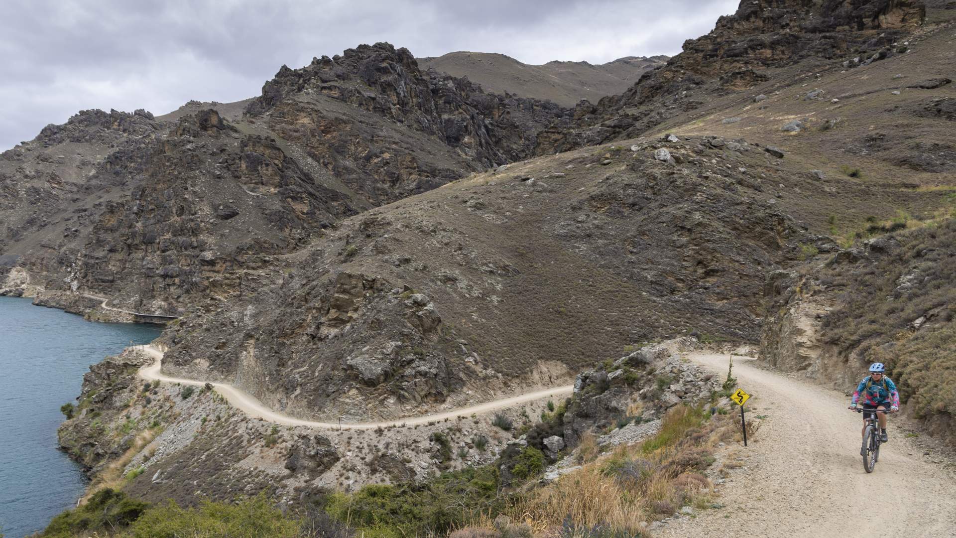
You're not done with climbing yet! There's still more hills along the Lake Dunstan Trail...
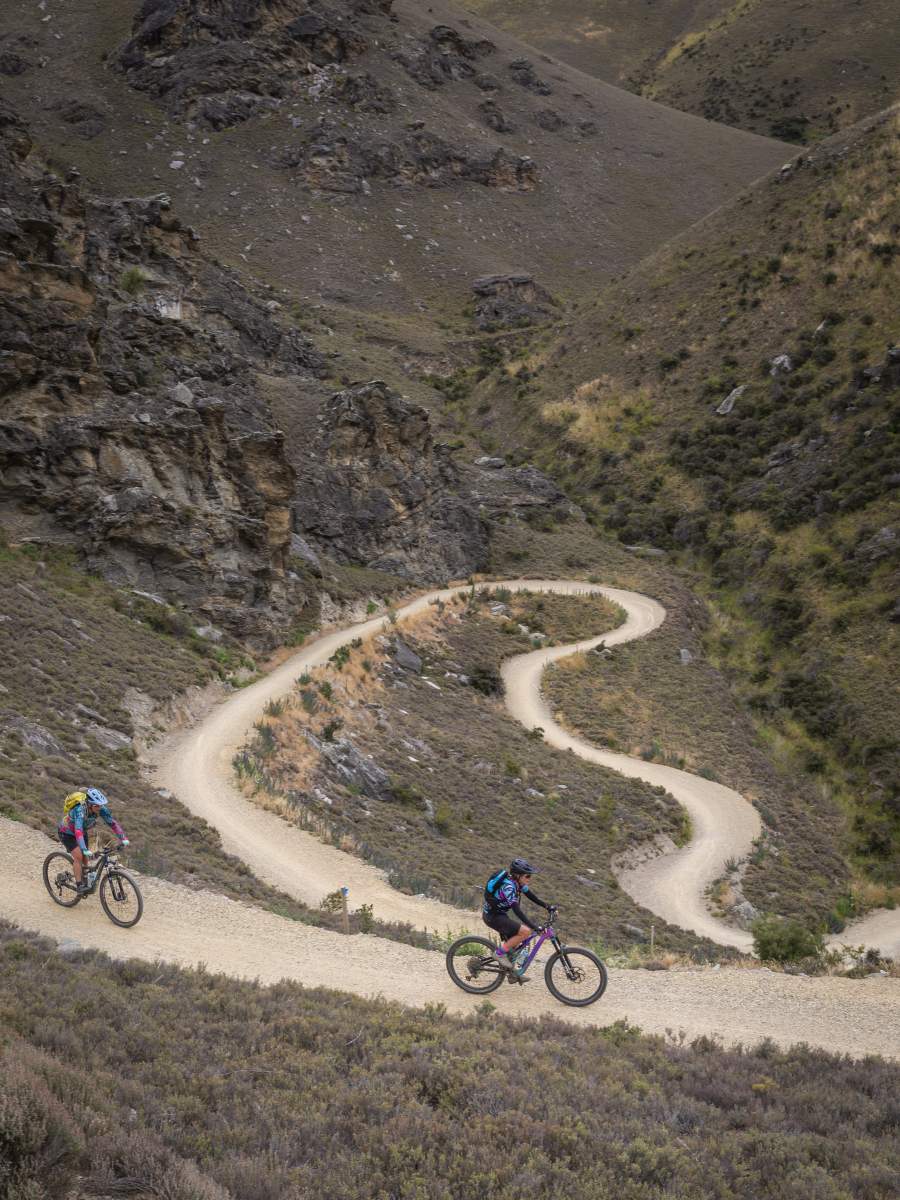
Tight corners and swithcbacks are a feature of the Lake Dunstan Trail.
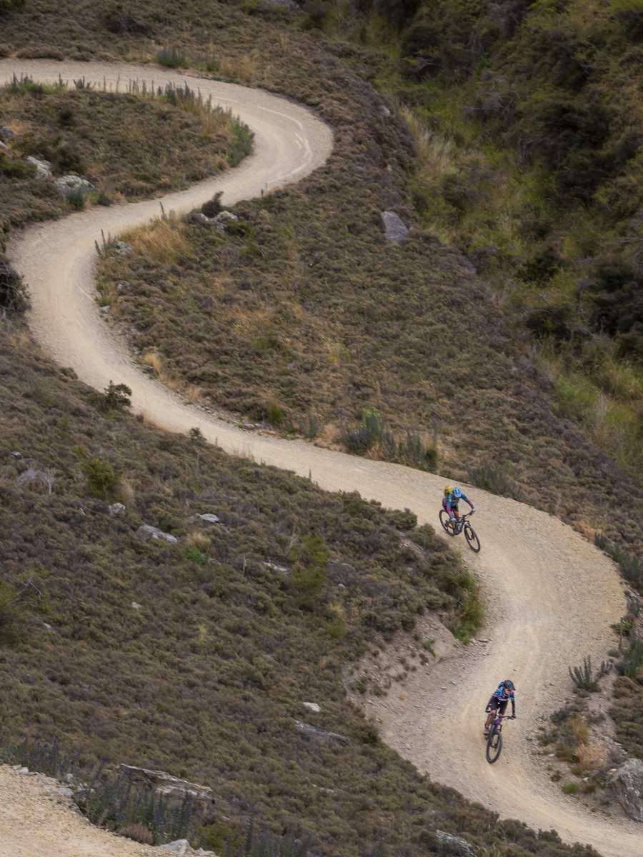
Always be prepared to meet oncoming riders, and ring your bell or call out on sharp bends.
A good head for heights is required on the Lake Dunstan Trail. It's exposed and narrow in places.
At Cornish Point you come out of the gorge and the landscape changes from rugged cliffs and bluffs to geometric rows of vines as you enter wine country. There are some great views across the lake to the historic Cromwell Heritage Precinct.
About 4km from Cornish Point, the trail passes through Carrick Winery. With its grassy lawn, coffee cart / food truck, wine tasting and restaurant it’s an irresistible stop before the short ride back around the Bannockburn Inlet (a top spot for a refreshing swim) to complete the loop. Alternatively, a cold beer awaits at the Bannockburn Hotel or – energy levels permitting – you can visit more of Bannockburn’s vineyards and wineries along Felton Road to finish your circumnavigation of the Cairnmuir Mountains in style!
The cantilevered, clip-on walkways are a trail highlight.
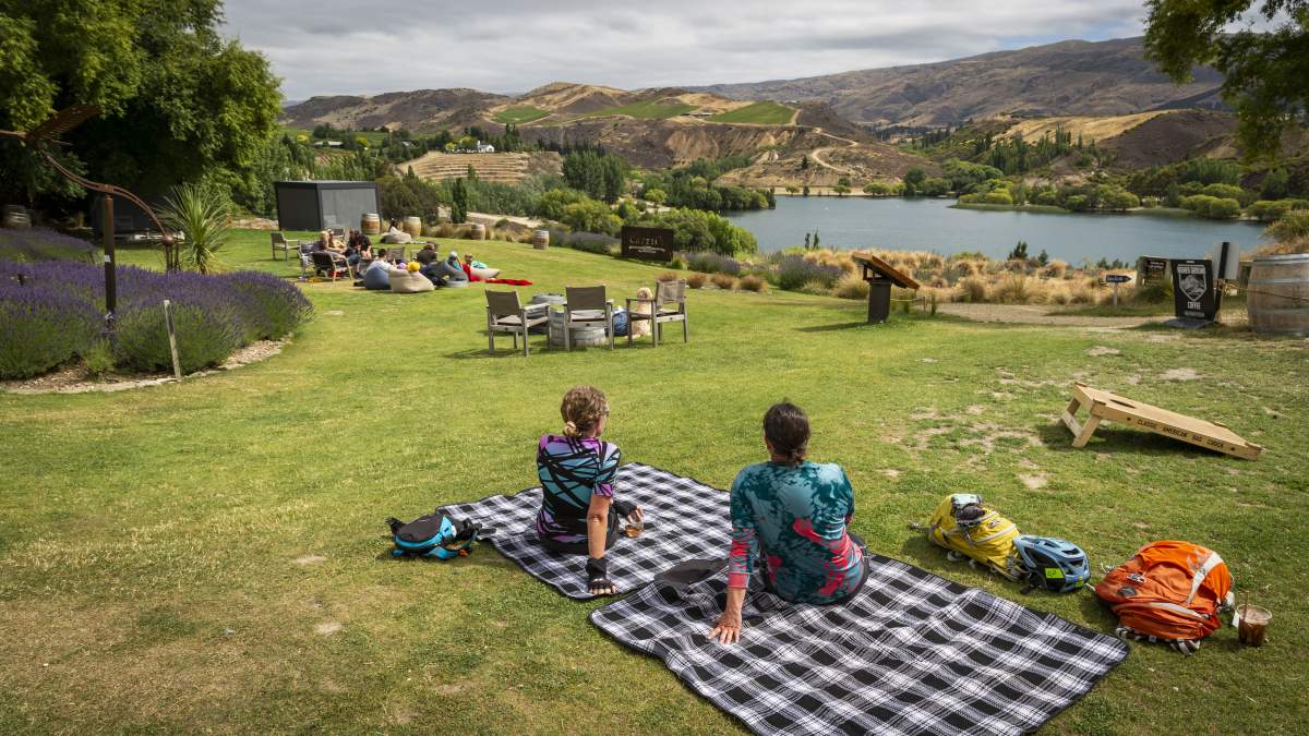
Enjoying a well-earned glass of rose at Carrick Winery, which is right on the trail.
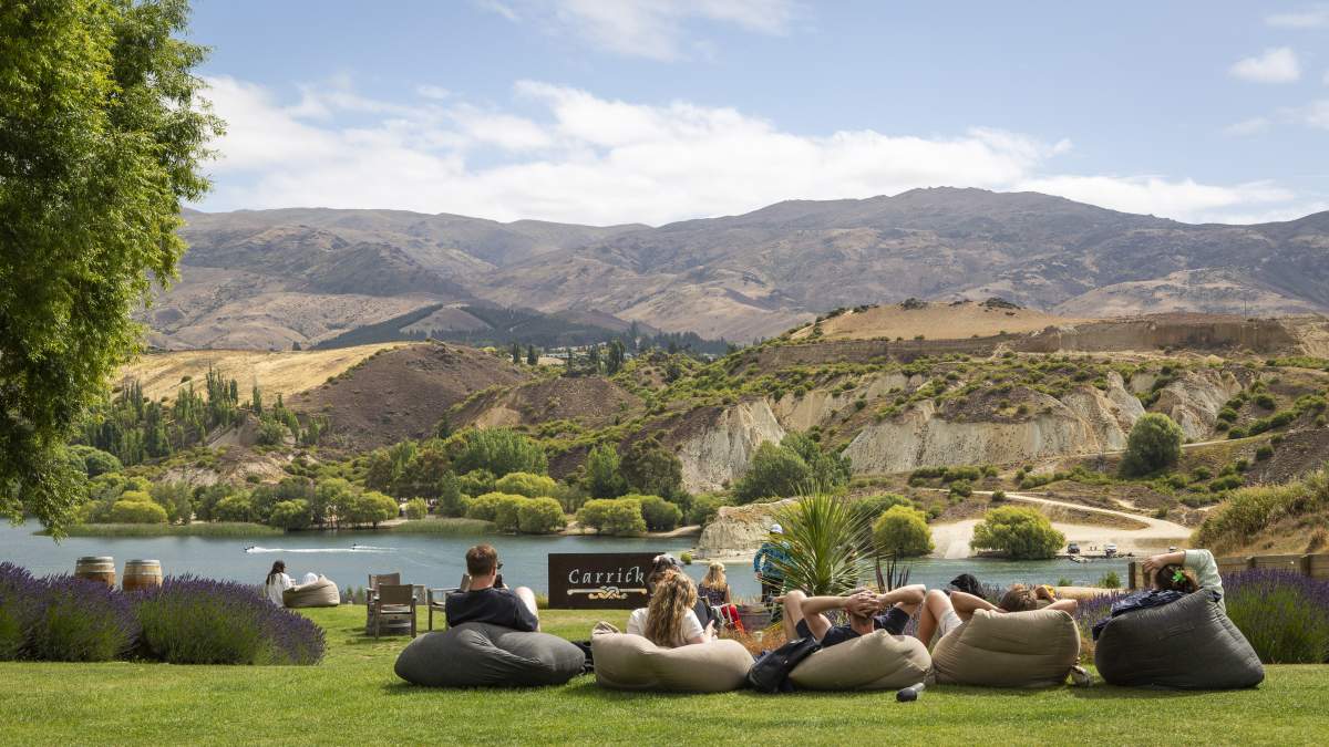
Kicking back at Carrick Winery with views across the Bannockburn Inlet.
Back at the Bannockburn Bridge, circumnavigation of the Cairnmuir Mountains complete!
Need to Know
- There is no drinking water, no shade or shelter along the route other than in Clyde and Bannockburn.
- The route is exposed to the heat in summer and cold in winter.
- Be prepared for long climbs and steep descents.
- The described circuit is only suitable for experienced intermediate or advanced riders with good fitness.
- It’s suitable for mountain bikes or gravel bikes. E-bikers should make sure batteries have the range to complete this loop and factor in the amount of climbing.
- Be aware of other road users including farm vehicles and obey all road rules.
- There’s limited cell phone coverage across the entire route. Consider carrying a personal locator beacon and always let someone know your intentions.
- The ride time will vary significantly depending on fitness level, bike type and weather conditions. Advanced riders will take approximately 4-hours (excluding breaks) and less fit riders might take up to 6-hours or more. Allow a full day to experience this loop to fully enjoy lunch and breaks in Bannockburn, Clyde or Cromwell.
- Follow the Land Safety Code.
- Please consider making a donation towards the maintenance of the Lake Dunstan Trail which is managed by a not-for-profit trust or complete a trail survey to let us know about your experience. Thanks!
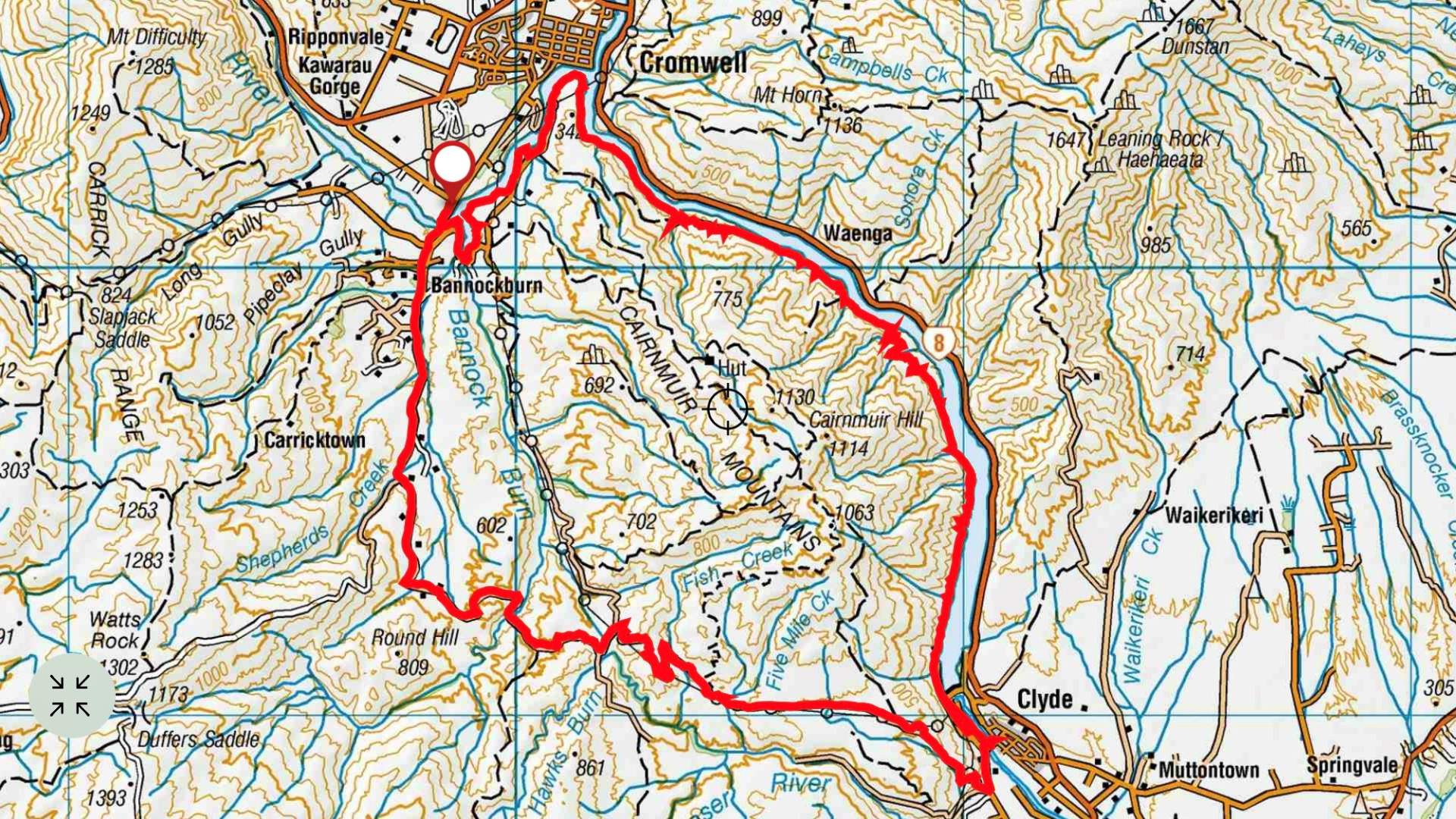
Topo Map of the Cairnmuir Circuit (LINZ - Crown Copyright Reserved).
Iconic Central Otago high-country landscapes abound.
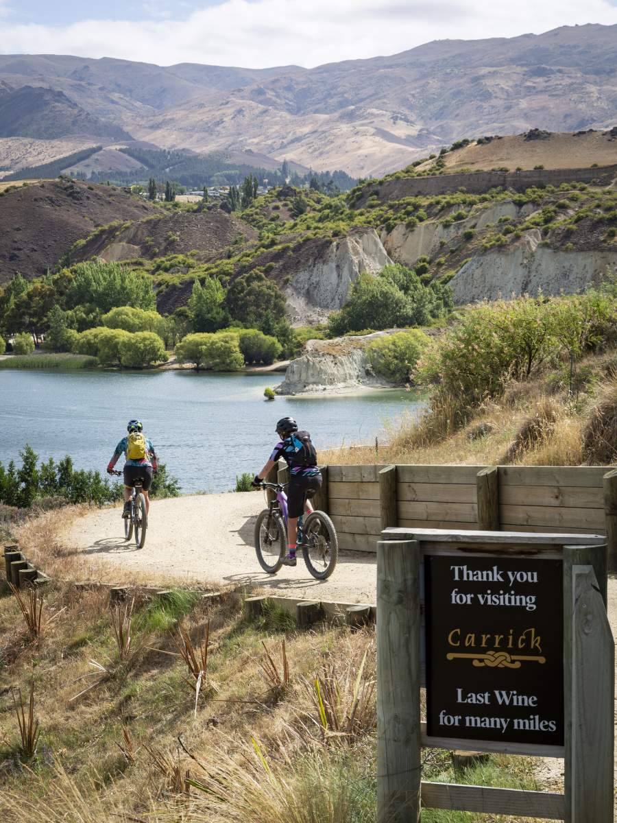
Oh no! The last wine for many miles!.... (Not really, you're never far from a nice glass of pinot noir in Central Otago).

Related Stories
-

Credit Card Rides
A credit card ride is a “light” version of a fully self-supported bikepacking trip.
Read more about Credit Card Rides -
The Ride Between
It's not about the ride... it's what you ride between that makes Otago's trails special.
Read more about The Ride Between -
Quick Reference Guide to the Cycle Trails of Otago
A quick guide to help you choose the best cycle trail for your next holiday or adventure.
Read more about Quick Reference Guide to the Cycle Trails of Otago -
Otago's Signature Tracks
Best short rides on the Queenstown Trails
Read more about Otago's Signature Tracks -
Easy self-guided cycling holidays in New Zealand
The growth in easy, self-guided cycling holidays in New Zealand.
Read more about Easy self-guided cycling holidays in New Zealand -
Otago's Classic Hits
Highlights of the Otago Central Rail Trail and Lake Dunstan Trail
Read more about Otago's Classic Hits -
Hawksburn - Thomsons Gorge Gravel Bike Double
An epic 12hour, 210km gravel bike mission through Central Otago.
Read more about Hawksburn - Thomsons Gorge Gravel Bike Double -
One Day Winter Wonders
The best bike rides on the Otago cycle trails in winter.
Read more about One Day Winter Wonders -
Clyde Dam Tour
A tour of the Clyde Dam is a unique opportunity to explore this icon of the Lake Dunstan Trail.
Read more about Clyde Dam Tour